
Matrice 400
Engineered for Excellence
Long-range drone platform.
Power-line-level obstacle sensing.
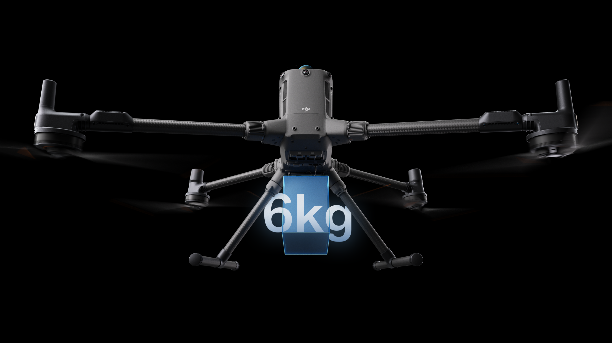
DJI's enterprise flagship Matrice 400 is designed for long-range, high-performance missions with up to 59 minutes of flight and up to 6 kg payload capacity. Rotating LiDAR and mmWave radar deliver advanced power-line-level obstacle sensing.

DJI Matrice 400 is DJI's flagship enterprise drone platform. With up to 59 minutes of flight time and up to 6 kg payload capacity, it is designed for long-range, high-performance missions. Integrated rotating LiDAR and mmWave radar provide advanced power-line-level obstacle sensing. O4 Enterprise Enhanced Video Transmission and airborne relay transmission further support safer operation and mission continuity.
Combining intelligent sensing, visual and thermal imaging, AR projection, ship-based takeoff/landing and advanced automation, DJI Matrice 400 supports emergency response, power line inspections, mapping and architecture, engineering and construction (AEC) applications.
Forward flight time
Up to 59 minutes of flight for extended missions.
Hovering
Extended hovering for inspection and observation missions.
Payload capacity
Different sensor and payload options.
Flight speed
Fast movement across large operational areas.
Obstacle sensing
Advanced power-line-level sensing.
Adapted to challenging conditions
Protection against dust and rain.
¹ Flight times depend on payload and test conditions. ² The 6 kg capacity is specified for the third gimbal connector at sea level. ³ Protection may decrease with wear. Details are below the specifications.
Extended Flight Time.
High-Speed Performance.
Matrice 400 offers up to 59 minutes of forward flight and up to 53 minutes of hovering, even with a payload. These capabilities support extended operations such as search and rescue, firefighting and large-scale mapping. A flight speed of up to 25 m/s also helps it navigate around large obstacles such as buildings and mountains.
Multiple Payloads. Multiple Scenarios.
Matrice 400's payload capacity supports a wide range of applications. With a maximum capacity of 6 kg, it supports switching between a single downward gimbal and dual downward gimbals. A third gimbal connector underneath adds flexibility. Four external E-Port V2 ports allow up to seven payloads to be mounted simultaneously.
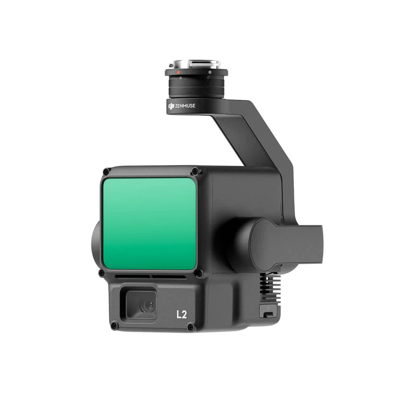
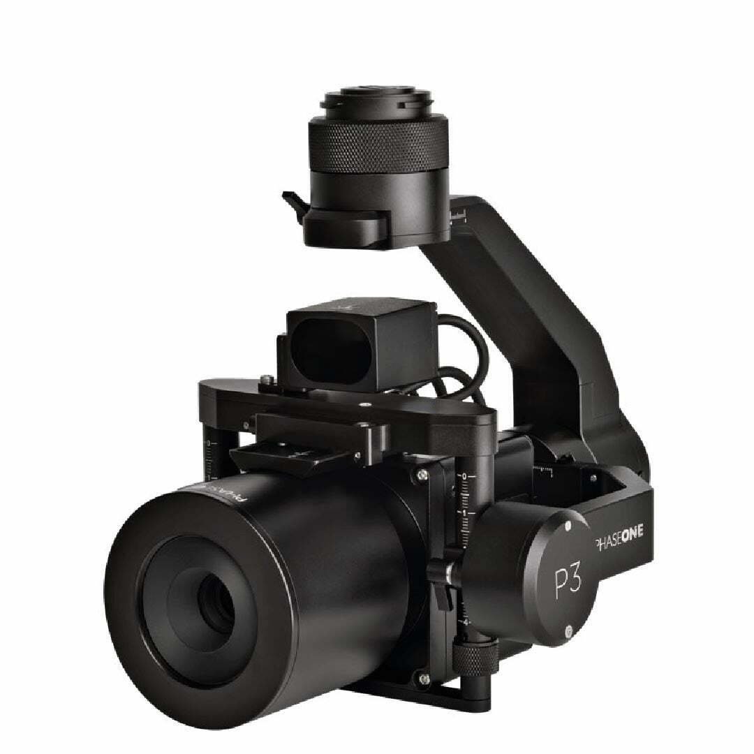
Depending on the mission, Matrice 400 can carry Zenmuse H30 Series, Zenmuse L3, Zenmuse L2, Zenmuse P1, Zenmuse S1 Spotlight, Zenmuse V1 Speaker, Manifold 3 or third-party payloads, expanding its capabilities across the DJI ecosystem.
For seven payload connections, the E4 port is expanded with an E-Port Hub board. Each connection's payload limit must be assessed separately.
Flight Time by Payload
Matrice 400 flight time is estimated according to its payload. Duration varies with the payload configuration.
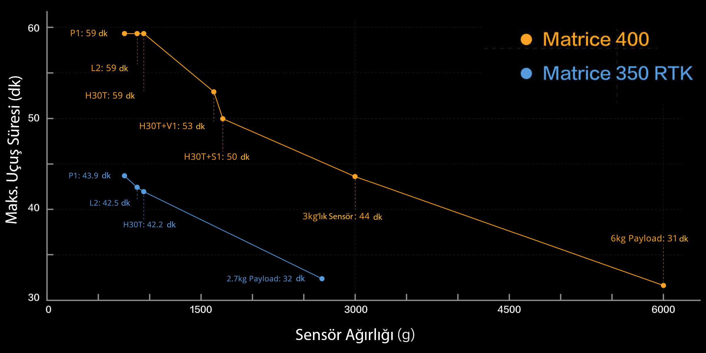
View enlarged chart ↗
The chart is the comparison from Atay's product page; actual flight times depend on environmental, payload and operating conditions.
Built for Challenging Conditions
Matrice 400 has an IP55 rating for operation in challenging conditions such as dust or rain. Its operating temperature range of −20 °C to 50 °C (−4 °F to 122 °F) supports performance in both hot and cold environments.
Strong Connectivity.
Intelligent Operation.
O4 Enterprise Enhanced Video Transmission and airborne relay transmission support mission continuity. Intelligent sensing, visual and thermal imaging with suitable payloads, AR projection, ship-based takeoff/landing and advanced automation address different mission needs on one platform.
Senses Its Surroundings.
Focuses on Your Mission.
Rotating LiDAR, high-precision mmWave radar and low-light fisheye vision sensors work together around power lines and complex structures.
Power-Line-Level Obstacle Sensing
Supports detection of thin power lines. Performance depends on line thickness, approach speed, weather and obstacle structure.
Fused Positioning
Combines data from multiple sensors to support stable flight around glass facades, wind turbines and bridges.
Full-Color Vision Support
Four low-light fisheye sensors help you see the surroundings. Below 12 lux ambient light, the image switches to black and white.
Obstacle sensing is not guaranteed for every object or condition. mmWave radar availability varies by country and region.
Stronger Video Transmission
O4 Enterprise Enhanced Video Transmission supports connectivity with ten aircraft antennas and a phased-array antenna system on the controller.

Airborne Relay Video Transmission
One Matrice 400 can serve as an elevated relay to support transmission for a second Matrice 400 in operations with limited line of sight.
4G-Assisted Connectivity
DJI Cellular Dongle 2 enables cellular networks and O4 transmission to be used together. The aircraft supports switching between carriers with two dongles.
Mission-Specific Connectivity
Sub2G and relay availability depend on regional frequency support. 4G additionally requires a dongle, network access and a supported service.
Intelligent Tools.
Smoother Operations.
Sensing, on-screen field information and automatic flight tools come together in one workflow.
Intelligent Sensing
Supports detection of people, vehicles and boats with Zenmuse H30 Series. Thermal imaging requires H30T. High-resolution grid photos and tracking tools simplify detailed inspection.
AR Projection
Power lines, map information and flight routes can be displayed over the camera view. During landing, an AR aircraft shadow helps assess position.
Live Annotation and Measurement
Mark points on screen without building a model; measure distances with lines and areas with boundaries. Share results with DJI FlightHub 2.
Real-Time Terrain Following
Supports maintaining relative height above ground in manual or automatic flight with DJI Pilot 2, providing more consistent GSD for mapping and similar target scale in search missions.
Ship-Based Takeoff and Landing
Supports takeoff from a stationary ship and landing on a suitably marked moving deck. DJI recommends a ship speed below 10 knots, wind below 5 m/s and a 3 × 3 m area.
Intelligent Flight Modes
Maintain direction with Cruise, fly to a selected point with FlyTo, follow a target with Smart Track or inspect around a point using POI.
Easier Fieldwork
with Automated Missions
DJI Pilot 2 and DJI FlightHub 2 support data collection for power lines, inclined surfaces and structures.
Power Line Inspection
Use H30 Series to follow conductors and ground wires, collecting imagery at the specified distance and speed. Consider mission conditions for supported line types and slopes.
LiDAR Line Following
Automatic line following and routing around intersecting lines with Zenmuse L3 or L2 support corridor scanning workflows.
Inclined and Geometric Routes
Plan inclined or geometric routes to survey building facades, slopes and structures. Arrange data collection to match the surface shape.
From Field to Model.
A Connected Workflow.
DJI software for flight planning, data processing and model editing.
DJI FlightHub 2
Cloud-based flight and payload control, remote takeoff/landing, advanced route planning and management of multiple live streams.
DJI Terra
2D and 3D production from visible-light data; point cloud processing and mapping workflows with supported LiDAR payloads.
DJI Modify
Edit 3D meshes and point clouds to complete surveying, modeling, model repair and sharing workflows.
A Mission-Ready Ecosystem
Complete your operation with control, power and positioning solutions.
DJI RC Plus 2 Enterprise Enhanced
High-brightness display, IP54 protection and a −20 °C to +50 °C operating range. Supports O4 Enterprise Enhanced Video Transmission.
TB100 Intelligent Flight Battery
Supports up to 400 charge cycles, improved heat dissipation and self-heating.
BS100 Battery Station
Sequentially charges three TB100 and two WB37 batteries. With 220 V input, TB100 fast charging takes 45 minutes; silent mode measured 36 dB in controlled testing.
TB100C Tethered Battery
Supports third-party tethered lighting and communication solutions. Offers dedicated connections for automatic charging station development.
D-RTK 3 Multifunctional Station
Supports centimeter-level positioning for multiple aircraft. Rover mode completes surveying workflows with the DJI Enterprise app and DJI Terra.
DJI AP100 Parachute
Offers automatic and manual deployment with an independent power system. Installation requires a gimbal safety tether; lower and rear mmWave radars are disabled, limiting thin-obstacle sensing in those directions.
Accessories may be sold separately. Package contents, software support and service availability depend on configuration.
Open for Development.
Ready for Data Management.
Integration options for custom sensors, applications and enterprise systems.
PSDK and E-Port V2
Custom payload development with USB 3.0 and 120 W power per port. E-Port Hub can expand the E4 port into four connections.
MSDK and Cloud API
Mobile apps with Mobile SDK 5; integration with third-party cloud systems through DJI Pilot 2 and MQTT.
Open Data Access
Developer interfaces for payload, LiDAR, radar and image data, with tools for intelligent algorithm development.
Data Security
Media encryption, Local Data Mode, one-tap log clearing and AES-256 video transmission encryption.
DJI Care Enterprise
Repair, battery and fleet coverage options depend on region and service package. Suitable coverage can be assessed through Atay.
Technical Specifications
Platform, flight and payload details.
Platform
| Model | DJI Matrice 400 |
|---|---|
| Weight (including propellers) | Without battery: 5020 ±20 g With battery: 9740 ±40 g |
| Maximum takeoff weight | 15.8 kg |
| Unfolded dimensions | 980 × 760 × 480 mm; including landing gear, excluding propellers |
| Folded dimensions | 490 × 490 × 480 mm; including landing gear and gimbal, excluding propellers |
| Protection | IP55³ |
| Operating temperature | −20 °C to +50 °C; without direct solar radiation |
Flight Performance
| Forward flight time | Up to 59 minutes¹ |
|---|---|
| Hovering | Up to 53 minutes¹ |
| Maximum horizontal speed | 25 m/s; at sea level, without wind |
| Ascent / descent | 10 m/s / 8 m/s |
| Wind resistance | 12 m/s during takeoff and landing |
| Maximum takeoff altitude | 7000 m |
Payload and Connections
| Maximum payload | 6 kg² |
|---|---|
| Payload configuration | Single/dual downward gimbal and third gimbal connection |
| External ports | 4 × E-Port V2 |
| Simultaneous payloads | Up to 7 |
| Video transmission | O4 Enterprise Enhanced Video Transmission |
| Relay support | Airborne relay video transmission |
Sensing and Intelligent Functions
| Obstacle sensing | Rotating LiDAR and mmWave radar; power-line-level sensing |
|---|---|
| Imaging | Visual and thermal imaging with suitable payloads |
| Intelligent operation | AR projection, ship-based takeoff/landing and advanced automation |
- 59-minute forward flight: measured at sea level without wind, carrying only H30T, at a constant 10 m/s until forced landing due to battery depletion. 53-minute hover: measured with the same payload in windless conditions from 100% to 0% battery. These are not guaranteed safe durations for mission planning.
- The 6 kg capacity was measured at the third gimbal connector at sea level; capacity decreases with altitude. Each connection has a separate payload limit.
- IP55 protection is not permanent and may decrease with wear.
Compatible Accessories
Sensor, lighting, audio and connectivity solutions listed on Atay's Matrice 400 page. For third-party products, mounting, adapter and software compatibility depend on the selected configuration.
 CHNSpec FS6BExplore product
  CHNSpec FS2X SeriesExplore product
  CHNSpec FS-60Explore product
  CHNSpec FS-500L SeriesExplore product
  CHNSpec FS-50L SeriesExplore product
  CHNSpec FS-IQ-VIS / FS-IQ-VISNIR / FS-IQ-SWIRExplore product
  Shenzhen Wayho SKY-W417 Airborne Hyperspectral SystemExplore product
  Shenzhen Wayho MAX-S810 Airborne Multispectral CameraExplore product
  DJI Zenmuse L3Explore product
  DJI Zenmuse P1Explore product
  CZI – ES638 Electronic Gas and Smoke LauncherExplore product
  CZI – IR10 Infrared SpotlightExplore product
  CZI – TK4 Tethered Power SystemExplore product
  CZI – MP130 Pro Digital Audio Broadcasting SystemExplore product
  CZI – GL60 Plus Gimbal SearchlightExplore product
  DJI Zenmuse V1Explore product
  DJI Zenmuse S1Explore product
  DJI Zenmuse L2Explore product
  DJI Zenmuse H30TExplore product
  DJI Zenmuse H30Explore product
  CZI – C30N Dual-Sensor Night Vision Gimbal CameraExplore product
  Phase One P3 Drone CameraExplore product
  Riebo D2M/DG3M Five-Lens Photogrammetric SensorExplore product
  DJI Cellular DongleExplore product
 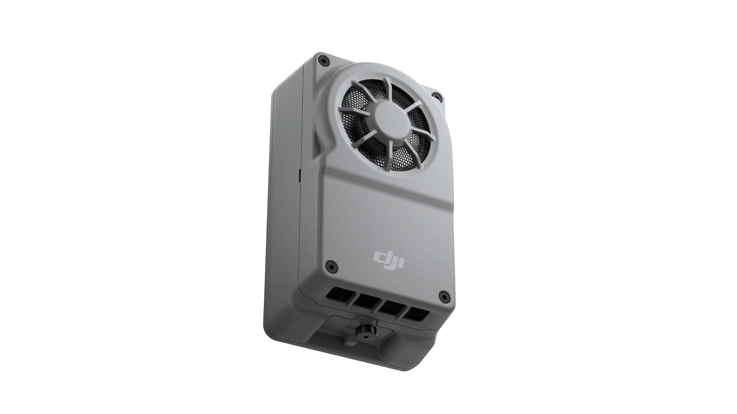 DJI Manifold 3Explore product
Get to Know Matrice 400
Let's choose the right platform and payload configuration for your mission.
Applications
One platform for missions from emergency response to infrastructure inspection.

Public Safety
Situational awareness, first response, accident and forensic investigation, firefighting, and search and rescue.

Inspection and AEC
Inspection of distribution lines, transformers, facilities, pipelines, solar and wind farms, and bridges; architecture, engineering and construction.

Mapping
Land surveying, cadastre, urban planning, mine mapping and forestry.

Power Line Inspection
Imaging line corridors and inspecting transmission infrastructure.

Oil and Gas
Aerial inspection of pipelines and large facilities.

Renewable Energy
Imaging and inspection of solar and wind power facilities.

Water Resource Management
Observation of water structures, basins and coastal areas.

Maritime
Aerial observation and situational awareness for maritime operations.