
DJI ZenmuseH20N
Vision Beyond the Darkness.
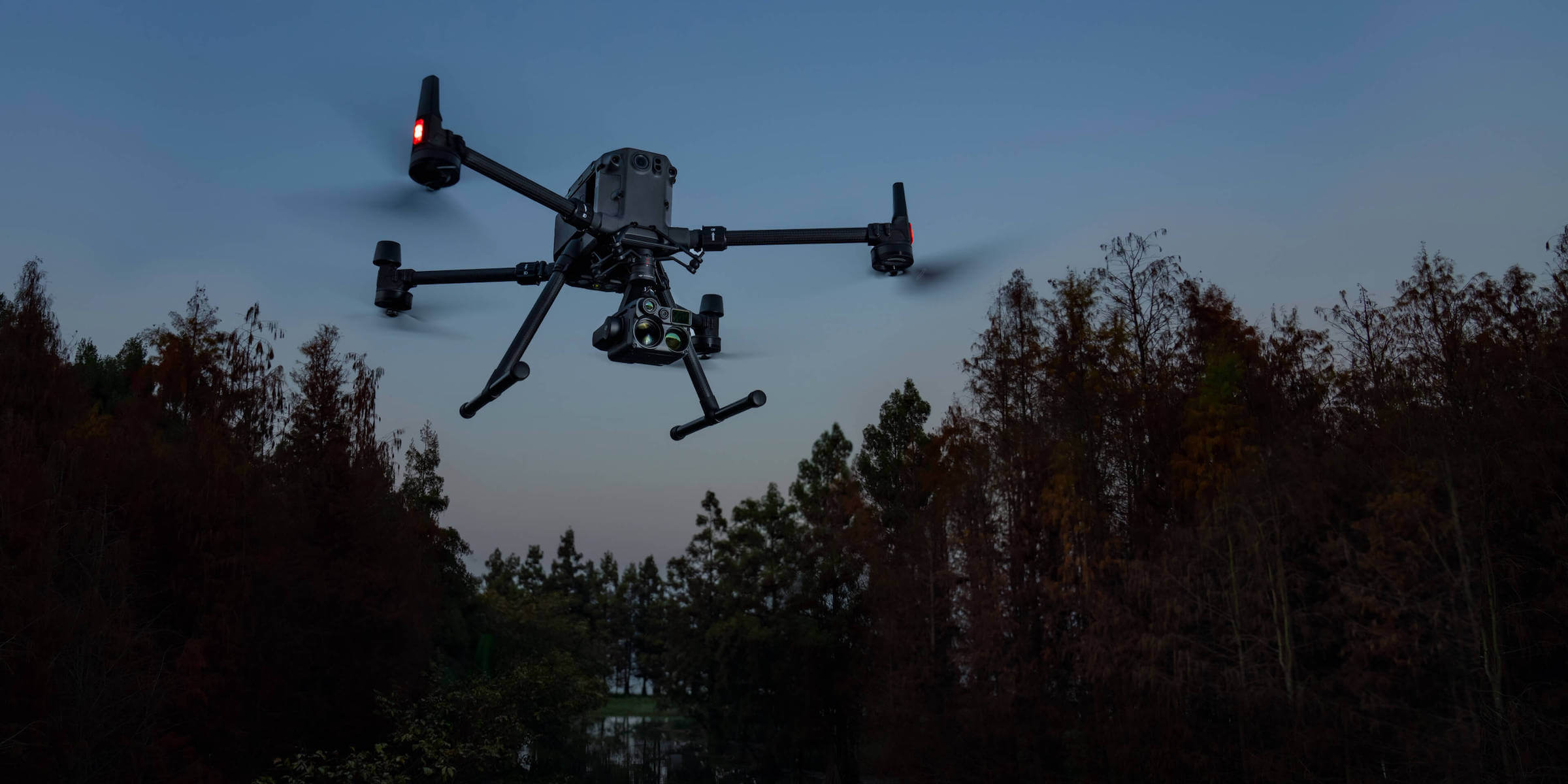
Wide-angle and zoom cameras with starlight sensors, dual thermal cameras and a laser rangefinder. Zenmuse H20N combines visible-light and thermal data for night operations.

Night Vision
Wide-angle and zoom cameras.
Hybrid Optical Zoom
128× maximum zoom.
Dual Thermal Cameras
Resolution of both thermal cameras.
Thermal Optical Views
Wide and telephoto thermal cameras.
Laser Rangefinding
3–1200 m measurement range.
Adapted to Field Conditions
−20 °C to +50 °C operating range.
STARLIGHT NIGHT VISION
Follow Details Through the Night.
Developed for Night Missions.
Starlight sensors in the H20N zoom and wide-angle cameras are designed for low-light imaging. Dual thermal cameras enable observation of temperature differences.
Combine visible-light and thermal imagery in the same operation to view field details from different perspectives.
MULTI-CAMERA SYSTEM
From Wide Views to Close Details.
4 MP Zoom Camera
1/1.8-inch CMOS starlight sensor; 20× hybrid optical and 128× maximum zoom.
2 MP Wide-Angle Camera
Observe the overall scene with a 1/2.7-inch CMOS starlight sensor and 29 mm equivalent focal length.
Laser Rangefinder
Add target measurements to your imaging workflow across a 3–1200 m range.
DUAL THERMAL CAMERAS
See Thermal Differences Up Close.
Wide Thermal Camera.
53 mm equivalent focal length and 640×512 resolution. View thermal distribution across a wide area.
Telephoto Thermal Camera.
196 mm equivalent focal length and 640×512 resolution. Assess distant thermal details more closely.
Up to 32× Thermal Zoom[3]
Locate hotspots and examine their details using two thermal cameras and digital zoom options.
Synchronised Split Screen
Scale thermal and starlight images together to compare the same scene side by side.
Embedded Temperature Data
Preserve temperature information in R-JPEG recordings for review after the mission.
THERMAL ANALYSIS
From Observation to Measurement.
Evaluate thermal data for your mission using spot and area measurements, alarms, isotherms and colour palettes.
Point and Area Measurement
Read the temperature at a point or assess the temperature distribution within a selected area.
Temperature Alarm
Notify the operator when specified temperature thresholds are exceeded.
Isotherms
Highlight the temperature range of interest within the thermal image.
Colour Palettes
View thermal data with a colour palette suited to your mission.
Gain Modes
Choose the gain mode for finer observation or a wider temperature range.
R-JPEG Recording
Review embedded temperature data in DJI Thermal Analysis Tool and adjust parameters such as emissivity and reflected temperature.
TECHNICAL SPECIFICATIONS
Every Detail, in One Place.
Expand each heading to explore camera, gimbal, rangefinding and operating-condition details.
General
| Product name | DJI Zenmuse H20N |
|---|---|
| Dimensions | 178x135x161 mm |
| Weight | 878 ±5 g |
| Ingress Protection Rating | IP44 |
| Laser Safety | Class 1M (IEC 60825-1:2014) |
| Compatible Aircraft | Matrice 350 RTK Matrice 300 RTK |
Gimbal
| Angular Vibration Range | ±0.01° |
|---|---|
| Mounting | Detachable |
| Controllable Range | Pan: ±320° Tilt: −120° to +60° |
| Mechanical Range | Pan: ±330° Tilt: −132.5° to +68° Roll: −90° to +60° |
| Maximum Control Speed | Pan: 90°/s Tilt: 90°/s |
Zoom Camera
| Sensor | 1/1.8-inch CMOS; effective pixels: 4 MP |
|---|---|
| Zoom | 20× hybrid optical; 128× maximum zoom |
| Lens | Focal length: 6.8–119.9 mm (equivalent: approximately 32.7–574.5 mm) Aperture: f/1.6–f/11 Focus: 1 m–∞ (wide); 8 m–∞ (telephoto) |
| Focus mode | MF/AF-C/AF-S |
| Exposure Mode | Manual, Auto |
| Exposure Compensation | ±3.0 (in 1/3 increments) |
| Metering mode | Spot metering, average metering |
| AE Lock | Supported |
| Electronic Shutter Speed | Photo: 8–1/8000 s Video: 1/30-1/8000 s Video (Night Scene mode, enhanced noise reduction off): 1/10–1/8000 s Video (Night Scene mode, enhanced noise reduction on): 1/5–1/8000 s |
| ISO Range | Video: 100-102400 Photo: 100–102400 |
| Video resolution | 2688×1512@30fps 1920×1080@30fps 1920×1080@10fps (Night Scene mode, enhanced noise reduction off) 1920×1080@5fps (Night Scene mode, enhanced noise reduction on) |
| Video format | MP4 |
| Video Subtitles | Supported |
| Maximum Image Size | 2688×1512 |
| Photo Format | JPEG |
Wide-Angle Camera
| Sensor | 1/2.7-inch CMOS; effective pixels: 2 MP |
|---|---|
| Lens | DFOV: 73.6° Focal length: 4.5 mm (equivalent: approximately 29 mm) Aperture: f/2.8 Focus: 1 m–∞ |
| Exposure Mode | Auto |
| Exposure Compensation | ±3.0 (in 1/3 increments) |
| Metering mode | Spot metering, average metering |
| AE Lock | Supported |
| Electronic Shutter Speed | Photo: 0.8–1/8000 s Video: 1/30-1/8000 s Video (Night Scene mode, enhanced noise reduction off): 1/10–1/8000 s Video (Night Scene mode, enhanced noise reduction on): 1/5–1/8000 s |
| ISO Range | Video: 100-102400 Photo: 100–102400 |
| Video resolution | 1920×1080@30fps 1920×1080@10fps (Night Scene mode, enhanced noise reduction off) 1920×1080@5fps (Night Scene mode, enhanced noise reduction on) |
| Video format | MP4 |
| Video Subtitles | Supported |
| Maximum image size | 1920×1080 |
| Image format | JPEG |
Telephoto Infrared Thermal Camera
| Thermal imager | Uncooled VOx Microbolometer |
|---|---|
| Lens | DFOV: 12.5° Focal length: 44.5 mm (equivalent: approximately 196 mm) Aperture: f/1.2 Focus: 45 m–∞ |
| Optical View | 8×; 196 mm equivalent focal length |
| Equivalent Digital Zoom | 16x, 32x |
| Video resolution | 640×512@30fps |
| Video format | MP4 |
| Image resolution | 640×512 |
| Image format | R-JPEG* (including 16-bit raw) |
| Pixel pitch | 12 μm |
| Spectral Band | 8–14 μm |
| Sensitivity (NETD) | ≤50 mK @ f/1.0 |
| Temperature Measurement Method | Spot Meter, Area Measurement |
| Temperature Measurement Range | −20 °C to 150 °C (High Gain) 0 °C to 500 °C (Low Gain) |
| Temperature Alert | Supported |
| FFC | Auto/Manual |
| Palette | White Hot/Fulgurite/Iron Red/Hot Iron/Medical/Arctic/Rainbow 1/Rainbow 2/Tint/Black Hot |
Wide Infrared Thermal Camera
| Thermal imager | Uncooled VOx Microbolometer |
|---|---|
| Lens | DFOV: 45.5° Focal length: 12 mm (equivalent: approximately 53 mm) Aperture: f/1.0 Focus: 5 m–∞ |
| Optical View | 2×; 53 mm equivalent focal length |
| Equivalent digital zoom ratio | 4x |
| Video resolution | 640×512 @ 30 fps |
| Video format | MP4 |
| Image resolution | 640×512 |
| Image format | R-JPEG (including 16-bit raw) |
| Pixel pitch | 12 μm |
| Spectral Band | 8–14 μm |
| Sensitivity (NETD) | ≤50 mK @ f/1.0 |
| Temperature Measurement Method | Spot Meter, Area Measurement |
| Temperature Measurement Range | −20 °C to 150 °C (High Gain) 0 °C to 500 °C (Low Gain) |
| Temperature Alert | Supported |
| FFC | Auto/Manual |
| Palette | White Hot/Fulgurite/Iron Red/Hot Iron/Medical/Arctic/Rainbow 1/Rainbow 2/Tint/Black Hot |
Laser Rangefinder
| Wavelength | 905 nm |
|---|---|
| Maximum Power | 3.5mW |
| Single Pulse Width | 6 ns |
| Measurement Accuracy | ±(0.2 m + target distance × 0.15%) |
| Measurement range | 3–1200 m (0.5 × 12 m vertical surface with 20% reflectivity) |
Data Storage
| Supported microSD Cards | Supports UHS-I Speed Grade 3 microSD cards up to 128 GB |
|---|---|
| Supported File System | exFAT |
Operating and Storage Conditions
| Operating temperature | −20 °C to 50 °C (−4 °F to 122 °F) |
|---|---|
| Storage temperature | −20 °C to 60 °C (−4 °F to 140 °F) |
COMPATIBLE AIRCRAFT
The Platform for Your Mission.
DJI Matrice 350 RTK
Compatible platform for integrated imaging and field operations.
Explore Product ↗DJI Matrice 300 RTK
Industrial platform compatible with Zenmuse H20N.
Explore Product ↗Camera, aircraft and controller firmware must use compatible, up-to-date versions.
APPLICATIONS
Different Missions. Shared Vision.
Search and Rescue and Public Safety
Combine thermal and visible-light data in low light to support field observation and team coordination.
Energy and Infrastructure Inspection
Inspect distant details with the zoom camera and assess temperature differences using thermal data.
Forestry and Site Monitoring
Use multi-sensor data to observe wide areas and assess thermal differences.
ZENMUSE H SERIES
Vision for Your Operation.
Explore four models for different imaging needs.
Zenmuse H20N for Your Mission.
Evaluate camera selection, compatible aircraft and operational requirements with Atay Mühendislik specialists.
Stated performance values depend on test conditions. Actual results may vary with target, distance, lighting and weather.
- The laser rangefinder's 1200 m upper limit applies under the manufacturer's target-surface and reflectivity test conditions. Actual range depends on field conditions.
- IP44 does not provide protection against immersion. Operating temperature is −20 °C to +50 °C.
- The 2× and 8× values describe the optical views of two separate thermal cameras. The 32× upper limit includes digital zoom; it is not continuous 32× optical zoom.
Product information: ATAY — Zenmuse H20N · DJI specifications ↗