
Matrice 350 RTK
Power Your Way Forward!
DJI Matrice 350 RTK combines an upgraded video transmission and control experience with an efficient dual-battery system and comprehensive safety features. Flexible payload and expansion options bring new capabilities to aerial operations.

Maximum Flight Time
Strong flight performance for extended field missions.
Ingress Protection Rating
Operating temperature from −20 °C to +50 °C.
Maximum Payload
Flexible payload configuration for different missions.
Maximum Flight Altitude
With 2112 propellers and the specified takeoff weight.
Maximum Wind Resistance
23 m/s maximum horizontal flight speed.
Sensing and Positioning
Dual vision and infrared sensing system.
Performance values apply under the relevant test conditions and vary with payload, battery and environment.
FLIGHT PERFORMANCE
Effortless, Powerful Flight Performance
With a robust airframe, improved protection, strong propulsion and high flight performance, DJI Matrice 350 RTK supports missions in a wide range of field conditions.
NEW TRANSMISSION SYSTEM
O3 Enterprise Transmission
DJI O3 Enterprise supports three-channel 1080p HD live view. Four-antenna systems on the aircraft and controller select the best two antennas for transmission while receiving simultaneously on all four, improving interference resistance and stability.
20 km / 8 km[4]
Maximum transmission distance is 20 km under FCC and 8 km under CE, SRRC and MIC standards.
Dual-Operator Mode
Dual-Operator Mode is used for three-channel 1080p HD live feeds.
4G Enhanced Transmission[7]
In supported regions, an additional 4G kit and internet-connected controller can supplement O3 connectivity with mobile networks.
NEW CONTROL EXPERIENCE
DJI RC Plus
With a high-brightness 7-inch screen and Dual-Operator Mode, DJI RC Plus adapts to different requirements. Its internal battery and WB37 together provide approximately six hours of operation.
Ready for Challenging Environments
IP54 protection and a −20 °C to +50 °C operating range support controller use in different weather conditions.
Smooth and Efficient Control
Buttons and dials on the front, rear and top provide quick control. Button functions can be customized to user preferences.
DJI Pilot 2
Monitor mission type, flight status and payload information in one interface, and easily manage the aircraft and payloads.

UPGRADED BATTERY SYSTEM
New Dual-Battery System
Matrice 350 RTK's dual TB65 system enables consecutive missions without powering off the aircraft during ground battery changes. Batteries support up to 400 charge cycles under specified storage conditions.[5]

Next-Generation Intelligent Battery Station
BS65 provides one solution for battery charging, storage and transport. Its 360° wheels simplify moving between sites.
50% / 90%
Storage Mode charges batteries to 50%; Ready-to-Fly Mode charges to 90%.
Intelligent Management
RC Plus and DJI Pilot 2 monitor battery status and health, discharge settings, updates and logs.
20–90% in 30 minutes
With 220 V input, two TB65 batteries charge from 20% to 90% in about 30 minutes or fully charge in about 60 minutes.
ENHANCED FLIGHT SAFETY
Know Your Surroundings.
Arm Lock Indicator
Arm lock detection helps identify unlocked arm connections.
Night-Vision FPV Camera
Supports viewing the surroundings and obstacles at night. Assists navigation with PinPoint; the FPV camera provides the flight view.
Six-Directional Sensing and Positioning
Dual vision and infrared sensors in six directions provide environmental sensing and positioning. Performance depends on light and obstacle characteristics.
CSM Radar[6]
Optional CSM Radar supports thin-obstacle detection upward and across 360° horizontally. Effective range reaches 30 m under specified conditions.
Multi-Layer Redundant Design
Redundancy in the aircraft and sensor systems supports flight safety in demanding operations.
POWERFUL PAYLOAD SUPPORT
A Configuration for Your Mission
Supports up to three simultaneous payloads with single downward, dual downward and single upward gimbal options. A 2.7 kg total capacity and E-Port connectivity offer flexibility for public safety, inspection and mapping.
Explore photogrammetry with Zenmuse P1, LiDAR collection with L2, multi-sensor observation with H30 and H30T, and lighting and audio broadcasting with S1 and V1.
Gimbal mounts and payloads are purchased separately depending on the package. The single gimbal damper limit is 960 g; total capacity does not apply separately to each connection.
INTELLIGENT OPERATION
Collect Data. Coordinate. Repeat.
High-Precision Mapping
Supports Waypoint, mapping, linear and oblique missions. Follow terrain with Terrain Follow or use Smart Oblique with Zenmuse P1. With a suitable sensor and DJI Terra produce HD 2D and 3D digital results.
Air-to-Ground Coordination
Connect air, ground and cloud with PinPoint, cloud-based real-time mapping and DJI FlightHub 2. Share live operational views through point, line and area annotations.
Automated Precision Inspection
Create and save routes with Live Mission Recording and reuse them for recurring inspections. With Zenmuse H20 Series, AI Spot-Check supports automatic subject framing and manual composition adjustments.
Terrain Follow requires internet access and downloaded DEM files. Smart Oblique requires Zenmuse P1; cloud coordination requires DJI FlightHub 2; AI Spot-Check requires a Zenmuse H20 Series payload.
DATA AND INTEGRATION
Connects to Your Field Workflow.
Data Security
Media encryption, Local Data Mode, one-tap clearing of all device data and AES-256 video transmission encryption.
Payload SDK
E-Port, SkyPort V2 and DJI X-Port integration for gas detectors, speakers, multispectral sensors and other certified payloads.
Mobile SDK and Cloud API
Custom mobile apps and third-party cloud connectivity through DJI Pilot 2 for data transfer, live streaming and route distribution.
PACKAGE CONTENTS
Choose the Right Package for Your Project.
Standard Package
- DJI Matrice 350 RTK UAV — without batteries
- DJI Matrice 350 BS65 Intelligent Battery Station
Battery-Inclusive Package
- DJI Matrice 350 RTK UAV
- DJI TB65 Intelligent Flight Battery — 2 units
- DJI Matrice 350 BS65 Intelligent Battery Station
Drone + Battery + Zenmuse P1
- DJI Matrice 350 RTK UAV
- DJI TB65 Intelligent Flight Battery — 2 units
- DJI Matrice 350 BS65 Intelligent Battery Station
- DJI Zenmuse P1
TECHNICAL SPECIFICATIONS
Every Detail, in One Place.
Expand the specifications for the aircraft, controller, sensing and battery systems.
Drone and Flight Performance
| Dimensions (unfolded, without propellers) | 810 × 670 × 430 mm (L × W × H) |
|---|---|
| Dimensions (folded, with propellers) | 430 × 420 × 430 mm (L × W × H) |
| Diagonal Wheelbase | 895 mm |
| Weight (with single downward gimbal) | Without batteries: approximately 3.77 kg With two TB65 batteries: approximately 6.47 kg |
| Maximum Payload of Single Gimbal Damper | 960 g |
| Maximum Takeoff Weight | 9.2 kg |
| Operating Frequency | 2.4000-2.4835 GHz 5.150-5.250 GHz (CE: 5.170-5.250 GHz) 5.725-5.850 GHz In some countries and regions, 5.1 GHz and 5.8 GHz bands are prohibited or 5.1 GHz is restricted to indoor use. Consult local laws and regulations for details. |
| Transmitter Power (EIRP) | 2.4000-2.4835 GHz: < 33 dBm (FCC) < 20 dBm (CE/SRRC/MIC) 5.150-5.250 GHz (CE: 5.170-5.250 GHz): < 23 dBm (CE) 5.725-5.850 GHz: < 33 dBm (FCC/SRRC) < 14 dBm (CE) |
| Hovering Accuracy | Vertical: ±0.1 m (with vision positioning) ±0.5 m (with GNSS positioning) ±0.1 m (with RTK positioning) Horizontal: ±0.3 m (with vision positioning) ±1.5 m (with GNSS positioning) ±0.1 m (with RTK positioning) |
| RTK Positioning Accuracy (RTK FIX) | 1 cm + 1 ppm (horizontal) 1.5 cm + 1 ppm (vertical) |
| Maximum Angular Velocity | Pitch: 300°/s Yaw: 100°/s |
| Maximum Pitch Angle | 30° In N mode with forward vision enabled: 25°. |
| Maximum Ascent Speed | 6 m/s |
| Maximum Descent Speed (vertical) | 5 m/s |
| Maximum Tilted Descent Speed | 7 m/s |
| Maximum Horizontal Speed | 23 m/s |
| Maximum Flight Altitude | 2110s propellers: 5000 m; takeoff weight ≤7.4 kg. 2112 High-Altitude Low-Noise Propellers: 7000 m; takeoff weight ≤7.2 kg. [3] |
| Maximum Wind Resistance | 12 m/s |
| Maximum Flight Time | 55 minutes Measured while Matrice 350 RTK flew without payload or wind at approximately 8 m/s until 0% battery. Data is for reference; actual duration varies with flight mode, accessories and environment. Observe the app's reminders. |
| Supported DJI Gimbals | Zenmuse H30, H30T, H20, H20T, H20N, L2, L1, P1, S1 and V1. Cameras, sensors and other payloads are purchased separately depending on the package. |
| Supported Gimbal Configurations | Single downward gimbal Single upward gimbal Dual downward gimbals Single downward + single upward gimbal Dual downward + single upward gimbal Upward and dual-downward mounts are sold separately; total and per-connection payload limits apply. |
| Ingress Protection Rating | IP55 The IP rating is not permanent and may decrease with product wear. |
| Global Navigation Satellite System | GPS + GLONASS + BeiDou + Galileo |
| Operating Temperature | -20 °C to +50 °C |
| Maximum Total Payload | 2.7 kg; single gimbal damper limit 960 g. |
| Third-Party Payloads | Certified payloads developed using DJI Payload SDK are supported. |
| Expansion Connection | E-Port; SkyPort V2 and DJI X-Port with suitable connections. |
| Class | C3 (EU) |
DJI RC Plus
| Display | 7.02-inch LCD touchscreen; resolution: 1920 × 1200; maximum brightness: 1200 nits |
|---|---|
| Weight | Approximately 1.25 kg (without WB37 battery) Approximately 1.42 kg (with WB37 battery) |
| Global Navigation Satellite System | GPS + Galileo + BeiDou |
| Internal Battery | Type: Li-ion (6500 mAh @ 7.2 V) Charging: use the battery station or a USB-C fast charger up to 65 W (maximum voltage 20 V). Charging Time: 2 hours Chemistry: LiNiCoAlO₂ |
| External Battery (WB37 Intelligent Battery) | Capacity: 4920 mAh Voltage: 7.6 V Type: Li-ion Energy: 37.39 Wh Chemistry: LiCoO₂ |
| Ingress Protection Rating | IP54 |
| Operating Time | Internal Battery: approximately 3.3 hours Internal + External Battery: approximately 6 hours |
| Operating Temperature | −20° to 50° C (−4° to 122° F) |
| Operating Frequency | 2.4000-2.4835 GHz 5.725-5.850 GHz |
| Transmitter Power (EIRP) | 2.4000-2.4835 GHz: < 33 dBm (FCC) < 20 dBm (CE/SRRC/MIC) 5.725-5.850 GHz: < 33 dBm (FCC) < 14 dBm (CE) < 23 dBm (SRRC) |
| Wi-Fi Protocol | Wi-Fi 6 |
| Wi-Fi Operating Frequency | 2.4000-2.4835 GHz 5.150-5.250 GHz 5.725-5.850 GHz |
| Bluetooth Protocol | Bluetooth 5.1 |
| Bluetooth Operating Frequency | 2.4000-2.4835 GHz |
Video Transmission
| Video Transmission System | DJI O3 Enterprise Transmission |
|---|---|
| Antenna | 4 video transmission antennas, 2T4R |
| Maximum Transmission Distance (unobstructed, interference-free) | 20 km (FCC) 8 km (CE/SRRC/MIC) |
| Maximum Transmission Distance (with interference) | Low interference, obstructed by buildings: approximately 0–0.5 km Low interference, obstructed by trees: approximately 0.5–3 km Strong interference, unobstructed: urban setting, approximately 1.5–3 km Medium interference, unobstructed: suburban setting, approximately 3–9 km Low interference, unobstructed: suburban/seaside setting, approximately 9–20 km FCC test references; actual distance varies with obstacles, interference and regional standard. [4] |
| Live View | Three-channel 1080p HD live view; requires Dual-Operator Mode. |
| 4G Enhanced Transmission | In supported regions, with Matrice 350 RTK 4G Dongle Kit and an internet-connected controller. The aircraft kit and, if needed, controller DJI Cellular Dongle are sold separately. [7] |
Vision System
| Obstacle Sensing Range | Forward/Backward/Left/Right: 0.7–40 m Upward/Downward: 0.6–30 m |
|---|---|
| Field of View | Forward/Backward/Downward: 65° (horizontal), 50° (vertical) Left/Right/Upward: 75° (horizontal), 60° (vertical) |
| Operating Environment | Surfaces with distinct patterns and sufficient illumination (>15 lux) |
Infrared Sensing System
| Obstacle Sensing Range | 0.1-8 m |
|---|---|
| Field of View | 30° (±15°) |
| Operating Environment | Obstacles with large, diffusely reflective surfaces; reflectivity >10%. |
FPV Camera
| Resolution | 1080p |
|---|---|
| Field of View | 142° |
| Frame Rate | 30 fps |
TB65 Intelligent Flight Battery
| Model | TB65 |
|---|---|
| Capacity | 5880 mAh |
| Voltage | 44.76 V |
| Type | Li-ion |
| Energy | 263.2 Wh |
| Weight | Approximately 1.35 kg |
| Operating Temperature | −20° to 50° C (−4° to 122° F) |
| Ideal Storage Temperature | 22° – 30° C (71.6° – 86° F) |
| Charging Temperature | −20° to 40° C (−4° to 104° F) Below 5 °C (41 °F) ambient temperature, the battery automatically activates heating. Charging at low temperatures may shorten battery life. Charging at 15–35 °C (59–95 °F) is recommended. |
| Charging Time | With 220 V input, fully charging two TB65 Intelligent Flight Batteries takes about 60 minutes; 20% to 90% takes about 30 minutes. With 110 V input, fully charging two TB65 Intelligent Flight Batteries takes about 70 minutes; 20% to 90% takes about 40 minutes. |
| Battery System | Two TB65 batteries; supports battery changes without powering off while the aircraft is on the ground. |
| Charging Cycles | Up to 400 cycles under specified storage conditions. [5] |
BS65 Intelligent Battery Station
| Dimensions | 580 × 358 × 254 mm (L × W × H) |
|---|---|
| Net Weight | Approximately 8.98 kg |
| Battery Storage Capacity | Eight TB65 Intelligent Flight Batteries Four WB37 Intelligent Batteries |
| Input Voltage | 100-120 VAC, 50-60 Hz 220-240 VAC, 50-60 Hz |
| Maximum Input Power | 1070 W |
| Output Power | 100-120 V: 750 W 220-240 V: 992 W |
| Operating Temperature | −20° to 40° C (−4° to 104° F) |
| Model | BS65 |
| Charging Modes | Storage Mode: 50% Ready-to-Fly Mode: 90% |
| Management | Battery status, health, self-discharge time, firmware updates and logs through DJI RC Plus and Pilot 2. |
| Carrying | 360° swivel wheels. |
LED Auxiliary Light
| Effective Illumination Distance | 5 m |
|---|---|
| Lighting Type | 60 Hz, continuous illumination |
- 55 minutes was measured without wind or payload at approximately 8 m/s until 0% battery. Actual flight duration varies with payload, battery, mode and environment.
- IP55 applies to the aircraft; IP54 to DJI RC Plus. Ratings are measured in controlled conditions and may decrease with wear.
- 7000 m applies with 2112 High-Altitude Low-Noise Propellers and takeoff weight ≤7.2 kg. With 2110s propellers and takeoff weight ≤7.4 kg, the limit is 5000 m.
- 20 km FCC and 8 km CE/SRRC/MIC are unobstructed, interference-free test values. Transmission distance is not round-trip flight range. Interference values are based on FCC tests; frequency availability varies by region.
- 400 charge cycles are specified provided that total time at 90% charge or above remains below 120 days within a 12-month period.
- CSM Radar is sold separately. The 30 m value applies to a target radar cross-section ≥0.4 m²; sensing varies with size and material. Radar obstacle avoidance must be enabled in DJI Pilot 2; DJI specifies a safety distance >2.5 m and flight speed <10 m/s.
- 4G Enhanced Transmission is not available in every country or region. It requires a separately sold Matrice 350 RTK 4G Dongle Kit on the aircraft and controller internet access through DJI Cellular Dongle or Wi-Fi. Discuss service and module availability with Atay.
COMPATIBLE EQUIPMENT AND ACCESSORIES
Solutions That Complete Your Mission.
Explore camera, LiDAR, lighting and audio broadcast options with product images.
 DJI Zenmuse P1Explore Product ↗
 DJI Zenmuse V1Explore Product ↗
 DJI Zenmuse S1Explore Product ↗
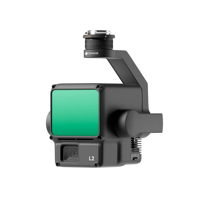 DJI Zenmuse L2Explore Product ↗
 DJI Zenmuse H30TExplore Product ↗
 DJI Zenmuse H30Explore Product ↗
Other Compatible Payloads (14)
 Shenzhen Wayho SKY-W417 Airborne Hyperspectral SystemExplore Product ↗
 Shenzhen Wayho MAX-S810 Airborne Multispectral CameraExplore Product ↗
 CZI – ES638 Electronic Gas and Smoke LauncherExplore Product ↗
 CZI – FL60 Multicolor Warning LightExplore Product ↗
 CZI – IR10 Infrared SpotlightExplore Product ↗
 CZI – TH4 V2 Release DeviceExplore Product ↗
 CZI – DT1K Thermal SearchlightExplore Product ↗
 CZI – LP35 Searchlight and Broadcast SystemExplore Product ↗
 CZI – TK3 Power Supply System SeriesExplore Product ↗
 CZI – MP130 Pro Digital Audio Broadcasting SystemExplore Product ↗
 CZI – GL60 Plus Gimbal SearchlightExplore Product ↗
 CZI – C30N Dual-Sensor Night Vision Gimbal CameraExplore Product ↗
 Riebo D2M/DG3M Five-Lens Photogrammetric SensorExplore Product ↗
 TERSUS – MVP 400 UAV LiDAR Mapping SystemExplore Product ↗
Controller, Battery and Platform Accessories
 DJI RC Plus1200-nit display; approximately 6 hours with internal battery and WB37.Learn More ↗
 BS65 Intelligent Battery StationCharging, storage and transport; space for 8 TB65 and 4 WB37 batteries.Learn More ↗
 TB65 Intelligent Flight Battery5880 mAh, 263.2 Wh; part of the dual-battery system.Learn More ↗
 CSM RadarOptional radar; 30 m sensing under specified conditions.Learn More ↗
 4G Dongle KitAdditional kit for 4G Enhanced Transmission in supported regions.Learn More ↗
 2112 High-Altitude PropellersFor 3000–7000 m altitude; 2 dB quieter than 2110s (in CE testing).Learn More ↗
Payloads and accessories are purchased separately depending on the package. Mount, software version and total payload limit depend on configuration.
The Right Matrice 350 RTK for Your Project.
Let's configure the aircraft, payloads and battery package for your operation.
Applications
Adapts to different field missions with suitable payloads and software.
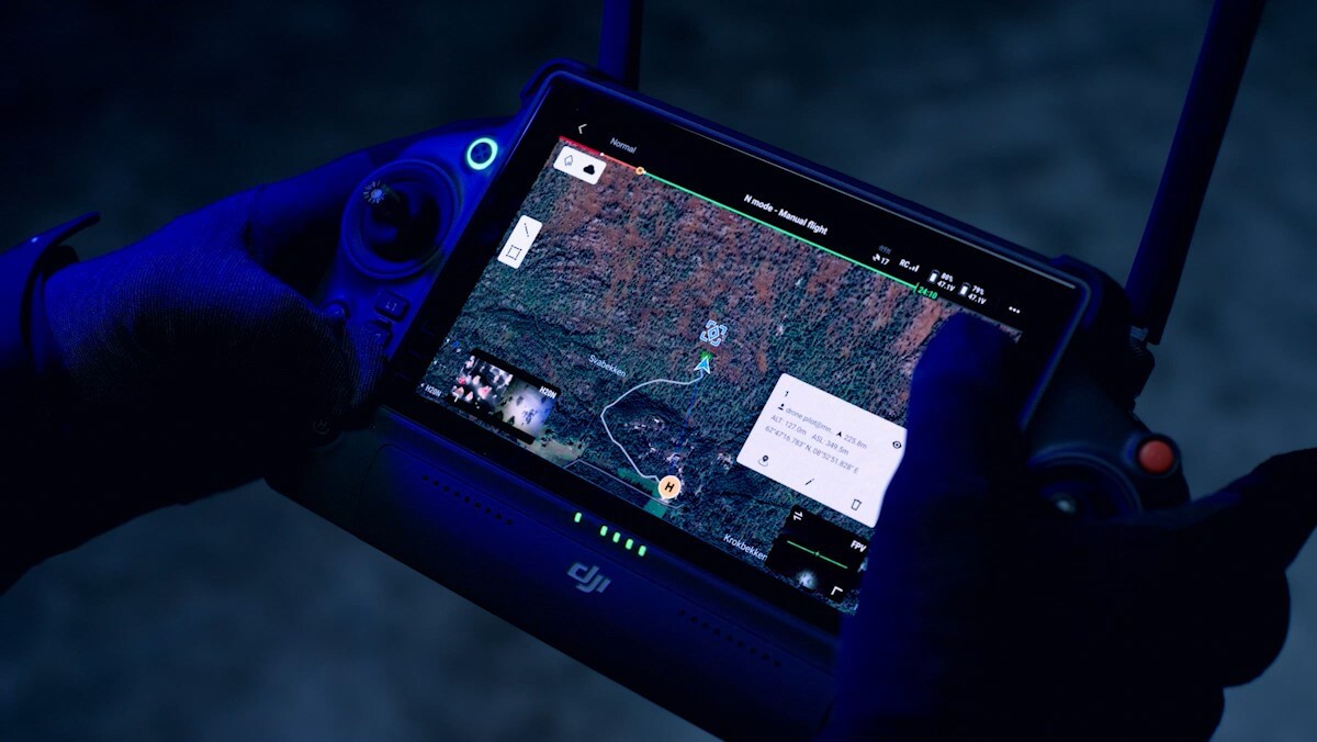
Public Safety
Situational awareness, first response, accident and incident investigation, firefighting, and search and rescue.
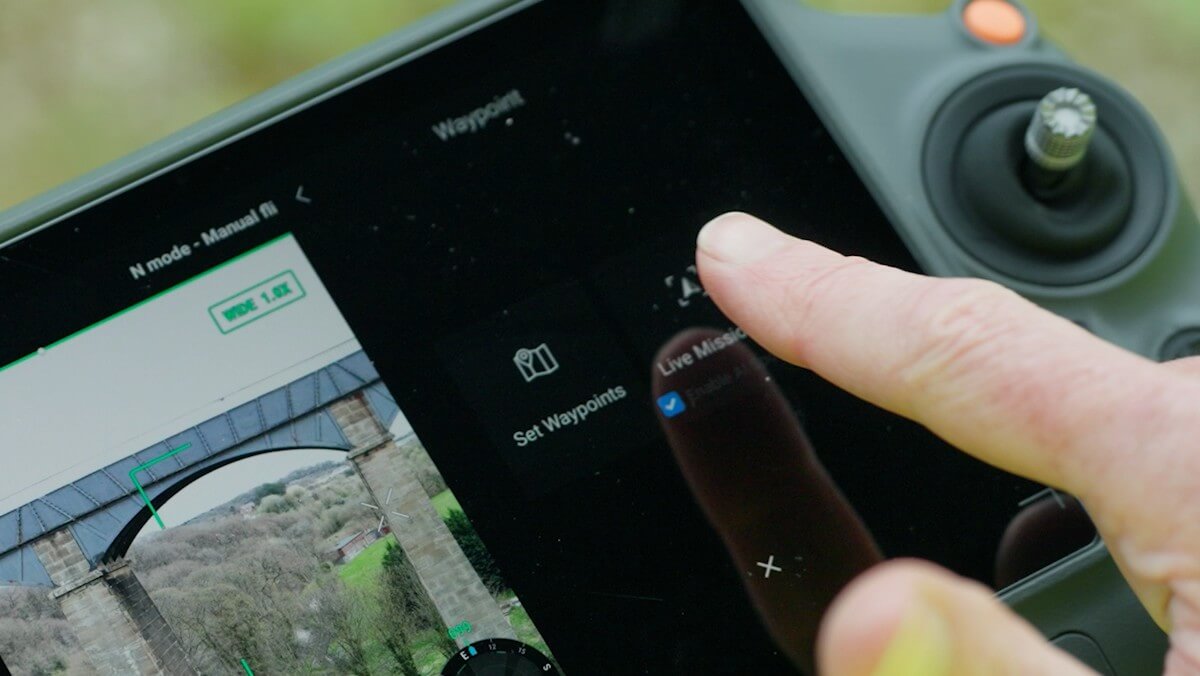
Inspection
Inspection of power distribution lines, transformers, facilities, pipelines, solar and wind farms, and bridges.
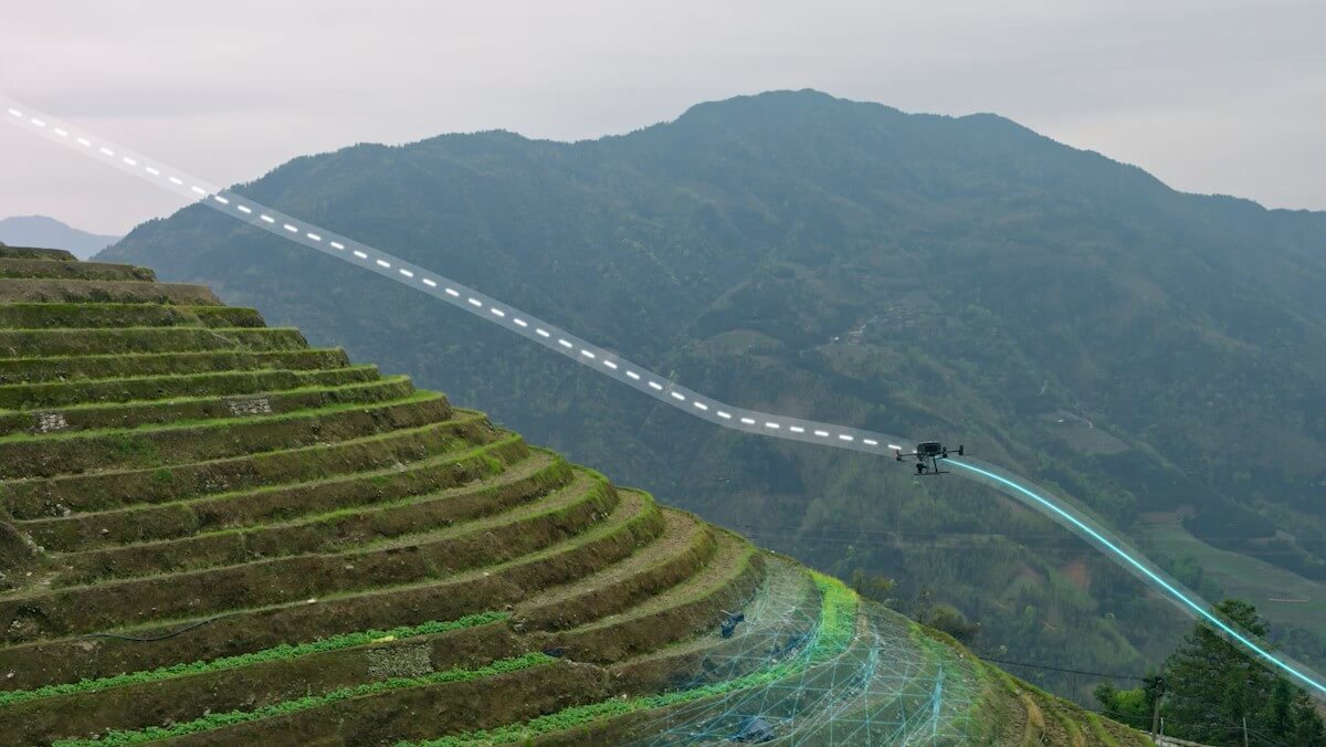
Geospatial
Data collection for surveying, cadastre, urban planning, mine mapping and forestry.