
Oscar Trek
GNSS RTK Receiver with Camera
Capture the image.
Measure the point you see.
Contactless point measurement with camera, GNSS and IMU technology. Select multiple targets in an Oscar Trek photograph to measure in the field or later in the office.

Visual point measurement
Typical 2D accuracy at a target distance of 2–10 m.[1]
Multi-GNSS tracking
Multi-constellation and multi-frequency support.
Tilt compensation within 60°
Calibration-free IMU support.[1]
Combined runtime of two batteries
Up to 8 hours per battery; the second battery serves as a spare.[2]
Internal storage
Storage for survey and field data.
Field durability
Protected housing with a 1.54-inch OLED display.
From images
to coordinates.
Oscar Trek combines high-resolution camera imagery with position and tilt data. Obtain coordinates without physically touching the target point under suitable visibility and survey conditions.
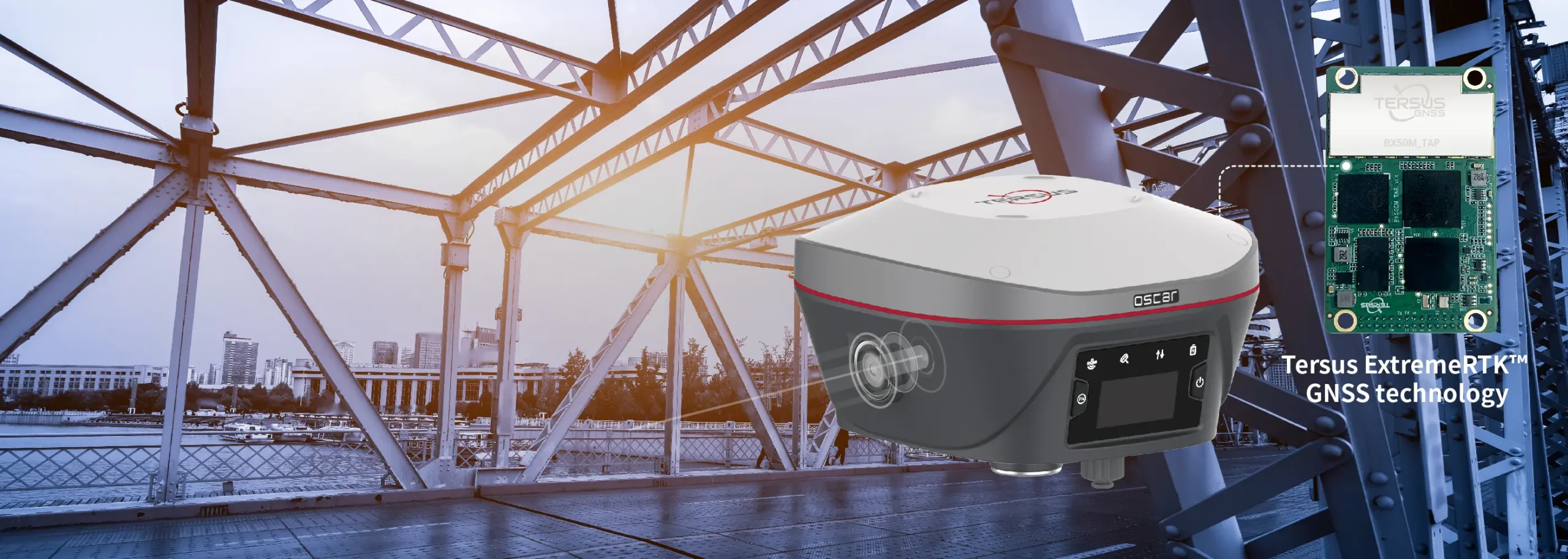
One image, multiple points
Select and measure different targets within an image. Use photographs to revisit your field records.
In the field or office
Evaluate visual survey data in the field or continue working on saved images in the office.
See the points.
Check the result.
A global shutter camera, low-distortion lens and image-processing algorithms support the survey workflow.
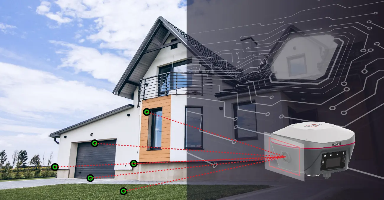
Real-time processing.
Generate point coordinates from recorded images and conduct measurements alongside visual data.
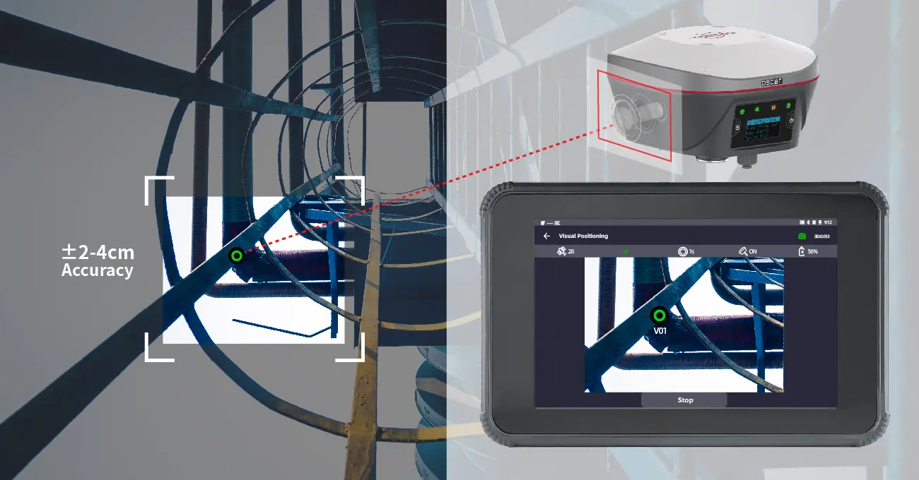
2–4 cm visual accuracy.
The typical 2D accuracy stated in Atay's technical table applies to image-based point measurement at a target distance of 2–10 m.[1]
In a single shot
in complex terrain.
Identify target points on façades, corners and hard-to-reach surfaces within the image. Check and edit your selections before saving them to the project.
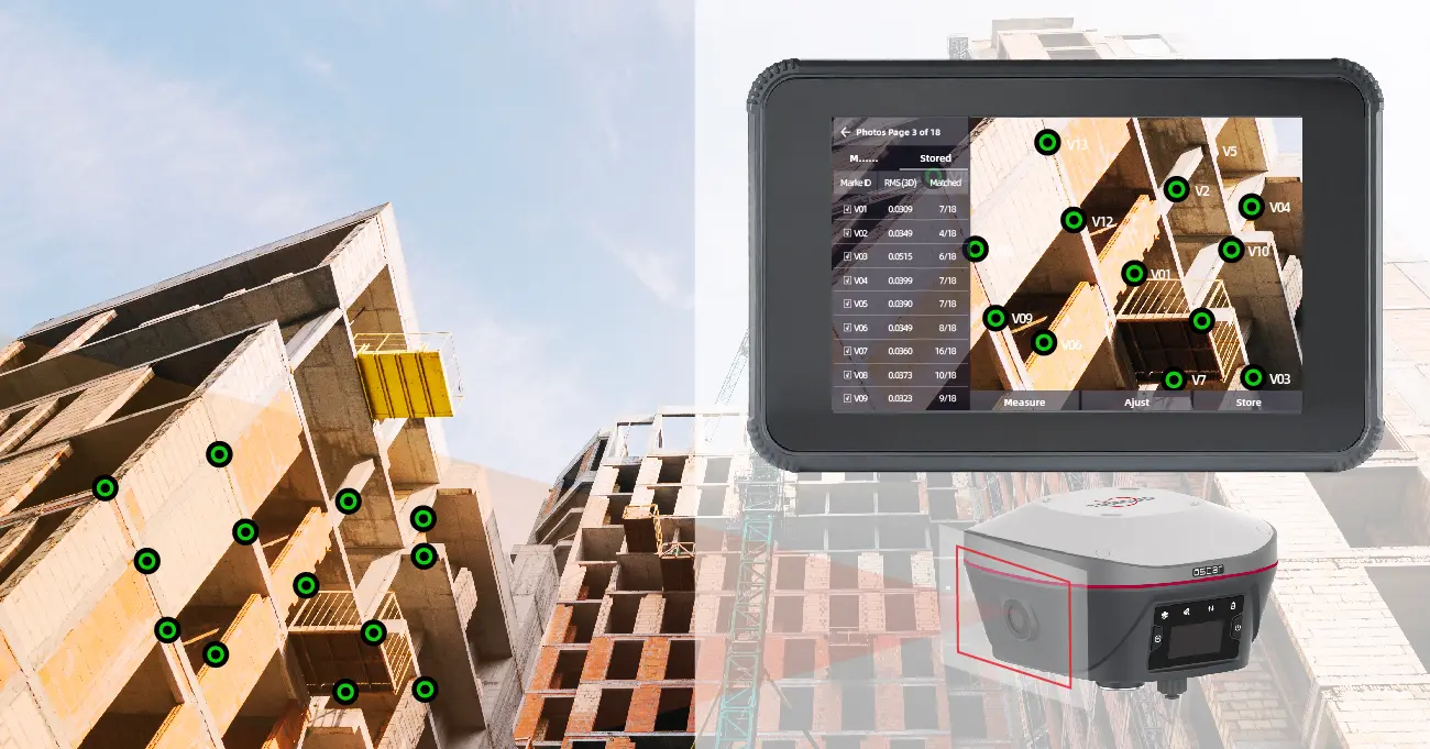
Different targets in the same image.
Expand your survey data by selecting multiple points from a single photograph.
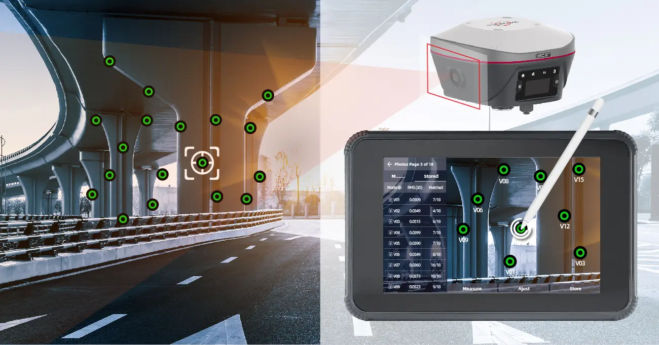
Select, check, save.
Mark the points to measure on the image, check the results and save them.
Measure the details
within your view.
Record surfaces that are difficult to approach physically, using suitable viewing angles and imaging conditions. Visual surveying helps you evaluate different field targets within the same project.
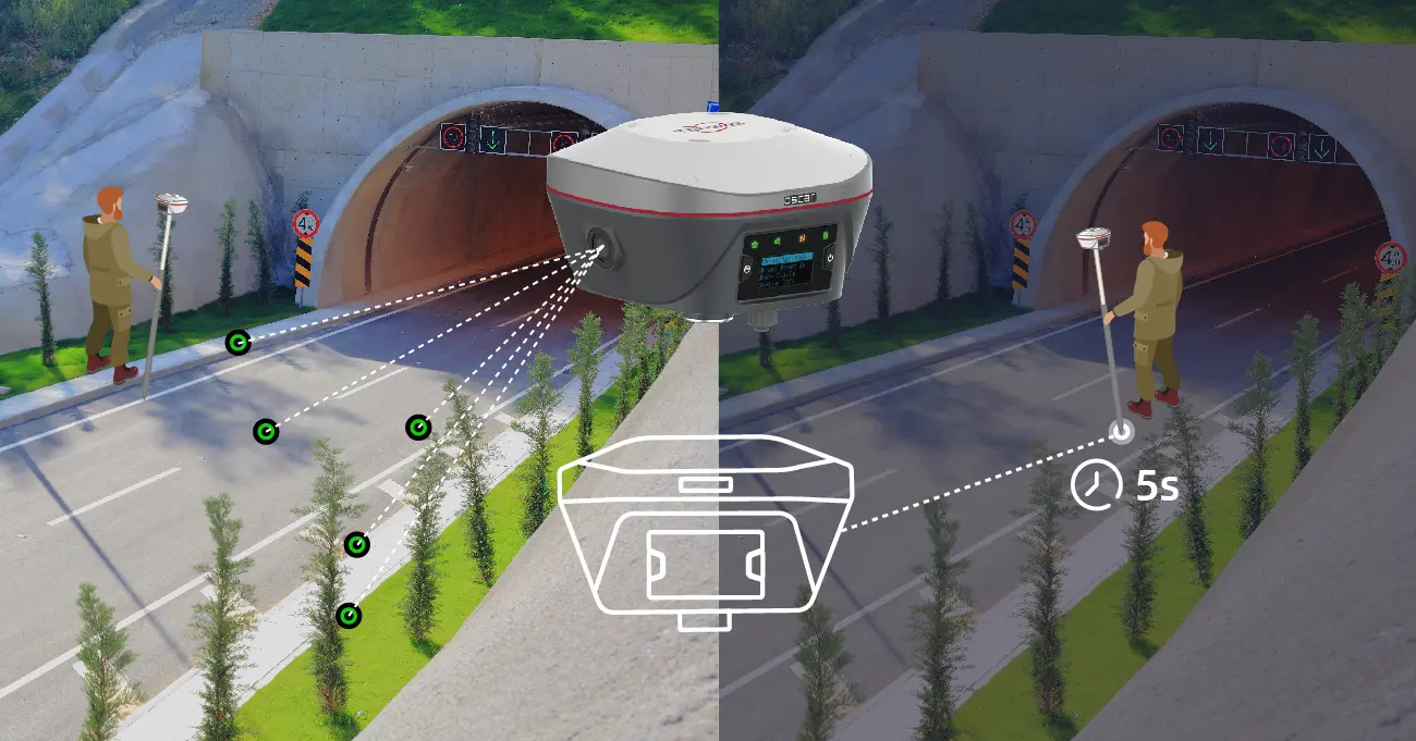
Turn field records
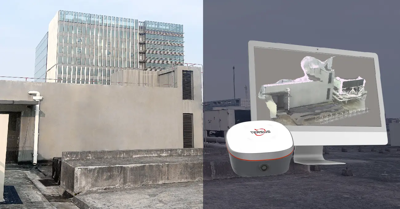
into models.
Process raw visual survey data in compatible 3D modelling software. Model recorded surfaces and use project details in measurement and visualisation work.
Manage fieldwork
from one screen.
The TC80 controller and Android-based NUWA can be used together for surveying, stakeout and data management. A 5.5-inch display and physical keypad support everyday field use.
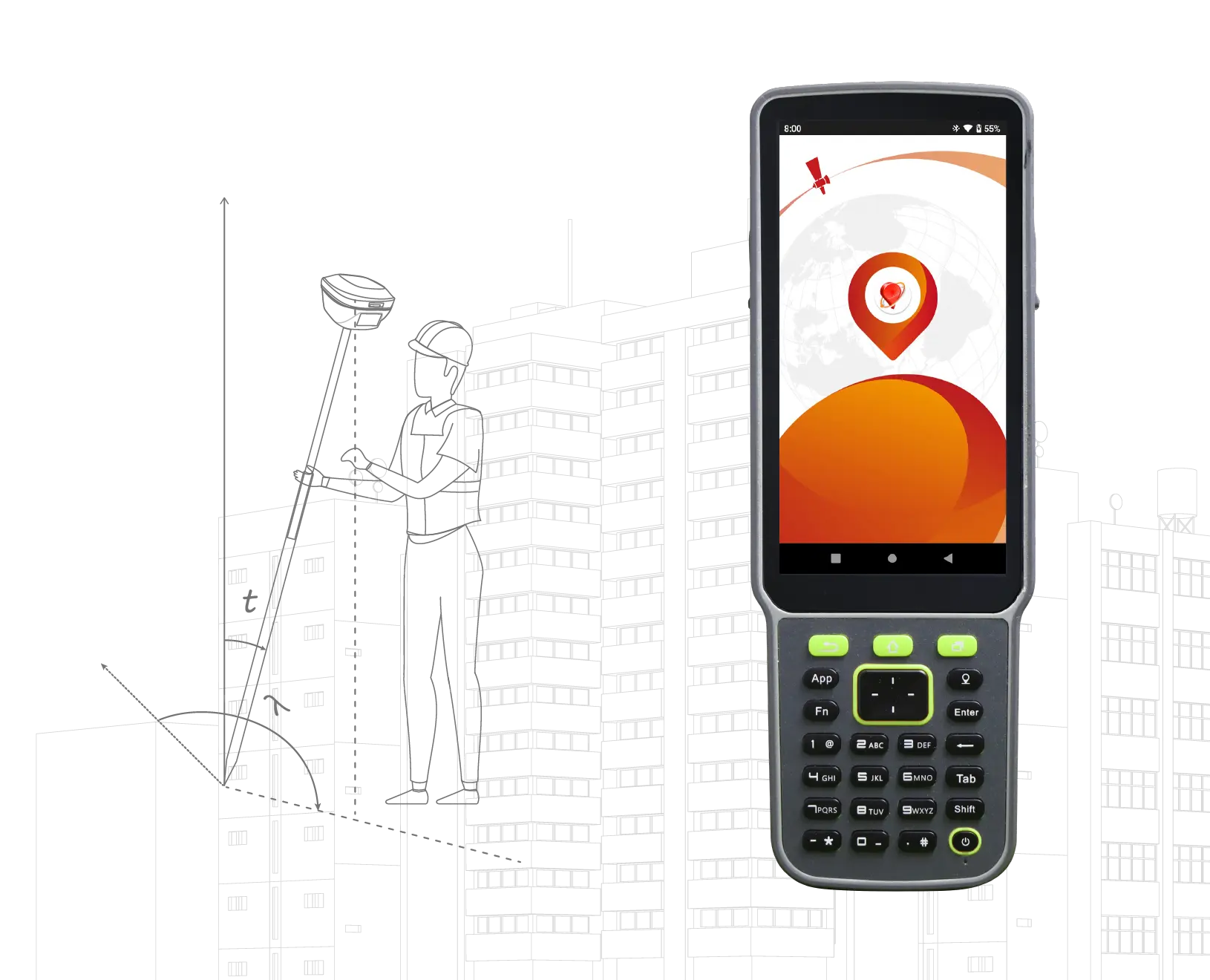
Open the project.
Continue surveying.
Manage fieldwork with NUWA's CAD, road stakeout, mapping and data-sharing tools. Controller and software availability depends on the selected package.
CAD and road stakeout
Point and line stakeout with DWG / DXF files; road centreline, cross-section and elevation operations.
Mapping and graphical surveying
Work with online maps and DXF, KML, KMZ and LandXML backgrounds; manage point and line measurements by code.
Project sharing
Project backup and data transfer between field and office through cloud synchronisation.
Technical specifications.
Explore Oscar Trek positioning, connectivity and hardware specifications.
GNSS and signal tracking
| Channel count | 576 |
|---|---|
| GPS | L1 C/A, L2C, L2P, L5 |
| GLONASS | L1 C/A, L2 C/A |
| BeiDou | B1, B2, B3; BDS-3 support |
| Galileo | E1, E5a, E5b |
| QZSS | L1 C/A, L2C, L5 |
| SBAS | WAAS, EGNOS, GAGAN, SDCM, MSAS |
| Data update rate | 20 Hz |
Positioning performance
| RTK accuracy (RMS) | Horizontal: 8 mm + 1 ppm Vertical: 15 mm + 1 ppm |
|---|---|
| Network RTK accuracy (RMS) | Horizontal: 8 mm + 0.5 ppm Vertical: 15 mm + 0.5 ppm |
| High-precision static (RMS) | Horizontal: 2.5 mm + 0.1 ppm Vertical: 3.5 mm + 0.4 ppm |
| Static / fast static (RMS) | Horizontal: 2.5 mm + 0.5 ppm Vertical: 5 mm + 0.5 ppm |
| PPK accuracy (RMS) | Horizontal: 8 mm + 1 ppm Vertical: 15 mm + 1 ppm |
| DGPS accuracy (RMS) | Horizontal: 0.25 m Vertical: 0.5 m |
| Single-point accuracy (RMS) | Horizontal: 1.5 m Vertical: 3.0 m |
| Initialisation time | Typically 4 seconds.[1] |
| Time to first fix (TTFF) | Cold start: <35 seconds Warm start: <10 seconds |
| Signal reacquisition | <1 second |
| Time / velocity accuracy (RMS) | 20 ns / 0.03 m/s |
| Initialisation reliability | >99.99% |
| Tilt compensation | ≤2 cm within 60°; calibration-free IMU.[1] |
Cameras and visual surveying
| Point measurement from images | 2–4 cm (2D), at a target distance of 2–10 m.[1] |
|---|---|
| Effective pixels | 1920 × 1200 |
| Camera type | Global shutter |
| Focal length | 3.24 mm |
| Field of view | Diagonal: 88.2° · Horizontal: 80.2° · Vertical: 51° |
| TV distortion | <0.1% |
| Visual workflow | Multi-point measurement; 3D modelling of raw data in compatible software |
System and data
| Operating system | Linux |
|---|---|
| Internal storage | 16 GB |
| Differential data | CMR, CMR+ (GPS only), RTCM 2.3 / 3.0 / 3.1 / 3.2 |
| Data output | RINEX, NMEA-0183, Tersus Binary |
| Field software | Tersus NUWA |
Connection
| Cellular connectivity | 4G LTE / UMTS / GSM |
|---|---|
| Network protocols | NTRIP Client, NTRIP Server, TCP, Tersus Caster Service (TCS) |
| Wi-Fi | 802.11 b/g |
| Bluetooth | 4.1 |
| NFC | Supported |
| USB | USB 2.0 OTG × 1 |
| Serial port | RS232 × 1 |
| Serial port data rate | Up to 921600 bps |
Internal radio
| UHF frequency range | 410–470 MHz |
|---|---|
| Radio output power | 0.5 / 1 / 2 W |
| Operating mode | Half-duplex |
| Channel spacing | 12.5 / 25 kHz |
| Modulation | GMSK, 4FSK |
| Radio data rate | 4800 / 9600 / 19200 bps |
| Radio protocols | TrimTalk450, TrimMark 3, South, Transparent, Satel |
| Typical communication distance | >5 km; subject to field and antenna conditions. |
Battery and power
| Input voltage | 9–28 V DC |
|---|---|
| Battery | 7.4 V / 6400 mAh × 2 |
| Single-battery runtime | Up to 8 hours.[2] |
| Combined runtime with two batteries | Up to 16 hours in total when batteries are used sequentially.[2] |
| Battery usage | The device uses one battery at a time; the second is a spare. |
| Charging temperature | +10 °C to +45 °C |
| Typical power consumption | ≈5 W in network or radio reception ≈8 W at 0.5 W transmission · ≈9 W at 1 W · ≈11 W at 2 W |
| Power indicator and electronic bubble level | Supported |
Physical specifications
| Display | 1.54-inch OLED |
|---|---|
| Dimensions | 157 × 157 × 103 mm |
| Weight | Approximately 1.2 kg without batteries / 1.4 kg with batteries |
| Protection rating | IP68 |
| Operating temperature | −40 °C to +70 °C |
| Storage temperature | −55 °C to +85 °C |
| Relative humidity | 100%, non-condensing |
| Drop resistance | 2 m pole drop onto concrete |
| Vibration resistance | MIL-STD-810G, FIG 514.6C-1 |
| Buttons | FN and power |
| LED indicators | Satellite, tilt, correction data and power |
- Accuracy and initialisation times depend on satellite visibility and geometry, multipath, atmospheric and survey conditions. ppm is the baseline-dependent error component; 1 ppm equals 1 mm per kilometre. The 2–4 cm visual measurement figure is specified for 2D measurement at a target distance of 2–10 m. Tilt accuracy of ≤2 cm applies at 60°.
- Oscar Trek uses one battery at a time. In network or rover radio mode, each battery provides up to 8 hours, or up to 16 hours total when two batteries are used sequentially. Runtime varies with operating mode, ambient temperature and battery condition. Dimensions and weight may vary with manufacturing and measurement methods.
Product information is based on the Atay Mühendislik page. Tersus product information.
Complete your workflow.
Access relevant setup and operating resources.
RTK settings with a drone
Review the setup steps in Atay's GNSS and drone connection guide.
Open PDF Guide ↗Oscar Trek resources
Access the data sheet, brochure and user resources on the manufacturer's page.
Open Manufacturer Resources ↗Add visual surveying
to your workflow.
Request product information, a demo and a quotation for Oscar Trek. Let us help select hardware, connectivity and software options for your survey work.