
Metaverse PainterMVP
Mobile Mapping System
Turn data captured on the move
into maps.
Combine GNSS-aided INS, RTK/PPK positioning and LiDAR integration. Record and process mobile mapping data with a Linux-based processing platform.

GNSS-aided INS
Configuration with one or two GNSS antennas.
LiDAR measurement range
For the scanner configuration on the Atay page.
Integrated platform
Wi-Fi, data recording and automated post-processing software.
Positioning and scanning.
In one system.
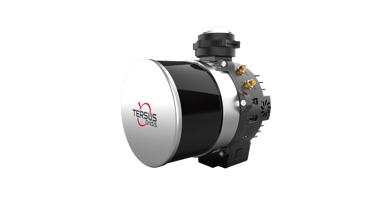
Combine GNSS, inertial navigation and LiDAR data. Use an optional external cellular modem for RTK corrections and complete the workflow with recording and post-processing tools.
Your sensors
for your project.
LiDAR, camera and mounting options are configured for the application.
LiDAR integration
Use with compatible sensors from brands such as Hesai, Velodyne, Quanergy, Ouster, RIEGL and LIVOX.
Camera options
Optional RGB or thermal camera integration.
Mounting options
DJI Skyport adapter, vibration isolator and aerial / vehicle mounting accessories.
Record. Process.
Transfer to your project.
Combine sensor and position data in a planned survey process.
Configure the system
Select LiDAR, camera, GNSS antenna and mounting options for the survey task.
Record the data
Collect GNSS/INS and scan data with the recording software.
Complete post-processing
Evaluate records and manage the point-cloud workflow with automated post-processing software.
Technical specifications.
Explore Metaverse Painter MVP features and configuration options.
System platform
| Processing platform | Linux-based |
|---|---|
| Positioning | GNSS-aided INS; RTK / PPK; single or dual antenna |
| Weight | Without camera: 1.17 kg With camera: 1.70 kg[1] |
| Power input | 9–36 V DC |
| Power consumption | Without camera: 17 W With Sony camera: 24 W |
| Operating temperature | -10 °C to +40 °C |
| Storage temperature | -40 °C to +85 °C |
| Data storage | 256 GB USB; up to 1 TB |
| Protection rating | IP64 |
| Connection | Wi-Fi; optional external cellular modem |
| Software | Data recording and automated post-processing software |
LiDAR / scanner performance[1]
| Laser class | Class 1 |
|---|---|
| Wavelength | 905 nm |
| Measurement principle | TOF; time of flight |
| Measurement range | 0.05–120 m |
| Horizontal field of view | 360° |
| Horizontal resolution | 5 Hz: 0.09° 10 Hz: 0.18° 20 Hz: 0.36° |
| Vertical field of view | 31°; -16° to +15° |
| Vertical resolution | 1° |
| Frame rate | 5 / 10 / 20 Hz |
| Returns | Single return: last, strongest or first Dual-return support |
| Maximum effective measurement rate | Single return: 640,000 points/s Dual return: 1,280,000 points/s |
| LiDAR accuracy / precision | 10 mm / 5 mm |
| Point-cloud precision | 3–5 cm; depending on the LiDAR used and survey conditions at 50 m AGL[1] |
GNSS / IMU performance
| Positioning accuracy (RMS) | PPK: 0.5 cm + 1 ppm RTK: 1 cm + 1 ppm[2] |
|---|---|
| GNSS data rate | Up to 100 Hz |
| IMU data rate | Up to 2000 Hz |
| Roll and pitch accuracy | <0.01° |
| Heading accuracy | <0.05° |
Sensor and accessory options
| LiDAR brands | Hesai, Velodyne, Quanergy, Ouster, RIEGL, LIVOX; compatible models |
|---|---|
| Camera | RGB or thermal camera; optional |
| DJI Skyport adapter | Optional |
| Mounting | Vibration isolator, antenna mounts, drone and vehicle mounting options |
| GNSS antenna arrangement | Single / dual antenna configuration |
- LiDAR range, field of view, point rate, point-cloud precision and system weight refer to the configuration presented on the Atay page. These values may vary with different sensor and camera selections.
- GNSS/INS accuracy depends on satellite visibility, correction data, survey environment, mounting and processing conditions. 1 ppm denotes an error component of 1 mm per kilometre.
Your mobile mapping system
configured together.
Let us select LiDAR, camera, GNSS antenna and mounting options for your project's survey requirements.