SKYDIO AUTONOMOUS SYSTEMS
Skydio X10
Intelligence in flight. Detail in every mission.
This small drone is equipped with the most advanced artificial intelligence in the sky and top-tier sensors. You can access the data you need anytime, anywhere.
Maximum flight speed: 45 miles per hour
Maximum flight time: 40 minutes
Deployment time: <40 seconds
Certification: IP55 (Resistant to dust and water)

Flight Time
Maximum flight time listed for X10.
Deployment
Rapid setup for field operations.
Protection
Dust and water resistance.
Visionary Cameras
The Skydio X10 boasts more megapixels and superior optical features than any drone in its class. It includes high-resolution visual and radiometric cameras within its modular sensor packages. These capabilities enable you to capture precise details for your tasks.


Appropriate Sensors for Your Mission

VT300-Z
Sensor specifications
| Narrow Camera | |
|---|---|
| - 46mm equivalent | |
| - 64 MP | |
| - f/1.8 aperture | |
| - 50° field of view | |
| Telephoto Camera | |
| - 190mm equivalent | |
| - 48 MP | |
| - f/2.2 aperture | |
| - 13° field of view | |
| Radiometric Thermal Camera | |
| - 60mm equivalent | |
| - 640 x 512 pixels | |
| - 41° field of view | |
| - <30 mK sensitivity |

VT300-L
Sensor specifications
| Narrow Camera | |
|---|---|
| - 46mm equivalent | |
| - 64 MP | |
| - f/1.8 aperture | |
| - 50° field of view | |
| 1" Wide Camera | |
| - 20mm equivalent | |
| - 50 MP | |
| - f/1.95 aperture | |
| - 93° field of view | |
| Radiometric Thermal Camera | |
| - 60mm equivalent | |
| - 640 x 512 pixels | |
| - 41° field of view | |
| - <30 mK sensitivity | |
| Flashlight | |
| - 22 lux at 3 meters |
Capture the Detail.

Focus on capturing the entire scene for mid-range shots.

Detect a 0.1 mm crack in the concrete under the bridge in low-light conditions.

Read the license plate from 800 feet away.
Unmatched Thermal Imaging
The Skydio X10 is the first drone to integrate the FLIR Boson+ sensor, offering the highest quality thermal imaging available. This sensor provides a resolution of 640 x 512 pixels and enhanced sensitivity up to <=30 mK. The X10 ensures you can make accurate radiometric readings anytime, anywhere.

Detect temperature differences even on a hot day.

Detect a person on the roof in complete darkness.
Optics Built for the Mission.
Add precise and timely details to every tactical decision.
Ready-made components did not deliver the image quality your team desired. Therefore, we have designed our own custom lenses. Equipped with unparalleled resolution and superior focus, these lenses are unmatched and not available anywhere else.


Image Processing
Achieve pixel-perfect images. Enhance white balance, reduce noise in photos, expand HDR capabilities, and more with sensors supported by the powerful Spectra 480 image signal processor.

Zoom Performance
Thanks to its compact and advanced zooming system that provides the highest quality zoom, the Skydio X10 maintains superior image quality even during zoomed-in shots.
Low-Light Capture
The Skydio X10 offers exceptional low-light performance with custom f/1.8 and f/2.2 aperture lenses that can capture 1.7-3.5 times more light than its competitors, enabling faster exposure times and delivering outstanding images in low-light conditions.
Intelligence on Board.
The Skydio X10 is powered by a built-in NVIDIA Jetson Orin GPU, providing unmatched computational power that enables real-time, accurate decision-making. It features six specially designed navigation lenses that offer 360-degree visibility, eliminating blind spots and ensuring safe flight in any environment.
- 10 times more computational power compared to the previous generation
- 10 times more effective navigation pixels compared to the previous generation
- Custom GPU processing capability supported by the built-in NVIDIA Jetson Orin GPU

Fly with ease.
You can safely perform the most complex missions even in environments where GPS is denied or with high EMI. The Skydio X10 is equipped with advanced artificial intelligence flight assistance and obstacle avoidance features. Whether you're on the field or piloting from hundreds of miles away, you no longer need an expert to get the job done.

Automate complex missions.
With its Spatial AI Engine, you can automatically complete targeted missions; this engine perceives and understands what you survey. The Skydio X10 can generate 2D maps and 3D models in real-time and efficiently. Moreover, you can transfer the acquired data to platforms like Pix4D, Bentley iTwin Capture, gNext, DroneDeploy, or ESRI SiteScan.

Smarter than ever.
The Skydio X10, as the only drone in its class with the most powerful integrated processing power, is designed to enhance artificial intelligence data capture and synthesis capabilities over time.
And do it all in the dark.
The Skydio X10 introduces a groundbreaking capability in the industry by providing autonomy in darkness for the first time. In NightSense mode, it can navigate and operate safely 24/7 even in zero light conditions. This feature is exclusive to the pioneering Skydio X10.
The X10 can utilize visible or infrared illumination for night vision. With an IR Navigation Camera and Illuminator, it can avoid obstacles and understand its surroundings in nighttime and low-light conditions.
Additionally, equipped with a Visible Light Navigation Camera and Illuminator, the X10 offers 360-degree visibility and illuminates its surroundings.
With these features, the Skydio X10 can autonomously fly using visible or infrared light.

Connected Flight Options.
Fly globally as you please.
Fly with the controller.
Fly autonomously based on scanning.
Delegate piloting to a remote operator.
Skydio Connect SL enables you to control the Skydio X10 over local connections, providing a direct and reliable link between the drone and the controller, allowing piloting from distances of up to 12.5 miles. It ensures reliability, especially in crowded areas and over long distances beyond line of sight.
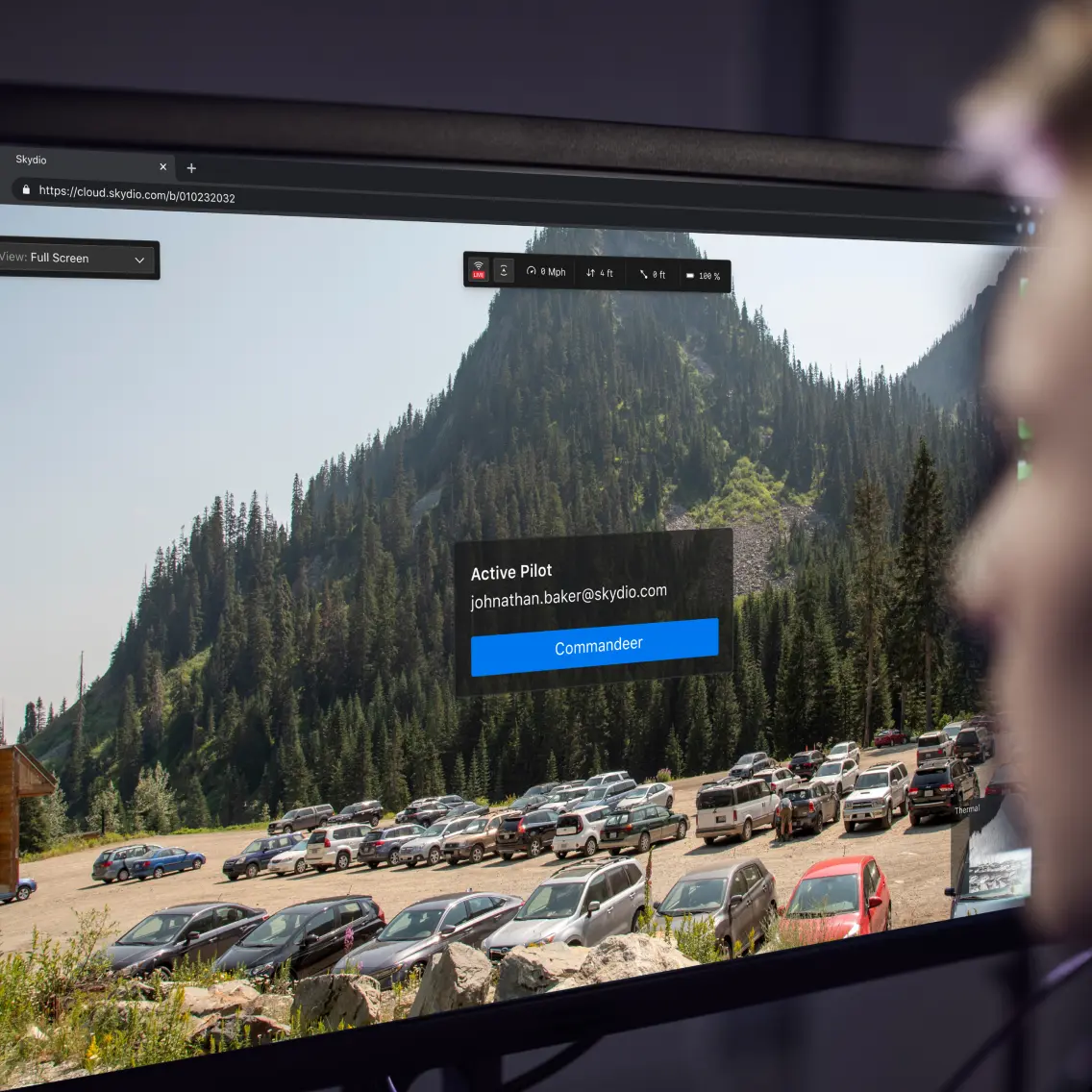
Skydio Connect 5G enables the Skydio X10 to autonomously fly remotely via 5G. This technology provides unlimited connectivity in areas with cellular coverage and allows you to manage missions through the browser via Remote Flight Deck.
Skydio Connect MH is a connectivity option that enhances performance in challenging environments. It offers global support across six frequency bands, allows channel selection during flight, and provides secure connection with AES-256 encryption.
An operator experience shaped by thousands of flight hours.
Plan, execute, and review every type of mission in the redesigned Skydio Flight Deck application.
A completely redesigned professional-level user interface. Navigate menus faster to save time and enable quicker operations during critical missions.


Navigation camera view.

Customize the interface to suit your needs.

Always see what the drone sees.

Quickly access essential functions.
See when conditions change.
Integrated Applications

3D Scan
Create digital twins for both indoor and outdoor environments.

Remote Flight Deck
Control the drone remotely via a web browser.

Onboard Modeling
Create 2D/3D models in the field.
An open modular platform.
The Skydio X10 quickly adapts to varying mission requirements with its modular sensor packages and four mounting points. These features allow you to mount accessories such as parachutes, microphones, spotlights, and more, weighing up to a maximum of 12 ounces.


Customize according to the mission requirements.

Spotlight
Enhance visibility during night operations.

Speaker - Mic
Establish communication and coordination in high-risk situations.

Parachute
Designed to meet safe flight requirements over people, provided by AVSS.

RTK/PPK GPS
Achieve exceptional accuracy for precise mapping and data collection.

NightSense Visible/IR Light
Perform autonomous flights in darkness.
TECHNICAL SPECIFICATIONS
Every Detail, in One Place.
Expand the sections below to explore Skydio X10 specifications and capabilities.
Drone
| Startup Time | Less than 40 seconds |
|---|---|
| Dimensions (unfolded, including propellers) | 31.1” x 25.6” x 5.7” |
| Dimensions (folded, without batteries) | 13.8” x 6.5” x 4.7” |
| Weight (including batteries) | |
| Connect SL | 2.11 kg / 4.65 lb |
| Connect SL + 5G | 2.14 kg / 4.72 lb |
| Maximum Takeoff Weight | 2.49 kg / 5.49 lb |
| Operating Frequency | |
| Connect SL | 2400-2483.5 MHz, 5150-5850 MHz |
| Cellular 5G | 600 MHz - 4400 MHz |
| Transmitter Power (EIRP) | |
| Connect SL | 34.3 dBm (2.4 GHz), 33.7 dBm (5 GHz) |
| 5G | 20 dBm |
| Hovering Accuracy (no wind or air currents) | |
| VIO | +/- 10 cm |
| GNSS | +/- 1 m |
| Maximum Angular Velocity | |
| Yaw | 100 degrees/second |
| Roll / Pitch | 225 degrees/second |
| Maximum Tilt Angle | 40 degrees |
| Maximum Ascent/Descent Speed | |
| Ascent | 6 m/s / 13.4 mph |
| Descent | 4 m/s / 9.0 mph |
| Maximum Non-vertical Descent Rate | 6 m/s / 13.4 mph |
| Maximum Horizontal Speed (at sea level) | 20 m/s / 45 mph |
| Maximum Horizontal Speed with Obstacle Avoidance | 16 m/s / 36 mph |
| Maximum Service Ceiling Above Sea Level (without additional payload) | 15,000 ft density altitude |
| Maximum Wind Resistance | 12.8 m/s / 28 mph or less |
| Maximum Highlight Duration | 35 minutes |
| Maximum Flight Time | 40 minutes |
| Processors | NVIDIA Jetson Orin SoC, Qualcomm QRB5165 SoC |
| Ingress Protection Rating | IP55 |
| GNSS | GPS + Galileo + GLONASS + BeiDou |
| Geofencing Restrictions | None |
| Operating Temperature Range | -20°C to +45°C / -4°F to 113°F |
| Wireless Range (line-of-sight operation, no interference) | |
| Urban | 1-2 km / 0.6-1.2 miles |
| Suburban | 2-6 km / 1.2-3.7 miles |
| Rural | 6-12 km / 3.7-7.5 miles |
| Maximum | 12 km / 7.5 miles |
| Wireless Network (media offload) | |
| Connect SL | WiFi6 |
| 5G | Cellular LTE/5G |
| Obstacle Avoidance Coverage | True 360° |
Controller
| Dimensions | 10.5" x 5" x 3" |
|---|---|
| Screen | 6.6" Dynamic AMOLED touchscreen |
| 120Hz Adaptive Refresh Rate | |
| Resolution | 2340 x 1080 pixels |
| Brightness | 1750 nits (peak outdoor brightness) |
| 392 ppi | |
| Weight | 1135 grams |
| Maximum Range | |
| Connect SL | 12 km / 7.5 miles |
| Connect 5G | Unlimited (wherever cellular coverage is available) |
| Operating Frequencies | |
| Connect SL | 2400-2483.5MHz, 5150-5850MHz |
| Connect 5G | 600MHz-4400MHz |
| Transmitter Power (EIRP) | |
| Connect SL | 34.7dBm (2.4GHz), 35.9dBm (5GHz) |
| Connect 5G | 20dBm |
| Ingress Protection Rating | IP54 |
| Operation Time | Approximately 5 hours |
| Battery | 9600mAh |
| GNSS | GPS + Galileo + GLONASS + BeiDou |
| Geographical Boundary Limitations | NO |
| Operating Temperature Range | -20°C to 45°C |
| Wired Outputs | HDMI and USB-C |
| Wireless Network | Wi-Fi, Cellular LTE/5G |
| Security | |
| NDAA compliant | |
| AES-256 encrypted data connection | |
| Encrypted internal disk storage | |
| Password protected | |
| Trusted root | |
| Secure boot | |
| Secure updates | |
VT300-Z and VT300-L Sensor Packages
| Angular Vibration Range | +/-0.01° |
|---|---|
| User Controllable Range | +/-90° tilt |
| Mechanical Range | +/-140° tilt, +/-90° pan, +75° to -230° rotation |
Telephoto Camera
| Sensor | 1/2" 48 MP CMOS |
|---|---|
| Field of View | 13° |
| Focal Length | 35 mm (equivalent to 190 mm) |
| Aperture | f/2.2 |
| Focus | Hybrid PDAF, 5 m to ∞ |
| Exposure Compensation | +-3 |
| Electronic Shutter Speed | 1/30 to 1/8000 |
| ISO Range | 100 - 16000 |
| Maximum Video Resolution | 3840x2880 |
| Maximum Photo Size | 8000x6000 |
Wide Camera
| Sensor | 1" 50.3 MP CMOS |
|---|---|
| Field of View | 93° |
| Focal Length | 8 mm (equivalent to 20 mm) |
| Aperture | f/1.95 |
| Focus | 100% pixel focus, 1 m to ∞ |
| Exposure Compensation | +-3 |
| Electronic Shutter Speed | 1/30 to 1/8000 |
| ISO Range | 100 - 16000 |
| Maximum Video Resolution | 3840x2880 |
| Maximum Photo Size | 8192x6144 |
Narrow camera
| Sensor | 1/1.7" 64 MP CMOS |
|---|---|
| Field of View | 50° |
| Focal Length | 10 mm (equivalent to 46 mm) |
| Aperture | f/1.8 |
| Focus | Hybrid PDAF, 1 m to ∞ |
| Exposure Compensation | +-3 |
| Electronic Shutter Speed | 1/30 to 1/8000 |
| ISO Range | 100 - 16000 |
| Maximum Video Resolution | 3840x2880 |
| Maximum Photo Size | 9248x6944 |
Thermal Camera
| Thermal Imager | Flir Boson+ Uncooled VOx Microbolometer |
|---|---|
| Field of View | 41° |
| Focal Length | 13.6 mm (equivalent to 60 mm) |
| Aperture | f/1.0 |
| Focus | 5 m to ∞ |
| Thermal Sensitivity | <30mK NEDT |
| Infrared Temperature Measurement Accuracy | +- 5°C or >5% |
| Image Processing | Adreno 650 GPU accelerated ISP pipeline |
| Maximum Video Resolution | 640x512 |
| Photo Size | 640x512 |
| Photo Format | JPEG, RJPEG |
| Pixel Pitch | 12 µm |
| Temperature Measurement Methods | Spot Meter, Area Measurement |
| Temperature Measurement Range | -40° to 150°C (-40° to 350°C low gain) |
| Palette | White Hot, Black Hot, Iron Bow, Rainbow |
Sensor Package Light
| Lighting | 1000 lumens |
|---|
Vision Systems / Navigation Cameras
| Configuration | Top and bottom trinocular setup with 6x camera |
|---|---|
| Sensor | Samsung 1/2.8" 32MP color CMOS |
| Light Sensitivity | Visible light |
| Aperture | f/1.8 |
| Field of View | 200° |
| Obstacle Detection Range | 20 meters |
| Coverage | True 360° |
Flight Battery
| Capacity | 8419 mAh |
|---|---|
| Voltage | 18.55V |
| Battery Type | Rechargeable Lithium Ion Polymer |
| Energy | 156.17 Wh |
| Net Weight | 1.56 lb +/- 0.003 lb |
| Operating Temperature Range | -20°C to 60°C |
| Storage Temperature Range | -20°C to +45°C (for storage less than 3 months) |
| Charging Temperature Range | 5°C to 45°C |
| Chemical System | Lithium Ion Polymer |
Skydio Connection
| Operating Frequencies | |
|---|---|
| SL Connect | 2400-2483.5 MHz, 5150-5850 MHz |
| 5G Connect | 600 MHz - 4400 MHz |
| Transmitter Power (EIRP) | |
| SL Connect | 34.7 dBm (2.4 GHz), 35.9 dBm (5 GHz) |
| 5G Connect | 20 dBm |
| Antenna Configuration | |
| SL Connect | 2Tx, 4Rx |
System Security
| Wireless Encryption | |
|---|---|
| SL Connect | AES-256 |
| 5G Connect | AES-128 |
| NDAA Compliance | NDAA Compliant |
| Root of Trust | HSM-protected keys |
| System Integrity | Secure Boot |
| Secure Updates | Encrypted with AES-256, signed, and verified |
| Internal Disk Storage | Encrypted |
| SD Cards | Unencrypted |
| Pairing | Secure wired pairing |
Dual Charger
| Dimensions | 180x75x48 mm |
|---|---|
| Weight (Without Battery) | 0.73 lbs |
| Charging Time (230W) | |
| 1 hour (0-100%) | |
| 35 minutes (20-90%) | |
| Charging Time (100W) | |
| 1 hour 45 minutes (0-100%) | |
| 1 hour 10 minutes (20-90%) | |
| Weather Resistance | No ingress protection |
The Right Skydio X10 Setup for Your Project.
Talk to the Atay team about your application, configuration and workflow requirements.
EXPLORE SKYDIO