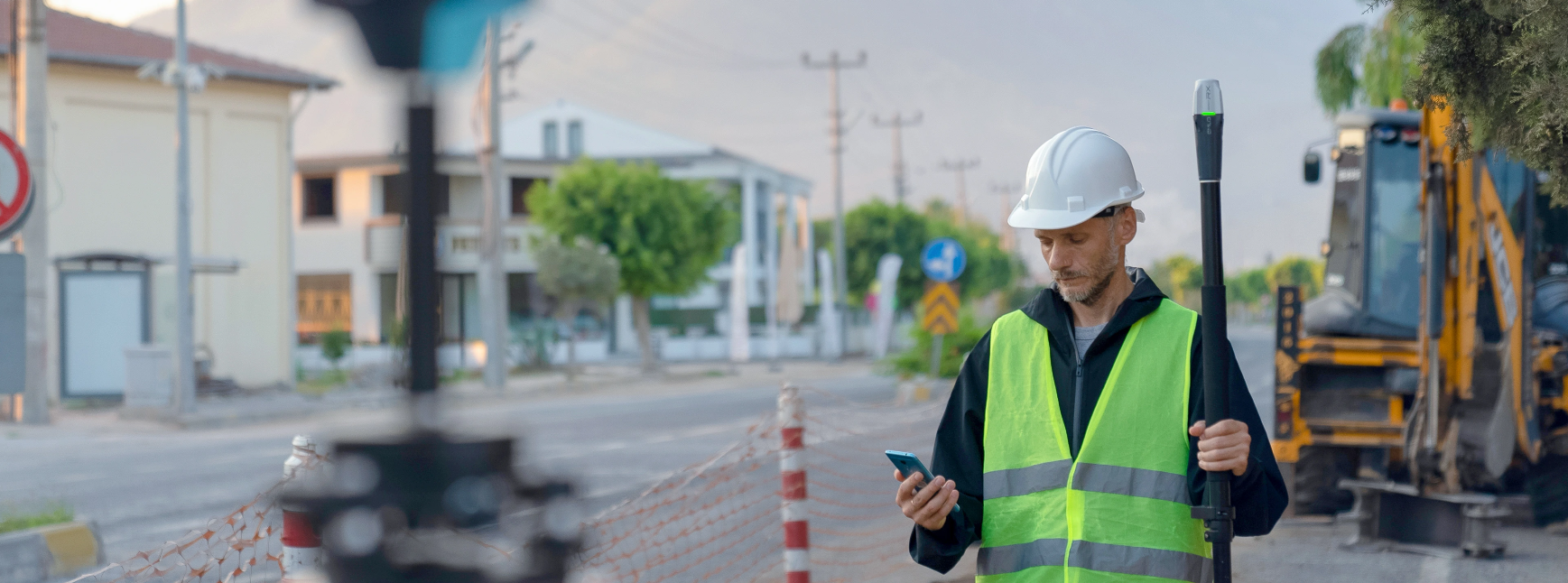
Emlid Reach RX

Pocket-sized and lightweight

Centimeter-precision network RTK rover

Installation is very simple! Just add NTRIP. Emlid Reach RX allows you to connect and start measuring within seconds via Bluetooth.

Enable Bluetooth on your device and find your Reach RX in the Emlid Flow application.

emlid-rx 2

Enter the IP address and port information to receive corrections.

emlid-rx 3

Collect your first point with Emlid Reach RX.

Pocket-sized and lightweight

Due to its weight of only 250 grams, you can take Reach RX anywhere. It fits into any dashboard compartment or backpack pocket.

The whole team can use RTK

Reach RX is designed to meet the expectations of both experienced professionals aiming for highly accurate results and non-expert users in measurement. It requires no training.

Centimeter-accurate data

Emlid Reach RX tracks GPS/QZSS, Galileo, GLONASS, and BeiDou signals, and even in challenging conditions, it acquires corrections in less than 5 seconds.

You can review and manage data using Emlid Flow and Emlid Flow 360

Emlid Flow is a mobile application for both iOS and Android. It manages all field operations, from receiver settings and data collection to coding, stakeout, and measurements. All review data synchronizes with Emlid Flow 360, a cloud-based service that allows you to access review data and code lists for your projects from your browser.

Collect and mark points; you can use any coordinate system you want.

Select your coordinate system from the library or manually enter its parameters to create a project for data collection. The application supports thousands of coordinate systems, projections, grids, and geoids.

In measurement mode, the app displays East-North and straight-line distances and supports cutting and filling indicators. The close-range alignment mode assists in averaging directly over the point.

Collect and mark lines. Create alignment surveys on the go, initiate new alignments, and continue collecting existing alignments while in motion.

You can use predefined geometry types or a comprehensive code library. Lines are displayed instantly, so you can always see the progress of your project.

During measurement, you can easily navigate to a line and mark it with a distance and chaining.

The entire library will always be at your fingertips for quickly switching between different object codes.

You can upload your custom code library or use a built-in one, which contains a wide range of codes, to measure and define objects. This way, you can easily create new codes directly in your review project.

Work with different background maps.

You can load topographic maps, cadastral plans, and aerial photographs from WMS and WMTS sources or work with a built-in satellite map.

emlid-rx

Manage your projects in the cloud

The Emlid Flow application syncs with the Emlid Flow 360 service. This allows you to create and access survey projects using both the mobile application and the cloud service at flow360.emlid.com. You can manage coordinate systems and import/export data as well.

Manage your code libraries

Transfer your code library to Emlid Flow 360, and it will be immediately available for use in your projects within the Emlid Flow mobile application. Since everything is automatically synchronized, you don’t need to check if the latest version is on your device.

Compact and rugged, the Reach RX weighs 250 grams and measures 172 mm x 51 mm x 51 mm. Its weight is akin to a TV remote control, making it easily portable in your pocket.

It operates in temperatures ranging from -20 to +65°C (-4 to 149°F). We’ve extensively tested the Reach RX under conditions that simulate the coldest winters and hottest summers.

With an IP68 rating, the RX is waterproof up to 1.5 meters. Its connectors are sealed with silicone caps, providing protection against water and dust.

With its reliable battery feature, the Reach RX boasts a continuous operating time of 16 hours and can provide 2 days of work with less than 3 hours of charging. It can be charged on the go from any USB port or portable charger (power bank).

Utilizing Li-Ion battery technology, it operates effectively in both high and low temperatures as an industrial-grade battery.

With over 2000 charge-discharge cycles, it maintains its original capacity, ensuring long-lasting use.

A versatile solution for your fieldwork

Add Reach RS2+ as a base station

Don’t have NTRIP nearby? You can set up your own NTRIP service with Reach RS2+ and Emlid Caster. Then, you can add as many RX rovers as you need, and you’re good to go.

Folding prism pole

Your folding prism pole is perfect for seamless data collection with Reach RX. You can take this combination anywhere and collect points whenever you need, which is a great addition to your equipment box in the survey field.

Deploy Reach RX for team collaboration

If you have a large project team, Reach RX is an excellent choice. With a foolproof configuration, you can ensure your team collects reliable data without error.

TECHNICAL SPECIFICATIONS

Dimensions: 172 x 51 x 51 mm (6.77 x 2.00 x 2.00 inches)
Mount: 5/8”-11 UNC
Weight: 250 grams (8.81 ounces)
Operating Temperature: -20 to +65°C (-4 to 149°F)
Protection: IP68 (up to 1.5 meters depth for maximum 30 minutes)

Operating Time: Up to 16 hours
Battery: Li-Ion 5200 mAh, 3.6V, 18.72 Wh
Charging: USB Type-C, 5V 2A
Certifications: FCC, CE, IC

RTK:
Horizontal: 7 mm + 1 ppm
Vertical: 14 mm + 1 ppm
Convergence time: ~5 sec, under normal conditions

Communication Interface: Bluetooth 4.2
Ports: USB Type-C

Input data format: RTCM3
Input data protocol: NTRIP
Position data format: NMEA

Trackable Signals:
– GPS/QZSS: L1C/A, L2C
– GLONASS: L1OF, L2OF
– BeiDou: B1I, B2I
– Galileo: E1B/C, E5b

Number of Channels: 184
Update Rate: 5Hz

Need to Learn More?