
Matrice 4E
A new-generation solution for precision aerial surveying.
The Era of Intelligent Flight Begins with Matrice 4E!
DJI Matrice 4E is a new-generation professional drone platform developed for surveying and engineering, with a compact, intelligent multi-sensor design. Laser-rangefinder-assisted sensing and precise measurement capabilities support high accuracy in mapping and survey operations.

Improved environmental sensing supports safer, more stable flight operations. The Matrice 4E accessory ecosystem has been comprehensively updated to suit different mission scenarios.
20 MP Wide-Angle Camera
Mechanical shutter and adjustable aperture.
Fast Interval Shooting
High-speed image collection in JPEG.
Maximum Flight Time
With standard propellers, under test conditions.
Mapping Flight Speed
Fast aerial scanning from multiple angles.
Laser Rangefinder
Point, line and area measurements.
Precision Positioning
Integrated module and L5 frequency support.
Test conditions for ¹ flight time, ² speed and ³ measurement range appear below the specifications.
Precision Mapping,
Effortless and Time-Saving
Fast 0.5-Second Interval Shooting
DJI Matrice 4E's wide-angle camera supports high-speed shooting at 0.5-second intervals in both orthophoto and oblique modes, enabling fast aerial scanning from multiple angles.
Matrice 4E also supports operational speeds up to 21 m/s on mapping flights, improving efficiency in field surveying and mapping.

Five-Direction Oblique Capture
The gimbal collects images at different angles according to the survey area. Multiple viewpoints in one flight improve the efficiency of oblique photography missions.

Three-Direction Orthophoto Capture
Matrice 4E also captures lateral images during orthophoto collection, helping reduce side-overlap requirements. Under specified test conditions, 2.8 km² can be mapped in one flight.4
Distortion Correction 2.0
Each Matrice 4E wide-angle camera is factory calibrated. In-camera correction and DJI Terra support reconstruction accuracy; DJI specifies residual distortion below 2 pixels.
Automatic Survey Quality Report
DJI Pilot 2 generates a post-mission report with photo positions, RTK status and shooting parameters. Missing or problematic images can be captured while still on site.
Smart 3D Capture.
Routes That Follow the Surface.
Create a rough model on the controller with Matrice 4E, then plan detailed survey routes close to structure surfaces. Virtual routes and waypoint photos help assess coverage and flight safety.

Smart 3D Explore for Modeling
When paired with Manifold 3, DJI Matrice 4E supports Smart 3D Explore for modeling. Using Manifold 3's computing power, it analyzes the object's surroundings, automatically plans safe flight routes and builds a rough 3D model viewable in real time on the controller.
This simplifies close-range photogrammetry workflows and improves modeling efficiency.
Smart 3D Explore requires Manifold 3. Accessories and software versions should be assessed for the selected configuration.
Intelligent Operations
The built-in AI model can automatically detect vehicles, vessels and targets during search-and-rescue operations or routine flights. Support for switching AI models expands potential applications.
The system also supports high-resolution grid imagery and advanced target tracking for more precise, efficient and reliable field workflows.
Laser Rangefinder, Precise Measurement
The laser rangefinder enables precise real-time measurement. Point marking, line creation and area calculation help locate inspection targets or assess affected areas during emergencies such as forest fires.
Data can be shared with teams through a DJI Pilot QR code or FlightHub 2, improving field coordination and workflow efficiency.
Observation Range Recording
DJI Pilot 2 can highlight the camera frame's center point and observed ground area on the map, showing the inspected region directly in its geographic context.
This helps locate target areas quickly and accurately during patrol and search-and-rescue missions, especially in mountainous terrain without clear landmarks.
Efficient Flight,
Intelligent Operations
Cruise Control
Keeps the drone flying steadily in a chosen direction without continuously holding the control sticks, simplifying piloting on long flights.
Automatic Flight Adaptation in Emergencies
Automatically optimizes the route and speed according to environmental conditions for faster, safer access to the target location.
Smart Track
Provides precise target positioning and automatic zoom adjustments. It can reacquire a target after brief obstruction.
POI (Point of Interest)
Enables continuous observation and 3D modeling around a selected point, improving fixed-point inspection and modeling efficiency.
Three Cameras.
Closer to the Details.
Wide-angle, medium tele and tele cameras collect imagery at different distances, from mapping to infrastructure inspection.
Wide-Angle Camera
4/3 CMOS, 20 MP effective pixels, f/2.8–f/11, 24 mm equivalent, mechanical shutter
Medium Telephoto Camera
1/1.3-inch CMOS, 48 MP effective pixels, f/2.8, 70 mm equivalent
Telephoto Camera
1/1.5-inch CMOS, 48 MP effective pixels, f/2.8, 168 mm equivalent

Detailed Medium-Range Inspection
The 70 mm equivalent medium tele camera helps assess details more closely during line, bridge and facility inspections.

Clear Telephoto Imaging
A 48 MP tele camera and improved stabilization support distant target inspection. Electronic dehazing has three levels for different environments.
Safer Flight,
Continuous Operation
DJI Matrice 4E includes an integrated RTK module with expanded L5 frequency support and a GNSS + Vision Fusion Positioning and Navigation System. Visual positioning allows dynamic updating of the Return-to-Home point and fast takeoff within 15 seconds. The drone can complete return-to-home without GNSS under suitable conditions, supporting operations where urban obstructions and interference affect signals.
Low-Light Environmental Sensing
Six high-resolution fisheye vision sensors support low-light positioning and obstacle sensing. Vision sensing requires sufficient light and surface texture.
Intelligent Route Support
Terrain elevation and detailed maps can be loaded through an internet-connected DJI RC Plus 2 Enterprise. Vision assistance helps assess the surroundings.
Visual positioning and return-to-home without GNSS depend on suitable environmental conditions. Vision sensing is limited on textureless surfaces or below 0.5 lux illumination.
O4 Enterprise.
Strong Image Transmission.
The aircraft's eight-antenna system and the controller's high-gain antenna support image transmission in challenging environments. Optional DJI Cellular Dongle 2 enables 4G-assisted connectivity.

Live View
1080p / 30 fps live view on the controller.
Transmission Distance
Without obstacles or interference: FCC 25 km, CE 12 km. These are communication ranges, not round-trip flight distances.
Fast Data Download
Download speeds up to 20 MB/s at close range without interference.
DJI Cellular Dongle 2 is sold separately. Cellular transmission availability depends on country, carrier and network conditions.
From Field to Model.
A Connected Workflow.
DJI Pilot 2
Customizable intelligent-function toolbar, different flight routes, virtual models and route previews.
DJI FlightHub 2
Remote flight and payload control, takeoff/landing and mission planning. Monitor multiple live streams on one screen.
DJI Terra
Camera distortion correction for Matrice 4E, offline PPK processing of visible-light imagery and D-RTK 3 data import. 2D, 3D and point cloud production.
DJI Modify
Model repair and sharing through 3D mesh and point cloud editing.
Developer Integrations
Custom payloads, apps and data processing workflows with PSDK, Mobile SDK 5, Cloud API and DJI Terra API.
Data Security
Local Data Mode, one-tap device data clearing and AES-256 video transmission encryption.
Technical Specifications
All the details, together.
General and Flight Performance
| Model | DJI Matrice 4E |
|---|---|
| Takeoff weight | 1219 g with standard propellers, battery and microSD card. May vary with manufacturing tolerances. |
| Dimensions | Folded: 260.6 × 113.7 × 138.4 mm Unfolded: 307.0 × 387.5 × 149.5 mm Excluding propellers |
| Maximum takeoff weight | Standard propellers: 1420 g Low-noise propellers: 1430 g |
| Maximum payload | 200 g |
| Maximum flight time¹ | Standard propellers: 49 min Low-noise propellers: 46 min |
| Hovering time¹ | Standard propellers: 42 min Low-noise propellers: 39 min |
| Maximum horizontal speed² | 21 m/s; at sea level, without wind |
| Ascent / descent | 10 m/s / 8 m/s With accessories: 6 m/s / 6 m/s |
| Wind resistance | 12 m/s during takeoff and landing |
| Maximum altitude | 6000 m; 4000 m with payload |
| Operating temperature | −10 °C to +40 °C |
Cameras and Photography
| Wide-Angle Camera | 4/3 CMOS, 20 MP effective pixels, f/2.8–f/11, 24 mm equivalent, mechanical shutter |
|---|---|
| Medium Telephoto Camera | 1/1.3-inch CMOS, 48 MP effective pixels, f/2.8, 70 mm equivalent |
| Telephoto Camera | 1/1.5-inch CMOS, 48 MP effective pixels, f/2.8, 168 mm equivalent |
| Wide-angle shutter speed | Mechanical: 2–1/2000 s Electronic: 2–1/8000 s |
| Minimum photo interval | JPEG: 0.5 s Wide-angle JPEG + RAW: 2 s |
| Maximum photo size | Wide-angle: 5280 × 3956 Medium telephoto: 8064 × 6048 Telephoto: 8192 × 6144 |
| Photo format | Wide-angle: JPEG / DNG (RAW) Medium telephoto and telephoto: JPEG |
Video and Gimbal
| Video resolution | 4K: 3840 × 2160 / 30 fps FHD: 1920 × 1080 / 30 fps |
|---|---|
| Video encoding | H.264 / H.265 |
| Maximum video bitrate | H.264: 60 Mbps H.265: 40 Mbps |
| Gimbal | 3-axis stabilization |
| Controllable tilt | −90° to +35° |
Laser Rangefinder and Positioning
| Measurement range³ | 1800 m (1 Hz); on a target with 20% reflectivity |
|---|---|
| Oblique incidence range | 600 m (1 Hz) |
| Blind zone | 1 m |
| Ranging accuracy | ± (0.2 + 0.0015 × D); D is measurement distance in meters. At 1–3 m: system error <0.3 m; random error <0.1 m @1σ. |
| RTK GNSS accuracy | RTK Fix: horizontal 1 cm + 1 ppm; vertical 1.5 cm + 1 ppm |
| Positioning | GNSS + Vision Fusion Positioning and Navigation System; integrated RTK module and L5 frequency support |
| Environmental sensing | Omnidirectional binocular vision system and downward 3D infrared sensor |
Connectivity, Storage and Battery
| Image transmission | O4 Enterprise; 1080p / 30 fps live view |
|---|---|
| Maximum transmission distance | FCC: 25 km; CE: 12 km. One-way communication range without obstacles or interference. |
| Connection ports | 1 × E-Port, 1 × E-Port Lite. Accessories must be installed before powering on. |
| Storage | microSD; U3 / Class 10 / V30 or higher. No internal storage. |
| Battery | 6741 mAh; 14.76 V; 99.5 Wh; Li-ion 4S |
| Battery weight | 401 g |
| Charging temperature | +5 °C to +40 °C |
| Charging hub | Sequential charging of 4 batteries; standard 100% and standby 90% modes |
- 49/46-minute flight: measured without wind or payload at approximately 9 m/s until the battery reaches 0%. 42/39-minute hover: measured at sea level without wind from 100% to 0%. Actual mission duration depends on environment, propellers and accessories.
- 21 m/s is measured with an unloaded aircraft near sea level without wind. The maximum horizontal speed setting in DJI Pilot 2 must be configured accordingly.
- The 1800 m laser range is specified for a target with 20% reflectivity. Rain and fog may reduce measurement performance.
- 2.8 km² coverage is specified at 5 cm GSD, 80% forward overlap, 70% side overlap and 15 m/s. Consider the urban mapping limitations of three-direction orthophoto capture during mission planning.
Compatible Accessories
Explore lighting, surveying, connectivity and computing solutions for your mission.
 CZI – TH2 Hook Release DeviceExplore product ↗
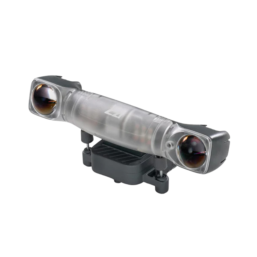 CZI – GL10V2 Gimbal SpotlightExplore product ↗
 CZI – MF30-M4/M30 Flow MeterExplore product ↗
 DJI Cellular DongleExplore product ↗
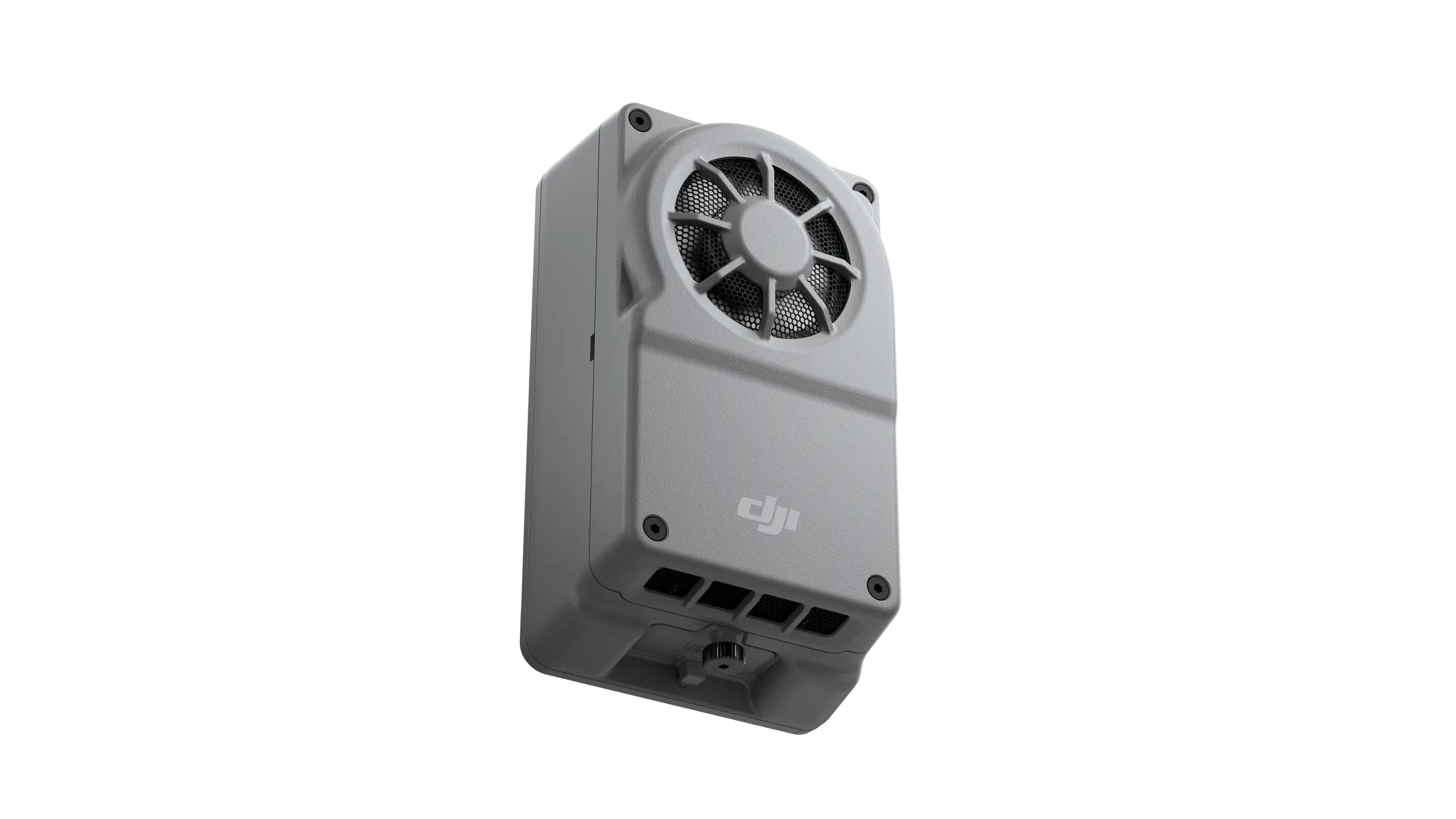 DJI Manifold 3Explore product ↗
For third-party products, mounting, adapter and software compatibility depend on the selected configuration.
DJI AL1 Spotlight
Gimbal-following lighting with continuous and flashing modes. Light coverage follows the camera direction.
DJI AS1 Speaker
Live broadcast, recorded messages and media transmission. DJI-supported text-to-speech languages are English and Mandarin Chinese.
D-RTK 3 Multifunctional Station
Precision positioning for multiple aircraft and surveying workflow support with Rover mode.
DJI RC Plus 2 Enterprise
High-brightness display, IP54 protection and an operating range of −20 °C to +50 °C. O4 Enterprise and 4G hybrid transmission in supported regions.
DJI Power 2000
Portable power for field operations. Supports Matrice 4 Series batteries with compatible charging equipment.
Meet Matrice 4E with Atay
We tested DJI Matrice 4's Smart Track feature for you!
Matrice 4E for Your Project.
Contact us to learn more about or purchase Matrice 4E.
Applications
A precision aerial surveying solution for mapping, construction and mining.

Mapping and Surveying
Land surveying, cadastre, urban planning, progress management, earthworks, 3D modeling, cultural heritage modeling, mine mapping, facade modeling and precision agriculture.

Inspection and Site Management
Construction site management, infrastructure and terrain modeling; inspection of power distribution lines, transformers, facilities, wind farms, bridges and roofs.

Public Safety
Accident and forensic investigation, disaster prevention and response.