
Matrice 30T
Powerful Flight Performance
DJI Matrice 30T balances powerful flight performance and portability to improve operational efficiency. It combines wide-angle, zoom and thermal cameras with a laser rangefinder on one platform.

Maximum Flight Time
Flight performance for extended field missions.
Environmental Protection
Operating temperature from −20 °C to +50 °C.
Thermal Imaging
30 fps native thermal imagery and temperature measurement.
Maximum Hybrid Zoom
48 MP zoom camera; 5×–16× optical zoom.
Laser Measurement Range
Distance measurement from 3 to 1200 m.
Maximum Wind Resistance
23 m/s maximum horizontal flight speed.
Flight time and measurement values apply under specified test conditions. Conditions and details appear in the specifications section.
Adaptable, Safe, Reliable
DJI Matrice 30T is equipped with IP55 protection. Its −20 °C to +50 °C operating range supports operations in changing field conditions.[3]
Six-Directional Sensing
Dual vision and ToF (Time-of-Flight) sensors on all six sides help sense the surroundings and support mission safety.
Integrated ADS-B Receiver
Provides timely warnings of nearby crewed aircraft, supporting pilot awareness.
Redundant Systems
Advanced redundancy helps critical missions continue in unexpected situations.
Enhanced Transmission
DJI Matrice 30T's four built-in antennas support three-channel 1080p video transmission. OcuSync 3 Enterprise enables seamless switching between video feeds in complex environments.
O3 Enterprise
Maximum transmission distance without obstacles or interference: 8 km under CE/SRRC/MIC and 15 km under FCC.
Dual-Operator Support
Dual-operator control helps teams collaborate during missions.
Precision Positioning
With a fixed RTK solution: horizontal accuracy of 1 cm + 1 ppm and vertical accuracy of 1.5 cm + 1 ppm.
Transmission distance is not the distance available for a mission; it varies with obstacles, interference and regional frequency restrictions. RTK positioning accuracy is not mapping or thermal measurement accuracy.
The Aerial Data You Need.
On One Platform.
DJI Matrice 30T combines wide-angle, zoom and thermal cameras. The integrated laser rangefinder helps capture the aerial data you need, when you need it.

Wide Camera
12 MP 1/2-inch CMOS sensor; 24 mm equivalent focal length and 84° DFOV. Capture a wide-area overview with 4K/30 fps video.
Zoom Camera
48 MP 1/2-inch CMOS sensor, 5×–16× optical zoom and 200× maximum hybrid zoom. Supports 8K photos and 4K/30 fps video.
Thermal Imaging Camera
40 mm equivalent focal length, 640 × 512 native resolution and 30 fps imagery. Temperature accuracy is ±2 °C or ±2%, whichever is greater.[4]
Laser Rangefinder
3–1200 m measurement range. Accuracy: ±(0.2 m + D × 0.15%), where D is distance to a vertical surface. Range is specified for a 0.5 × 12 m vertical surface with 20% reflectivity.
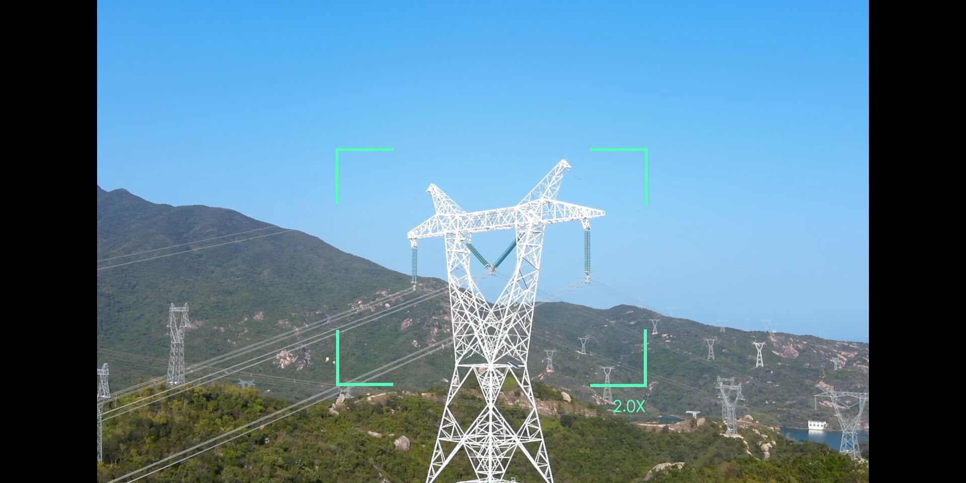
Inspect Distant Details
Optical and hybrid zoom support detailed observation without physically approaching the target.

Go Beyond Visible Light
Point and area temperature measurement, temperature alerts and different color palettes. Super-resolution mode produces a processed 1280 × 1024 image; the sensor's native resolution is 640 × 512.
Easy to Carry to Site.
Quick to Prepare for Missions.
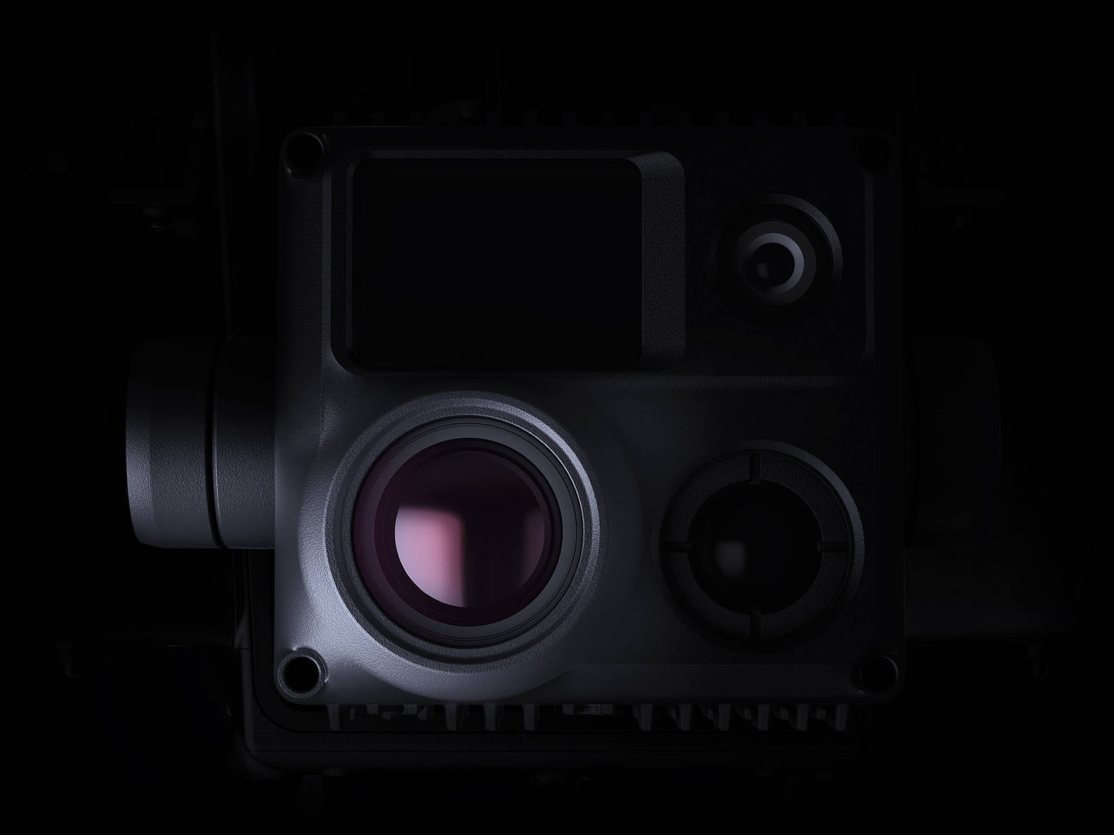
Compact and Foldable
Folds to 365 × 215 × 195 mm. At 3770 ±10 g including two batteries, it simplifies transport and field preparation.
Service ceiling without additional payload: 5000 m with 1671 propellers; 7000 m with separately purchased 1676 high-altitude propellers. Values are above sea level.

DJI RC Plus
7.02-inch touchscreen, 1920 × 1200 resolution and 1200-nit brightness. IP54 protection and a −20 °C to +50 °C operating range.[3]
Approximately 3 hours 18 minutes with the internal battery; approximately 6 hours with internal battery and WB37. Hot-swappable external batteries support operational continuity.[5]
From Flight to Team Management.
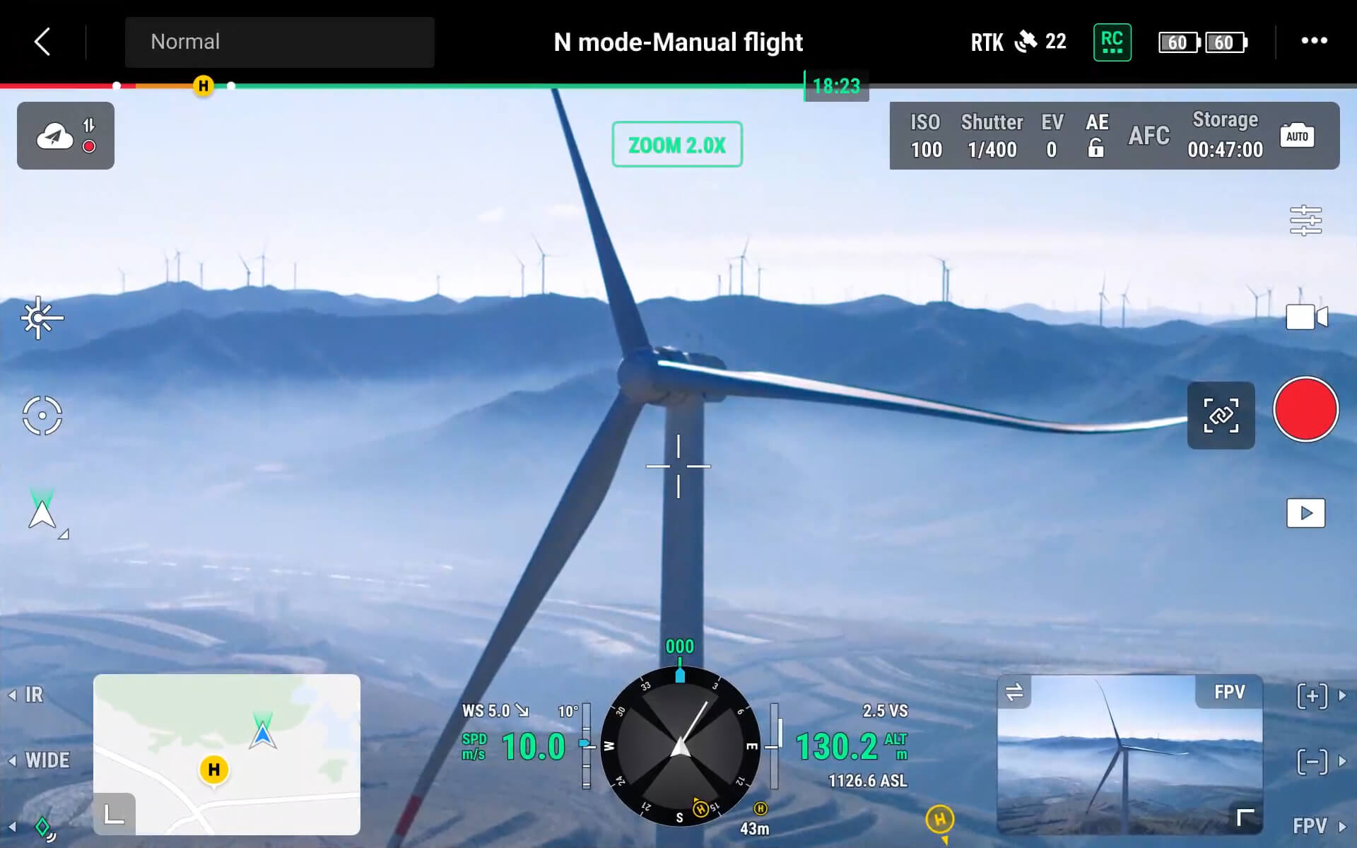
DJI Pilot 2
Flight and camera controls, preflight checklists, home point and PinPoint markers in one interface. Screen-side buttons and customizable controls give quick access to frequently used functions.
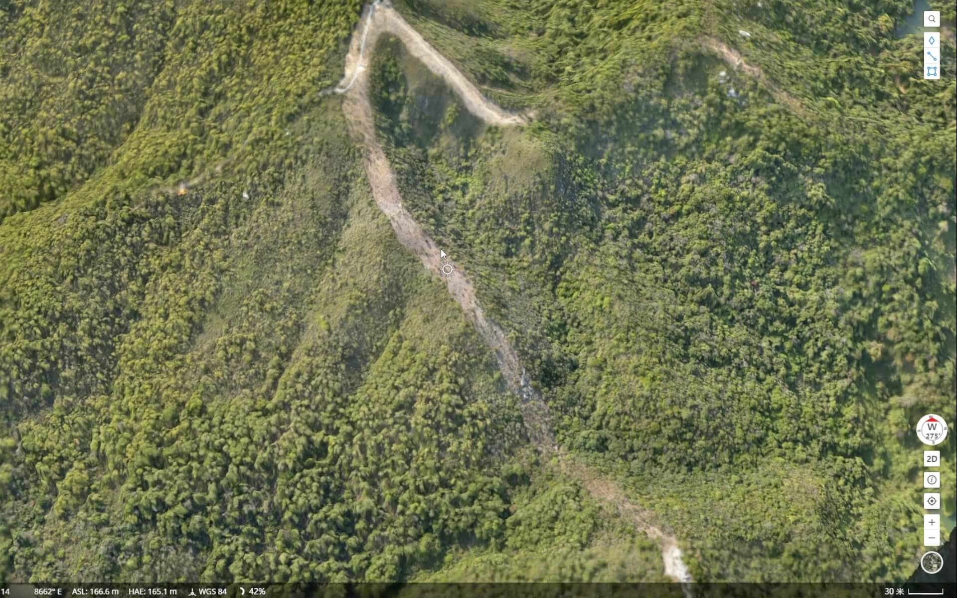
DJI FlightHub 2
2.5D base maps, panorama synchronization and RGB or thermal cloud mapping. Share site information across teams with live feeds and shared annotations.
Intelligent Inspection
Record targets and flight points with Live Mission Recording. Adjust gimbal angles and photo settings between waypoints.
Mission Planning
Transfer cloud-planned routes to Pilot 2; connect field and office workflows through mission data sharing and uploading.
Data Security
Local Data Mode, SD card AES encryption, AES-256 video transmission encryption and one-step data clearing.
Developer Ecosystem
MSDK, PSDK and Cloud API offer integration options for third-party apps, payloads and custom cloud workflows.
Cloud features may vary with software version, service plan and internet connection.
Power for Mission Continuity.

TB30 Intelligent Flight Battery
5880 mAh capacity and 131.6 Wh energy. Self-heating for cold conditions and hot swapping for quick battery changes while the aircraft is on the ground.

BS30 Intelligent Battery Station
Slots for four pairs of TB30 and one pair of WB37 batteries. TB30 pairs charge sequentially; one pair reaches 20% to 90% in about 30 minutes and 0% to 100% in 50 minutes.[6]
In the Box
Essential equipment for your field setup, together.
Explore Package Contents
The Matrice 30T basic package includes the aircraft, DJI RC Plus, two TB30 Intelligent Flight Batteries, one BS30 Intelligent Battery Station and a carrying case.


Click to enlarge the package images. Delivery contents are confirmed against the quoted package.
Technical Specifications
All the details, together. Select the headings to explore.
Aircraft and Flight
Drone
| Dimensions (unfolded, excluding propellers) | 470 × 585 × 215 mm (L × W × H) |
|---|---|
| Dimensions (folded) | 365 × 215 × 195 mm (L × W × H) |
| Diagonal Wheelbase | 668mm |
| Weight (including two batteries) | 3770 ±10 g |
| Maximum Takeoff Weight | 4069 g |
| Maximum Takeoff Weight for EU C2 Certification | 3998 g |
| Operating Frequency [1] | 2.4000-2.4835 GHz; 5.725-5.850 GHz |
| Transmitter Power (EIRP) | 2.4 GHz: <33 dBm (FCC); <20 dBm (CE/SRRC/MIC) 5.8 GHz: <33 dBm (FCC/SRRC); <14 dBm (CE) |
| Hovering Accuracy (windless or light-breeze environment) | Vertical: ±0.1 m (Vision System enabled); ±0.5 m (N mode with GPS); ±0.1 m (RTK) Horizontal: ±0.3 m (Vision System enabled); ±1.5 m (N mode with GPS); ±0.1 m (RTK) |
| RTK Positioning Accuracy (fixed RTK enabled) | 1 cm + 1 ppm (horizontal) 1.5 cm + 1 ppm (vertical) |
| Maximum Angular Velocity | Pitch: 150°/s; yaw: 100°/s |
| Maximum Pitch Angle | 35° (N mode and Forward Vision System enabled: 25°) |
| Maximum Ascent/Descent Speed | Ascent: 6 m/s Descent: 5 m/s |
| Maximum Tilted Descent Speed | 7 m/s |
| Maximum Horizontal Speed | 23 m/s |
| Maximum Service Ceiling Above Sea Level (without other payload) | 5000 m (with 1671 propellers) 7000 m (with 1676 propellers) |
| Maximum Wind Resistance | 12 m/s |
| Maximum Hovering Time [2] | 36 minutes |
| Maximum Flight Time [2] | 41 minutes |
| Motor Model | 3511 |
| Propeller Model | 1671 1676 High-Altitude (not included) |
| Ingress Protection Rating [3] | IP55 |
| GNSS | GPS+Galileo+BeiDou+GLONASS (GLONASS supported only when the RTK module is enabled) |
| Operating Temperature | −20° to 50° C (−4° to 122° F) |
| Portable Design | Foldable airframe |
| ADS-B Receiver | Warning support for nearby crewed aircraft |
Wide and Zoom Cameras
Wide Camera
| Sensor | 1/2-inch CMOS, effective pixels: 12 MP |
|---|---|
| Lens | DFOV: 84° Focal length: 4.5 mm (equivalent: 24 mm) Aperture: f/2.8 Focus: 1 m–∞ |
| Exposure Compensation | ±3 EV (in 1/3 EV steps) |
| Electronic Shutter Speed | Auto Mode: Photo: 1/8000–1/2 s Video: 1/8000–1/30 s M Mode: Photo: 1/8000–8 s Video: 1/8000–1/30 s |
| ISO Range | 100-25600 |
| Maximum Video Resolution | 3840×2160 |
| Photo Size | 4000×3000 |
| Video Frame Rate | 4K / 30 fps |
Zoom Camera
| Sensor | 1/2-inch CMOS, effective pixels: 48 MP |
|---|---|
| Lens | Focal length: 21–75 mm (equivalent: 113–405 mm) Aperture: f/2.8–f/4.2 Focus: 5 m–∞ |
| Exposure Compensation | ±3 EV (in 1/3 EV steps) |
| Electronic Shutter Speed | Auto Mode: Photo: 1/8000–1/2 s Video: 1/8000–1/30 s M Mode: Photo: 1/8000–8 s Video: 1/8000–1/30 s |
| ISO Range | 100-25600 |
| Maximum Video Resolution | 3840×2160 |
| Maximum Photo Size | 8000×6000 |
| Optical Zoom | 5×–16× |
| Maximum Hybrid Zoom | 200× |
| Video Frame Rate | 4K / 30 fps |
Thermal Camera
Thermal Camera
| Thermal Imager | Uncooled VOx Microbolometer |
|---|---|
| Lens | DFOV: 61° Focal length: 9.1 mm (equivalent: 40 mm) Aperture: f/1.0 Focus: 5 m–∞ |
| Noise Equivalent Temperature Difference (NETD) | ≤50 mK@F1.0 |
| Infrared Temperature Measurement Accuracy [4] | ±2 °C or ±2% (whichever is greater) |
| Video Resolution | Infrared Image Super Resolution Mode: 1280 × 1024 Normal Mode: 640 × 512 |
| Photo Size | Infrared Image Super Resolution Mode: 1280 × 1024 Normal Mode: 640 × 512 |
| Pixel Pitch | 12 μm |
| Temperature Measurement Method | Spot Meter, Area Measurement |
| Temperature Measurement Range | High Gain Mode: −20° to 150° C (−4° to 302° F) Low Gain Mode: 0° to 500° C (32° to 932° F) |
| Temperature Alert | Supported |
| Palette | White Hot/Black Hot/Tint/Iron Red/Hot Iron/Arctic/Medical/Fulgurite/Rainbow 1/Rainbow 2 |
| Native Thermal Resolution | 640 × 512 pixels |
| Frame Rate | 30 fps |
Gimbal and FPV Camera
Gimbal
| Angular Vibration Range | ±0.01° |
|---|---|
| Controllable Range | Pan: ±90° Tilt: −120° to +45° |
| Mechanical Range | Pan: ±105° Tilt: −135° to +60° Roll: ±45° |
FPV Camera
| Resolution | 1920×1080 |
|---|---|
| DFOV | 161° |
| Frame Rate | 30 fps |
Laser and Environmental Sensing
Laser Module
| Wavelength | 905 nm |
|---|---|
| Maximum Laser Power | 3.5mW |
| Single Pulse Width | 6 ns |
| Measurement Accuracy | ± (0.2 m + D×0.15%) D is distance to a vertical surface |
| Measurement Range | 3–1200 m (0.5 × 12 m vertical surface with 20% reflectivity) |
| Safety Classification | Class 1M |
| Accessible Emission Limit (AEL) | 304.8 nJ |
| Reference Aperture | 18 mm long, 18 mm wide (equivalent circular diameter: 20.3 mm) |
| Maximum Laser Pulse Emission Power at 5 Nanoseconds | 60.96W |
Vision Systems
| Obstacle Sensing Range | Forward: 0.6–38 m Upward/Downward/Backward/Sideways: 0.5–33 m |
|---|---|
| Field of View | 65° (H), 50° (V) |
| Operating Environment | Surfaces with clear patterns and sufficient lighting (>15 lux) |
Infrared Sensing Systems
| Obstacle Sensing Range | 0.1 to 10 m |
|---|---|
| Field of View | 30° |
| Operating Environment | Large obstacles with diffuse reflectivity (>10%) |
Auxiliary Lights
| Effective Illumination Distance | 5 m |
|---|---|
| Lighting Type | 60 Hz, continuous brightness |
TB30 Flight Battery
TB30 Intelligent Flight Battery
| Capacity | 5880 mAh |
|---|---|
| Voltage | 26.1V |
| Battery Type | Li-ion 6S |
| Energy | 131.6 Wh |
| Net Weight | Approximately 685 g |
| Operating Temperature | −20° to 50° C (−4° to 122° F) |
| Storage Temperature | 20° – 30° C (68° – 86° F) |
| Charging Temperature | −20 °C to +40 °C Self-heating activates automatically below 10 °C. Charging at low temperatures may shorten battery life. |
| Chemistry | LiNiMnCoO₂ |
DJI RC Plus and Connectivity
DJI RC Plus
| Display | 7.02-inch LCD touchscreen, 1920 × 1200 resolution and 1200 cd/m² high brightness |
|---|---|
| Internal Battery | Type: Li-ion (6500 mAh @ 7.2 V) Charging: battery station or USB-C charger; maximum rated power 65 W (maximum voltage 20 V) Charging Time: 2 hours Chemistry: LiNiCoAlO₂ |
| External Battery (WB37 Intelligent Battery) | Capacity: 4920 mAh Voltage: 7.6 V Battery Type: Li-ion Energy: 37.39 Wh Chemistry: LiCoO₂ |
| Operating Time [5] | Internal Battery: approximately 3 hours 18 minutes Internal + External Battery: approximately 6 hours |
| Ingress Protection Rating [3] | IP54 |
| GNSS | GPS+Galileo+BeiDou |
| Operating Temperature | −20° to 50° C (−4° to 122° F) |
O3 Enterprise
| Operating Frequency [1] | 2.4000-2.4835 GHz, 5.725-5.850 GHz |
|---|---|
| Maximum Transmission Distance (unobstructed, interference-free) | 15 km (FCC); 8 km (CE/SRRC/MIC) |
| Maximum Transmission Distance (with interference) | Strong interference (urban setting, limited line of sight, many competing signals): 1.5–3 km (FCC/CE/SRRC/MIC) Medium interference (suburban setting, open line of sight, some competing signals): 3–9 km (FCC); 3–6 km (CE/SRRC/MIC) Weak interference (open area, clear line of sight, few competing signals): 9–15 km (FCC); 6–8 km (CE/SRRC/MIC) |
| Transmitter Power (EIRP) | 2.4 GHz: <33 dBm (FCC); <20 dBm (CE/SRRC/MIC) 5.8 GHz: <33 dBm (FCC); <14 dBm (CE); <23 dBm (SRRC) |
Wi-Fi
| Protocol | Wi-Fi 6 |
|---|---|
| Operating Frequency [1] | 2.4000-2.4835 GHz; 5.150-5.250 GHz; 5.725-5.850 GHz |
| Transmitter Power (EIRP) | 2.4 GHz: <26 dBm (FCC); <20 dBm (CE/ SRRC/MIC) 5.1 GHz: <26 dBm (FCC); <23 dBm (CE/ SRRC/MIC) 5.8 GHz: <26 dBm (FCC/SRRC); <14 dBm(CE) |
Bluetooth
| Protocol | Bluetooth 5.1 |
|---|---|
| Operating Frequency | 2.4000-2.4835 GHz |
| Transmitter Power (EIRP) | <10 dBm |
BS30 Battery Station
BS30 Intelligent Battery Station
| Dimensions | 353×267×148 mm |
|---|---|
| Net Weight | 3.95 kg |
| Compatible Battery Type | TB30 Intelligent Flight Battery WB37 Intelligent Battery |
| Input | 100-240 VAC, 50/60Hz |
| Output | TB30 Battery Port: 26.1 V, 8.9 A (up to two simultaneous outputs) WB37 Intelligent Battery: 8.7 V, 6 A |
| Output Power | 525W |
| USB-C Port | Maximum 65 W output |
| USB-A Port | Maximum 10 W output (5 V, 2 A) |
| Power Consumption (when not charging batteries) | < 8W |
| Output Power (during battery heating) | Approximately 30 W |
| Operating Temperature | −20° to 40° C (−4° to 104° F) |
| Ingress Protection Rating [3] | IP55 (with cover properly closed) |
| Charging Time [6] | Approximately 30 minutes (two TB30 batteries from 20% to 90%) Approximately 50 minutes (two TB30 batteries from 0% to 100%) |
| Protection Features | Reverse Current Protection Short-Circuit Protection Overvoltage Protection Overcurrent Protection Temperature Protection |
| Charging Slots | Slots for 4 pairs of TB30 and 1 pair of WB37 batteries; TB30 pairs charge sequentially. |
- 5.8 and 5.1 GHz bands are unavailable in some countries; in some, 5.1 GHz is indoor-only. Frequencies and transmitter power depend on regional regulations.
- Maximum flight and hovering times are laboratory test values. The 41-minute flight was measured without wind at approximately 36 km/h. Actual duration varies with payload, environment and flight profile.
- IP ratings are not permanent and may decrease with use. BS30's IP55 rating applies with its cover properly closed.
- Thermal temperature accuracy was tested in laboratory conditions. ±2 °C or ±2% of the measured value applies, whichever is greater; actual results depend on measurement conditions.
- Controller runtimes are laboratory values; screen brightness, temperature and usage affect duration.
- Charging times are room-temperature laboratory values and may vary with battery temperature and charging conditions.
Compatible Accessories
Lighting, announcement, measurement and connectivity solutions listed by Atay for Matrice 30T.
 CZI – MF30-M4/M30 Flow MeterExplore product ↗
 CZI – LP12 Searchlight and Broadcast SystemExplore product ↗
 CZI – GL60 MiniExplore product ↗
 DJI Cellular DongleExplore product ↗
Select accessories according to product version, mount and software compatibility. Confirm the suitable Matrice 30T connection module version and regional service support with Atay.
Matrice 30T for Your Project.
Contact Atay Mühendislik for detailed information about Matrice 30T and compatible equipment.
Applications
Thermal imaging, zoom and ranging for different field missions.

Public Safety
Visible-light and thermal imaging for day/night observation, incident assessment and team situational awareness.
Energy and Infrastructure Inspection
Combine zoom and thermal data to remotely inspect power lines and facilities and assess temperature differences.
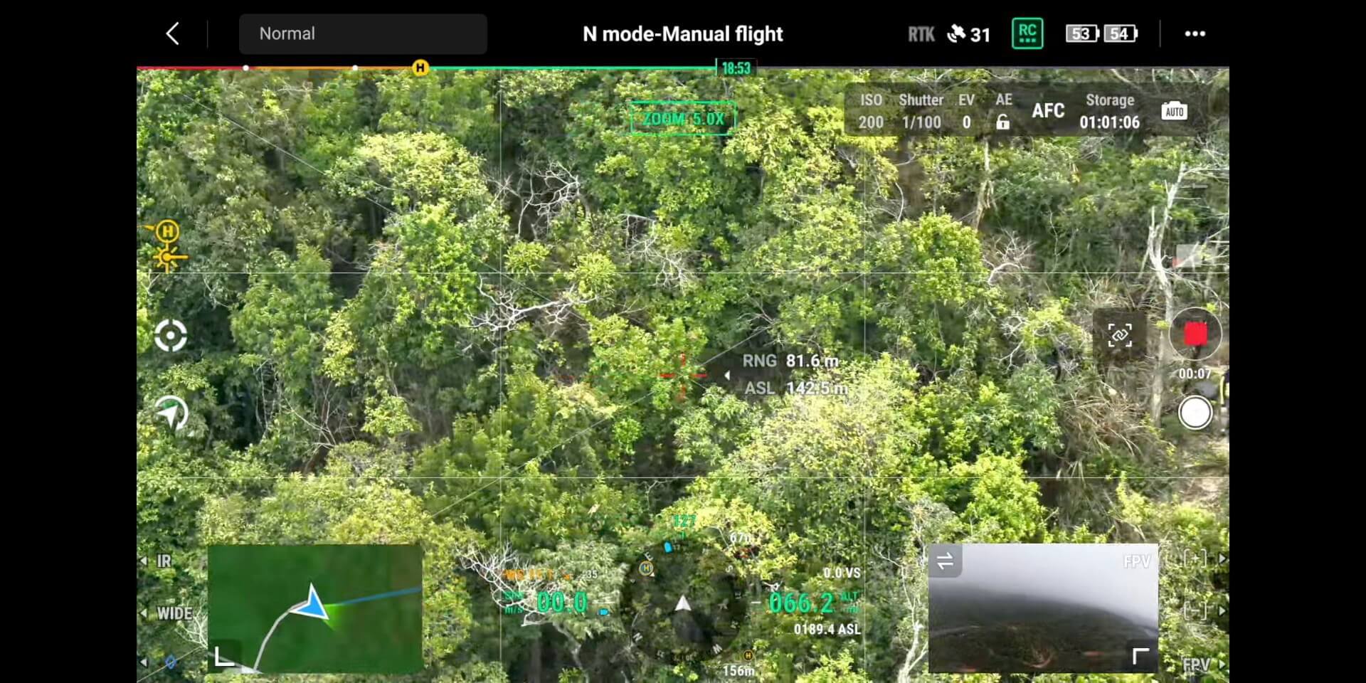
Search and Rescue
Assess targets through wide-area scanning, thermal observation and laser ranging, and share field information with teams.