
PIX4Dmatic STANDARD
Large-scale photogrammetry and modelling softwarePoint clouds, orthomosaics and 3D models from photographsPIX4Dmatic STANDARD produces photogrammetric outputs from aerial photographs, corridor flights and terrestrial images. It processes large image sets to generate point clouds, meshes, orthomosaics and digital surface models.
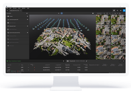
Generate maps and 3D models from large datasets.
Photogrammetric production
Generate dense point clouds, meshes, orthomosaics and DSMs from imagery.
Data sources
Supports evaluation of drone, mobile and LiDAR data within the same project workflow.
Basic measurements
Basic distance and volume measurements can be made on the generated project data.

A package focused on photogrammetry
STANDARD provides image processing, georeferencing and calibration tools. Consider ANALYST or PRO for advanced surveying and CAD requirements.
Applications and outputs
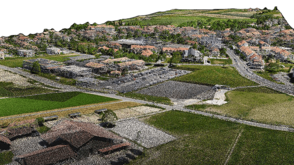


Images: application and output examples from the Atay Mühendislik product page.
Features and workflow
Tap a heading to view the details.
Image-processing scope
| Specification | PIX4Dmatic STANDARD |
|---|---|
| Photogrammetric processing · 3D model / DSM / orthomosaic / mesh | Included |
| Integrated processing of drone, mobile and LiDAR data | Included |
| Georeferencing and calibration | Included |
| Point-cloud generation | Included |
Surveying and CAD scope
| Specification | PIX4Dmatic STANDARD |
|---|---|
| Basic topographic / survey outputs | No |
| Terrain classification · TIN / DTM / contours | No |
| Distance and volume measurements | Included |
| Basic vector creation | No |
| Advanced vector / CAD tools | No |
Merging and licensing
| Specification | PIX4Dmatic STANDARD |
|---|---|
| Project merging · e.g. drone + LiDAR | No / limited |
| All STANDARD and ANALYST features | Outside the scope of this package |
| Cloud integration / sharing | With a suitable licence and Cloud access where required |
Advanced vector / CAD, terrain classification and TIN / DTM / contour tools are not included in STANDARD. Project merging is limited.
Let us define the right solution for your project.
Contact Atay Mühendislik for software selection, licence scope, training and technical support.