

Example screens from the CATALYST Insights web application.
INSIGHTS
See ground changes.
Assess risks earlier.
CATALYST Insights turns satellite imagery into interpretable measurements and ready-to-use data. Its SAR-based ground displacement monitoring service enables evaluation of movement across large areas through a web application and API, supporting risk monitoring for critical assets.
- Ground displacement monitoring
- mm scale¹
- Data access
- Web + API
- Historical movement analysis
- Archive
- Threshold-based monitoring
- Alerts
¹ Ground displacement measurement performance depends on satellite data, imaging geometry, surface characteristics and analysis conditions. Update frequency is determined by satellite passes and the processing schedule.
TECHNOLOGY AND PERFORMANCE
Details make a difference.
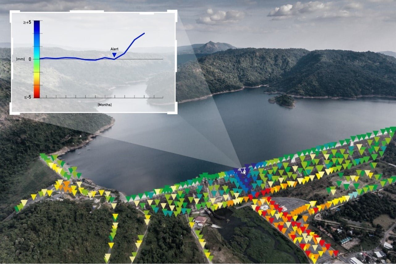
Satellite-based ground displacement monitoring
Track movements such as subsidence and uplift with SAR and InSAR analysis. Measurements across large areas help assess changes around assets.
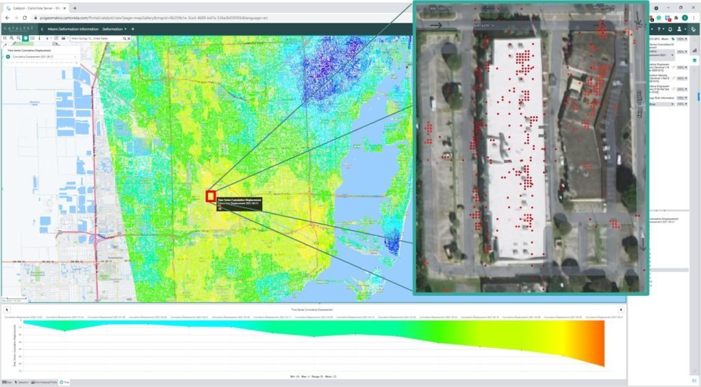
Measurements ready for interpretation
Examine mapped measurements and changes over time in a user-friendly interface; support risk assessments with geospatial data.
Relate the past to current conditions
Movement histories derived from archived satellite data help explain when changes began and how they developed.
Focus with custom alerts
Define custom alerts to track movements beyond set tolerances and prioritise assets requiring inspection.
Monitor large areas regularly
Use dense, regularly updated measurements to assess individual assets, cities, transport corridors and large project areas.
Connect to your workflow through the API
Integrate displacement measurements and alerts into existing risk-management and operational systems via the API.
HISTORICAL SAMPLE DATA
Explore movement history.
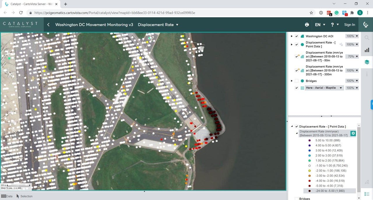
Washington DC, USA
August 2015 – August 2021The sample data presented on the Atay page shows ground displacement measurements around Dulles Airport.
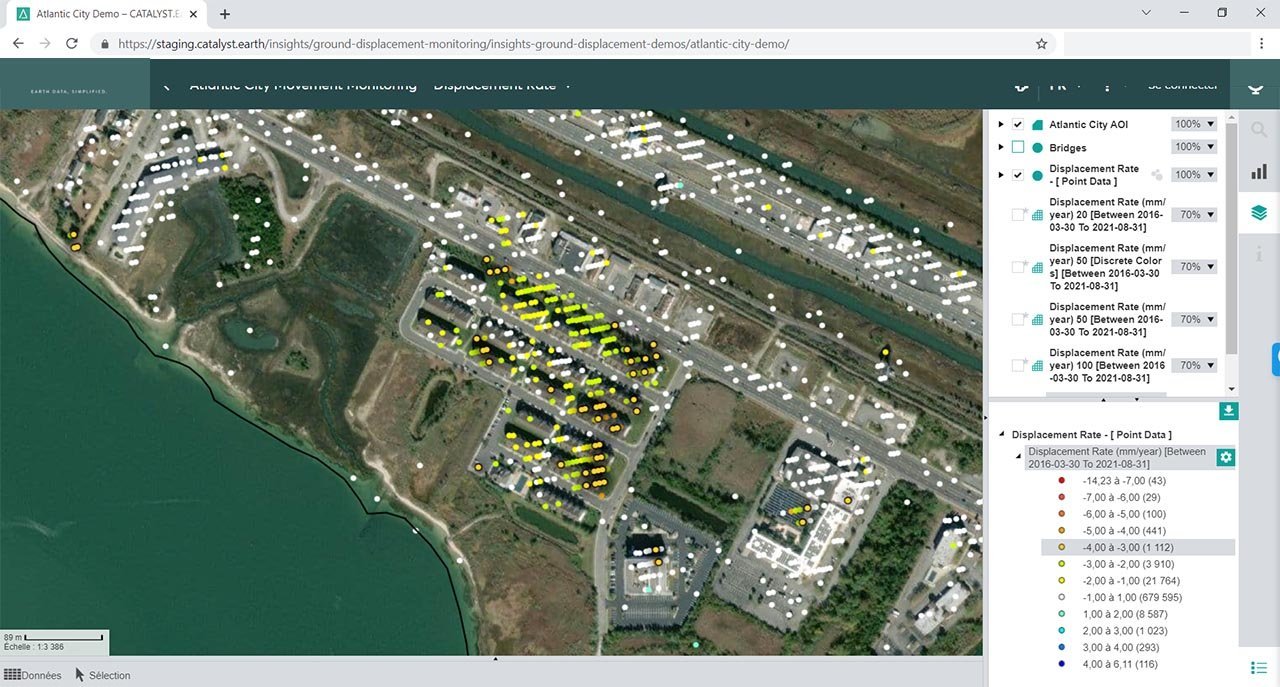
Atlantic City, USA
March 2016 – August 2021Historical sample data presenting displacement rates alongside bridge locations and areas of interest.
Images are examples from the stated periods, taken from data published on the Atay Mühendislik product page.
CATALYST INSIGHTS SOLUTION FAMILY
Dedicated services for different risks.
Ground Displacement Monitoring
Monitor ground displacement and movements around critical assets.
Vegetation Management
Prioritise vegetation-related risks to energy infrastructure.
Horizon
AI-assisted Earth observation service for defence and public agencies.
UrbanSAR
A solution for monitoring millimetre-scale movement across large areas.
Service scope and access within the solution family are assessed separately for each project's needs.
APPLICATIONS
Technology that fits your project.
Dams and mining sites
Assess movements, slopes and deformation trends around facilities.
Transport and critical infrastructure
Track changes in areas containing airports, roads and bridges.
Urban and asset management
Compare building surroundings and urban-scale movement trends.
WORKFLOW
Three steps to operation.
Define the area
Specify the assets, locations and assessment period to monitor.
Examine changes
Assess areas at risk using maps, measurements and movement histories.
Integrate into your workflow
Use alerts and API access to incorporate findings into operations.
Service scope, monitored area, date range, data access and alert requirements are determined for each project.
TECHNICAL SPECIFICATIONS
Explore the technical details.
Ground displacement monitoring and measurements
| Data source | Satellite radar (SAR) imagery |
|---|---|
| Analysis approach | InSAR; SBAS-PSI-based displacement workflow |
| Measurement scale | Millimetre scale under suitable analysis conditions¹ |
| Analysis content | Displacement, movement history and trends over time |
| Area coverage | Monitoring from individual assets to large regions |
| Updates | Periodic updates depending on satellite passes and processing schedules |
Access and operation
| User interface | Web application |
|---|---|
| Integration | Data and alert access through the API |
| Alerts | Custom alerts based on specified tolerances |
| Archive analysis | Historical movement assessment depending on available satellite archives |
¹ Ground displacement measurement performance depends on satellite data, imaging geometry, surface characteristics and analysis conditions. Update frequency is determined by satellite passes and the processing schedule. Service scope, monitored area, date range, data access and alert requirements are determined for each project.
ATAY MÜHENDİSLİK
Let us define the right solution for your project.
Talk to our specialists about CATALYST INSIGHTS and the configuration suited to your application.