
DJI ENTERPRISE
Mavic 3E
Your Everyday Commercial Drone
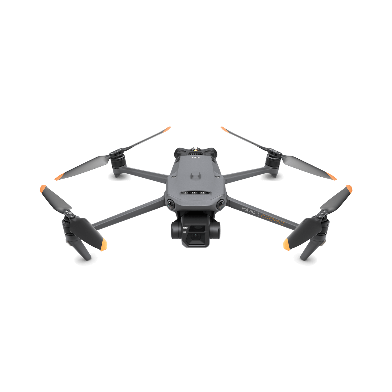
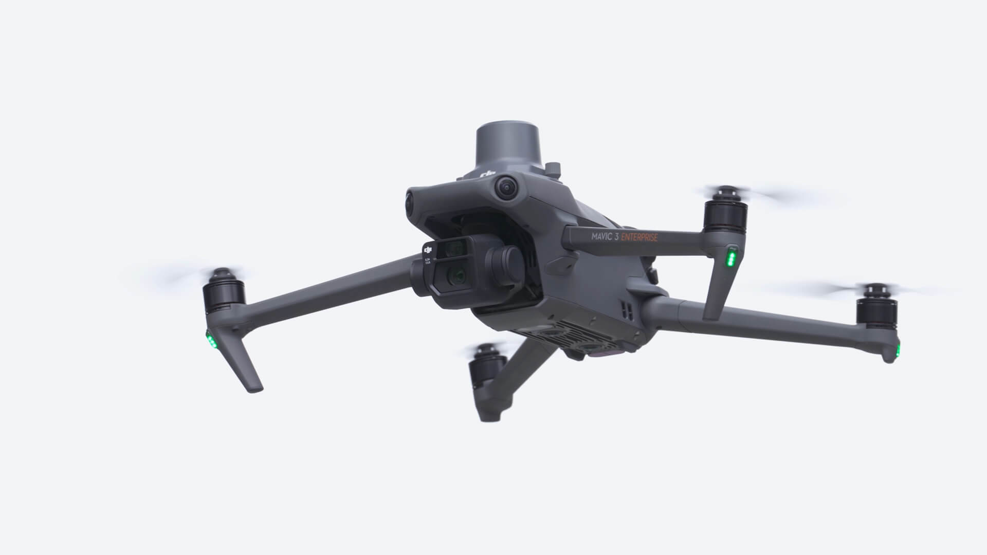
DJI Mavic 3E improves mapping and mission efficiency with its mechanical shutter, 56× hybrid zoom camera and RTK module support for centimetre-level positioning. Its compact airframe fits everyday field operations.
4/3 CMOS camera
Mechanical shutter and high-resolution imaging.
Fast interval shooting
Minimum JPEG capture interval of the RGB camera.
Hybrid zoom
Distant details with a 12 MP tele camera.
Maximum flight time
With the standard flight battery. [1]
Coverage per flight
Depends on mapping mission conditions. [3]
Precise positioning
Centimetre-level positioning with an optional module.
Portable and Compact
Combining reliability and functionality in a compact airframe, Mavic 3E is designed to optimise business operations and collect reliable data.
POWERFUL CAMERA PERFORMANCE
Fast Mapping
The DJI Mavic 3E's wide-angle 4/3 CMOS, 20 MP sensor features a mechanical shutter to reduce motion blur. Its support for fast 0.7-second interval JPEG capture helps complete mapping missions efficiently.
4/3 CMOS
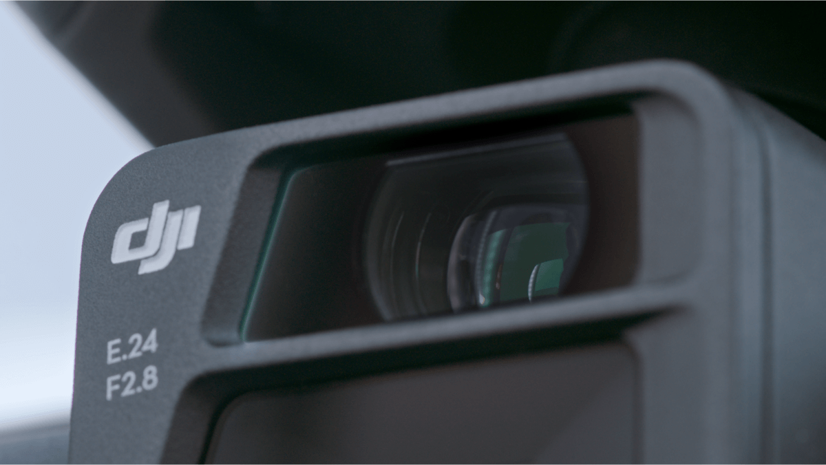
20 MP sensor, 24 mm equivalent lens and 84° field of view.
Mechanical Shutter
Capture images during moving flight with a mechanical shutter range of 8–1/2000 seconds.
JPEG + RAW
JPEG and DNG (RAW) recording options for mapping and image processing.
Open video in a separate tab ↗
Improved Low-Light Performance
The wide-angle camera combines an intelligent low-light mode with 3.3 μm pixels for improved performance in dim conditions.
Open video in a separate tab ↗
Focus and Find
The 12 MP tele camera supports 56× maximum hybrid zoom to reveal essential details from a distance.
EXCEPTIONAL OPERATIONAL EFFICIENCY
Batteries Optimized for Endurance
Survey more ground on every mission with up to 45 minutes of flight time and mapping coverage of up to 2 km² per flight.[1][3]
100 W Charging Hub
Charge three batteries sequentially to prepare for the next mission.
88 W Direct Charging
Charge the drone directly with a compatible adapter.
DJI O3 Enterprise
1080p / 30 fps live view on the controller; maximum communication distance of 15 km for FCC and 8 km for CE / SRRC / MIC.[2]
Omnidirectional Sensing for Safer Flight
Detect surrounding obstacles with wide-angle sensors and adjust braking distance and proximity alerts to suit mission requirements.
Advanced RTH
Automatically plans a suitable return route to save time and power.
APAS 5.0
Supports automatic rerouting around obstacles during manual flight.
RTK Positioning
The optional RTK module works with network RTK, custom network RTK services and the D-RTK 2 Mobile Station.
Sensing requires suitable lighting and surface conditions. RTK positioning accuracy is not the same metric as resulting map accuracy.
Missions for Your Project
Real-Time Terrain Following
Mavic 3E's omnidirectional sensing enables automatic flight-height adjustment when mapping areas with elevation differences, without importing external elevation data.
Smart Oblique Capture
During Smart Oblique Capture, the gimbal automatically rotates forward, centrally and backward. Images from the angles required for 3D modelling can be collected in two routes.
Live Mission Recording
Record mission actions such as drone movement, gimbal orientation, photo capture and zoom level for future automated flights.
Corridor Mission Planning
Draw a line on the map for highways, rivers or oil pipelines, then divide the area into mappable sections to prepare automated flight missions.
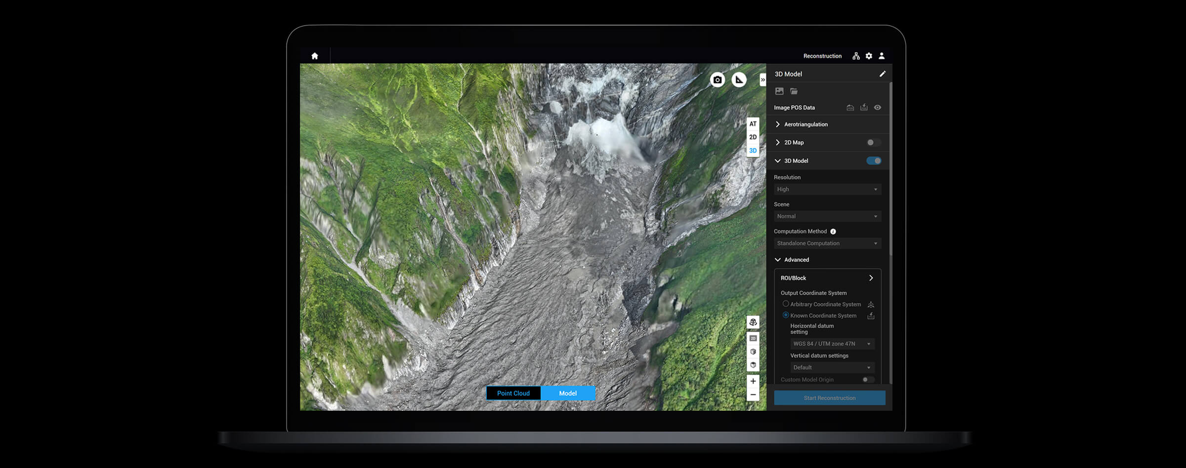
From Flight to Map, Together.
DJI Pilot 2
Access flight, camera and mission planning controls through the controller.
DJI Terra
Use collected imagery in 2D mapping and 3D modelling workflows.
DJI FlightHub 2
Bring field teams and the operations centre together with route planning, mission management and live annotations.
Software licenses and cloud services depend on the selected package.
Data Security and Integration
Data Control
Local Data Mode, one-tap device data clearing and AES-256 video transmission encryption.
Cloud API
Connect to compatible cloud platforms through DJI Pilot 2.
Mobile SDK 5 and PSDK
Develop custom mobile applications and supported hardware integrations.
Package Contents
Mavic 3E In the Box
Mavic 3E package contents shown on the Atay product page. Click an image to enlarge it.


Delivery contents and inclusion of the RTK module are confirmed in the selected quotation.
Technical Specifications
All the details, together.
General and Flight Performance
General and Flight Performance
| Product Name | DJI Mavic 3E |
|---|---|
| Weight (with propellers, without accessories) | 915 g; includes the standard flight battery and microSD card, excludes the RTK module. [1] |
| Maximum Takeoff Weight | 1050 g; standard battery configuration. |
| Dimensions | Folded, without propellers: 221 × 96.3 × 90.3 mm Unfolded, without propellers: 347.5 × 283 × 107.7 mm (L × W × H) |
| Diagonal Distance | 380.1 mm |
| Maximum Ascent Speed | Normal Mode: 6 m/s Sport Mode: 8 m/s |
| Maximum Descent Speed | Normal and Sport Modes: 6 m/s |
| Maximum Flight Speed | At sea level, without wind: Normal Mode: 15 m/s Sport Mode: forward 21 m/s, sideways 20 m/s, backward 19 m/s |
| Maximum Wind Speed Resistance | 12 m/s; test value for takeoff and landing. |
| Maximum Takeoff Altitude Above Sea Level | 6000 m; without additional payload. |
| Maximum Flight Time | 45 minutes; without wind, with standard flight battery. [1] |
| Maximum Hovering Time | 38 minutes; without wind, with standard flight battery. [1] |
| Maximum Flight Distance | 32 km; total flight distance, not controller communication range. [1] |
| Maximum Pitch Angle | Normal Mode: 30° Sport Mode: 35° |
| Maximum Angular Velocity | 200°/s |
| GNSS | GPS + Galileo + BeiDou + GLONASS GLONASS is supported only when the RTK module is enabled. |
| Hovering Accuracy | Vertical: ±0.1 m (vision system); ±0.5 m (GNSS); ±0.1 m (RTK) Horizontal: ±0.3 m (vision system); ±0.5 m (high-precision positioning); ±0.1 m (RTK) |
| Operating Temperature Range | −10 °C to +40 °C |
| Visibility Light | Integrated aircraft beacon |
| Motor / Propeller | 2008 motor / 9453F Enterprise propeller |
| Internal Storage | None; images are saved to microSD. |
| Supported Memory Card | microSD with a speed class of V30 or higher; select compatible models from the manufacturer's recommended card list. |
Wide-Angle Camera
Wide-Angle Camera
| Sensor | 4/3 CMOS; 20 MP effective pixels |
|---|---|
| Lens | Field of view: 84° Equivalent focal length: 24 mm Aperture: f/2.8–f/11 Focus: 1 m–∞ |
| ISO Range | 100–6400 |
| Shutter Speed | Electronic shutter: 8–1/8000 s Mechanical shutter: 8–1/2000 s |
| Maximum Photo Size | 5280 × 3956 pixels |
| Photo Modes | Single / timed: 20 MP JPEG intervals: 0.7 / 1 / 2 / 3 / 5 / 7 / 10 / 15 / 20 / 30 / 60 s JPEG + RAW intervals: 3 / 5 / 7 / 10 / 15 / 20 / 30 / 60 s Smart Low-Light Shooting: 20 MP Panorama: 20 MP source image |
| Video Resolution | 4K: 3840 × 2160 / 30 fps FHD: 1920 × 1080 / 30 fps |
| Video Bitrate | 4K: 130 Mbps FHD: 70 Mbps |
| Photo Format | JPEG / DNG (RAW) |
| Video Format | MP4; MPEG-4 AVC / H.264 |
| File System | exFAT |
| Pixel Size | 3.3 μm |
Telephoto Camera
Telephoto Camera
| Sensor | 1/2-inch CMOS; 12 MP effective pixels |
|---|---|
| Lens | Field of view: 15° Equivalent focal length: 162 mm Aperture: f/4.4 Focus: 3 m–∞ |
| Zoom | 8× digital; maximum 56× hybrid zoom |
| ISO Range | 100–6400 |
| Shutter Speed | Electronic shutter: 8–1/8000 s |
| Maximum Photo Size | 4000 × 3000 pixels |
| Photo Modes | Single / timed: 12 MP JPEG intervals: 0.7 / 1 / 2 / 3 / 5 / 7 / 10 / 15 / 20 / 30 / 60 s Intelligent Low-Light Shooting: 12 MP |
| Video Resolution | 4K: 3840 × 2160 / 30 fps FHD: 1920 × 1080 / 30 fps |
| Video Bitrate | 4K: 130 Mbps FHD: 70 Mbps |
| Photo / Video Format | JPEG / MP4 (MPEG-4 AVC / H.264) |
Gimbal and Sensing
Gimbal
| Stabilization | 3 axes: tilt, roll and pan |
|---|---|
| Mechanical Range | Tilt: -135° to +100° Roll: −45° to +45° Pan: −27° to +27° |
| Controllable Range | Tilt: −90° to +35° Pan cannot be controlled independently. |
| Maximum Tilt Control Speed | 100°/s |
| Angular Vibration Range | ±0.007° |
Sensing System
| Sensor Configuration | Omnidirectional dual vision system with downward infrared sensor support. |
|---|---|
| Forward | Measurement: 0.5–20 m; detection: 0.5–200 m Effective sensing speed: ≤15 m/s FOV: horizontal 90°, vertical 103° |
| Backward | Measurement: 0.5–16 m; effective sensing speed: ≤12 m/s FOV: horizontal 90°, vertical 103° |
| Sideways | Measurement: 0.5–25 m; effective sensing speed: ≤15 m/s FOV: horizontal 90°, vertical 85° |
| Upward | Measurement: 0.2–10 m; effective sensing speed: ≤6 m/s FOV: front/rear 100°, left/right 90° |
| Downward | Measurement: 0.3–18 m; effective sensing speed: ≤6 m/s FOV: front/rear 130°, left/right 160° |
| Operating Environment | Forward, backward, sideways and upward: distinctly textured surfaces and >15 lux lighting. Downward: surfaces with diffuse reflectivity >20% and lighting >15 lux. |
| Flight Assistance | Advanced Return to Home and APAS 5.0. APAS 5.0 supports manual flight; sensing depends on environmental conditions. |
DJI RC Pro Enterprise and Video Transmission
DJI RC Pro Enterprise
| Model | DJI RC Pro Enterprise |
|---|---|
| Display | 5.5-inch; 1920 × 1080 resolution; 60 fps |
| Screen Brightness | 1000 nit |
| Touch Control | 10-point multi-touch |
| Internal Battery | Li-ion; 5000 mAh @ 7.2 V |
| Rated Power | 12 W |
| Operating Time | Approximately 3 hours; depends on operating conditions. |
| Charging Time | Approximately 1 hour 30 minutes: with a 100 W DJI adapter charging only the controller or a 15 V USB charger. Approximately 2 hours: with a 12 V USB charger. Approximately 2 hours 50 minutes: with a 100 W adapter charging the drone and controller together. [4] |
| Storage | 64 GB internal storage; expandable with microSD. |
| Video Output | Mini-HDMI |
| Wi-Fi | 802.11 a/b/g/n/ac/ax; 2 × 2 MIMO 2.400–2.4835 / 5.150–5.250 / 5.725–5.850 GHz [2] |
| Bluetooth | Bluetooth 5.1; 2.400–2.4835 GHz |
| Operating Temperature | −10 °C to +40 °C |
| Microphone | Built-in microphone |
Video Transmission
| System | DJI O3 Enterprise |
|---|---|
| Live View Quality | 1080p / 30 fps on the controller |
| Operating Frequency | 2.400–2.4835 GHz 5.725–5.850 GHz [2] |
| Maximum Transmission Distance | Without obstacles or interference: FCC: 15 km CE / SRRC / MIC: 8 km [2] |
| Transmission Distance with Interference | Strong interference: 1.5–3 km Medium interference: FCC 3–9 km; CE / SRRC / MIC 3–6 km Low interference: FCC 9–15 km; CE / SRRC / MIC 6–8 km [2] |
| Maximum Download Speed | 15 MB/s with DJI RC Pro Enterprise; laboratory test value. |
| Latency | Approximately 200 ms; depends on environment and device conditions. |
| Antenna Configuration | 4 antennas; 2T4R |
Battery and Charging
Intelligent Flight Battery
| Battery | DJI Mavic 3 Series Intelligent Flight Battery; standard version |
|---|---|
| Capacity | 5000 mAh |
| Nominal Voltage | 15.4 V |
| Maximum Charging Voltage | 17.6 V |
| Battery Type | LiPo 4S |
| Chemistry | LiCoO₂ |
| Energy | 77 Wh |
| Weight | 335.5 g |
| Charging Temperature | +5 °C to +40 °C |
Power Adapter and Charging Hub
| Adapter Input | 100–240 V AC; 50–60 Hz; 2.5 A |
|---|---|
| Adapter Output Power | Maximum total 100 W. When both ports are used, power is distributed according to demand; maximum 82 W per port, maximum 100 W total. |
| Charging on the Drone | Maximum 88 W fast charging |
| Charging Hub Input | USB-C: 5–20 V, 5 A |
| Charging Hub Battery Output | 12–17.6 V, 8 A |
| Charging Hub Rated Power | 100 W |
| Charging Method | Three batteries charge sequentially. |
| Charging Temperature Range | +5 °C to +40 °C |
RTK Module and Speaker
RTK Module
| Dimensions | 50.2 × 40.2 × 66.2 mm |
|---|---|
| Weight | 24 ±2 g |
| Connection / Power | USB-C / approximately 1.2 W |
| RTK Positioning Accuracy | RTK Fix: Horizontal: 1 cm + 1 ppm Vertical: 1.5 cm + 1 ppm |
| Application | Separately sold module; supports Network RTK, custom Network RTK services and D-RTK 2 Mobile Station. Positioning accuracy is not the same as map or model accuracy. |
Speaker
| Dimensions | 114.1 × 82 × 54.7 mm |
|---|---|
| Weight | 85 ±2 g |
| Connection / Rated Power | USB-C / 3 W |
| Maximum Sound Level | 110 dB at 1 m [5] |
| Effective Broadcast Distance | 70 dB at 100 m [5] |
| Bitrate | 16 / 32 Kbps |
| Functions | Text-to-speech, audio recording storage and looped broadcasting. |
| Operating Temperature | −10 °C to +40 °C |
- The 915 g weight, 45-minute flight time, 38-minute hovering time and 32 km total flight distance apply to the standard Mavic 3 Series Intelligent Flight Battery and Enterprise propeller configuration. The 45-minute value was measured at sea level in windless conditions at a constant 32.4 km/h. Actual results vary with payload and flight conditions.
- 15 km FCC and 8 km CE / SRRC / MIC are one-way communication distances measured in unobstructed, interference-free conditions; they are not round-trip flight ranges. Frequencies and performance depend on regional conditions.
- Coverage of 2 km² per flight applies at 5 cm GSD, 80% forward overlap, 60% side overlap and 15 m/s flight speed. Actual coverage and map accuracy depend on mission conditions.
- Charging times and power values may vary with the adapter, devices charged simultaneously and battery temperature.
- Speaker values of 110 dB at 1 m and 70 dB at 100 m are laboratory test results; they vary with the audio source, firmware and environmental conditions.
Compatible Equipment and Accessories
Positioning, control and connectivity solutions for your requirements.
 DJI RC Pro Enterprise1000-nit brightness, 5.5-inch display and built-in microphone.Learn More ↗
 RTK ModuleNetwork RTK and D-RTK 2 support for precise positioning.Learn More ↗
 D-RTK 2 Mobile StationReal-time GNSS correction data in a compatible RTK workflow.Learn More ↗
 SpeakerText-to-speech, audio storage and looped announcements.Learn More ↗
 DJI Cellular Dongle4G Enhanced Transmission and mobile connectivity for the controller in supported regions.Learn More ↗
The RTK module, D-RTK 2, speaker and connectivity module are sold separately. Discuss package contents, compatible mounts and regional service support with Atay.
Mavic 3E for Your Project.
Contact the Atay Mühendislik team for detailed information about Mavic 3E and compatible equipment.
Applications
Mapping, modelling and visible-light site inspection.
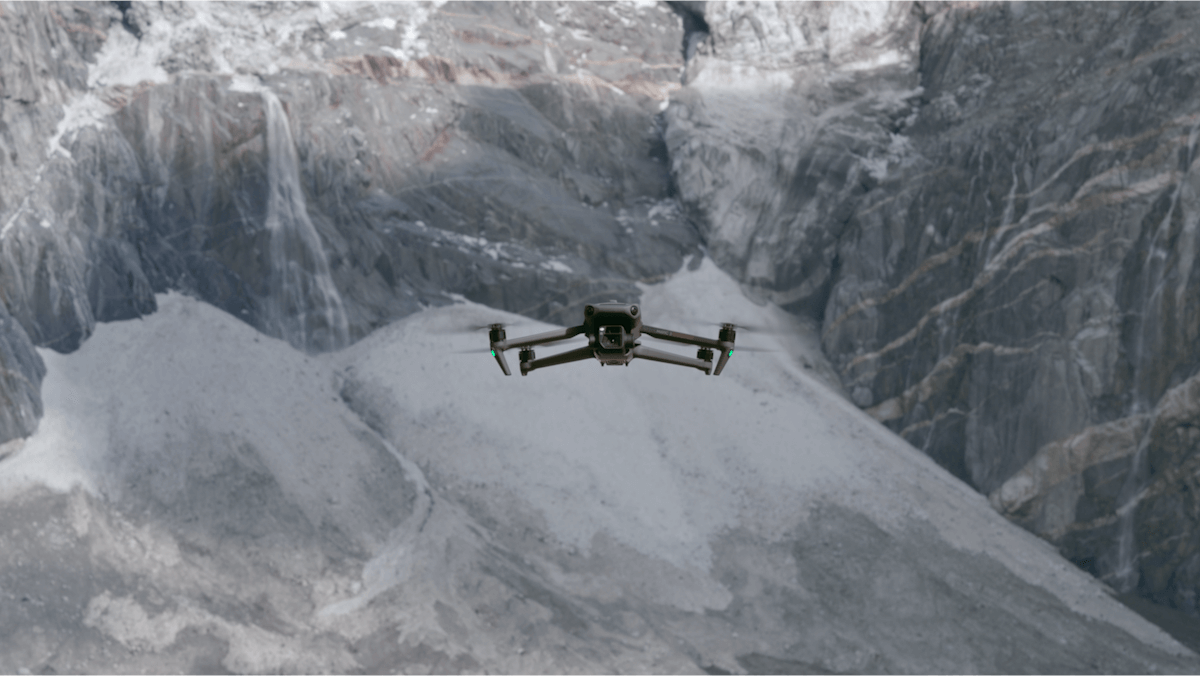
Mapping and Surveying
Collect imagery for orthophotos and 3D models with a mechanical shutter and fast interval shooting.
Construction and Infrastructure
Monitor site changes, capture structures from different angles and document progress.
Remote Visual Inspection
Assess distant details with 56× hybrid zoom and support inspections with repeatable missions.