
Matrice 4T
A new standard in intelligent aerial operations.
Matrice 4T with Atay Mühendislik Support
DJI Matrice 4T is a compact, multi-sensor professional drone platform developed for enterprise and industrial field operations. Its laser-rangefinder-assisted intelligent sensing system delivers precise, reliable data for target detection, distance measurement and operational analysis.

Advanced environmental sensors and optimized flight safety systems help Matrice 4T maintain stable performance in challenging field conditions. Intelligent flight assistance and a modular accessory ecosystem allow it to adapt quickly to different mission scenarios.
Matrice 4T serves applications including electrical infrastructure inspection, emergency response, public safety, search and rescue, and forestry, backed by Atay Mühendislik's expertise and technical support.
Wide-Angle, Medium Tele and Tele
Three visible-light cameras for different distances.
Thermal Sensor
1280 × 1024 imaging support in high-resolution mode.¹
NIR Auxiliary Light
Illumination for tele camera night imaging.²
Laser Rangefinder
Precise point, line and area measurements.³
O4 Enterprise
Communication range without obstacles or interference.⁴
Maximum Flight Time
With standard propellers, under test conditions.⁵
Test conditions and explanations appear below the specifications.
Thermal Imaging.
See the Differences on Site.
640 × 512 resolution, f/1.0, 53 mm equivalent focal length. Uncooled VOx microbolometer with high-resolution mode support.
Matrice 4T supports 1280 × 1024 thermal imaging in high-resolution mode. This mode increases output resolution; the sensor's native resolution is 640 × 512.
Point and Area Measurement
Assess temperatures at points and within areas on thermal images. Inspect differences during firefighting, search and rescue, and industrial inspections.
Temperature Measurement Range
−20 °C to +150 °C in high-gain mode; 0 °C to +550 °C in low-gain mode.
Calibrated Thermal Camera
Each device undergoes temperature accuracy calibration. An internal temperature sensor supports real-time measurement.
Stronger Vision
in Low Light.
An IR-Cut filter, NIR auxiliary light and low-light imaging tools adapt to field conditions from sunset to nighttime operations.
Night Mode
Three color night-imaging modes and two-level enhanced noise reduction improve low-light image quality.
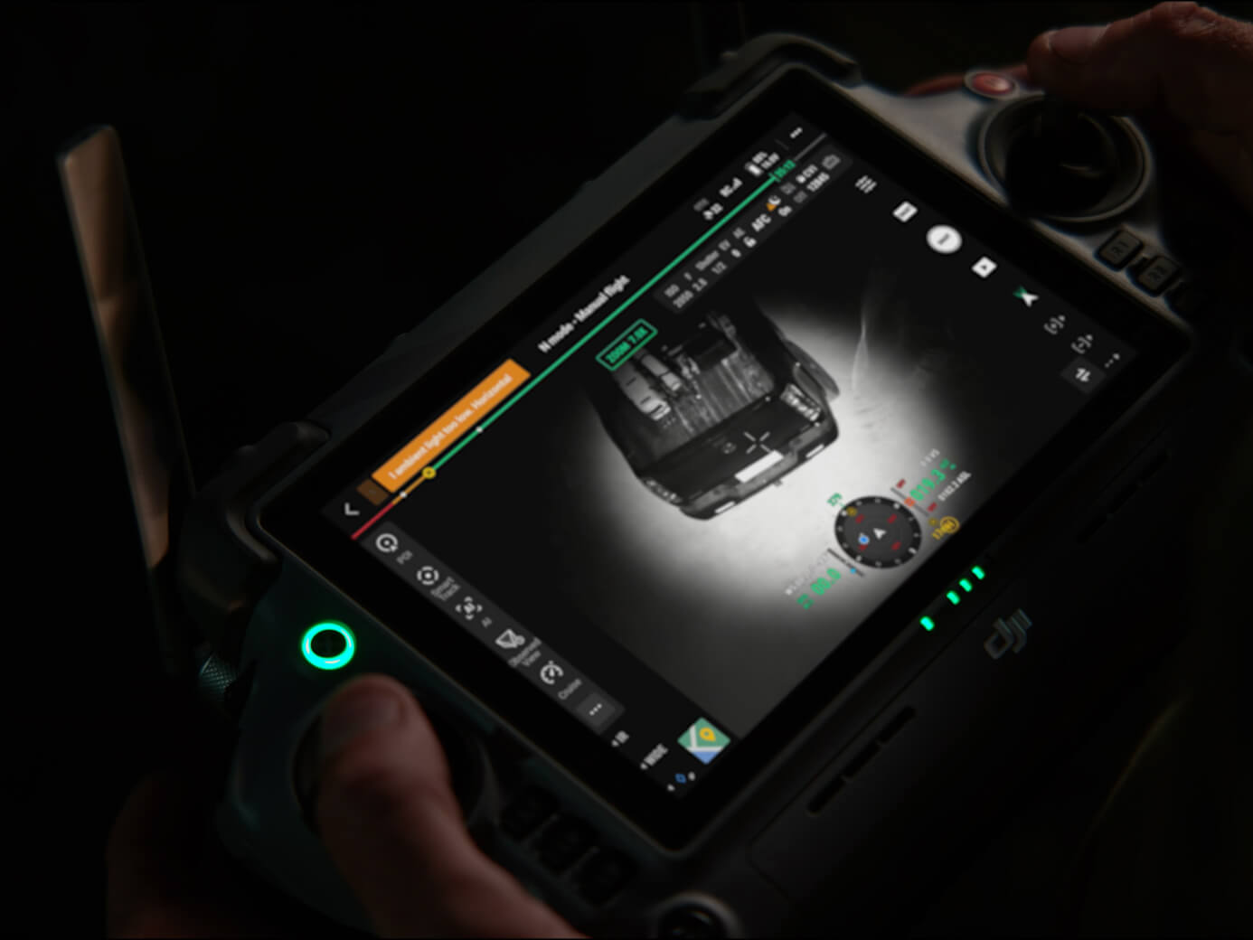
NIR Auxiliary Light
Field of view: 6°. Illumination distance: 100 m.
NIR lighting supports tele camera imaging in dark environments.²
Intelligent Low-Light Photography
The wide-angle camera's f/1.7 aperture and intelligent low-light functions support sunset and night missions.
Omnidirectional Sensing
Six low-light fisheye vision sensors provide environmental data for visual positioning and obstacle avoidance. Suitable lighting and surface texture are required.
Crystal-Clear Vision:
Reveal the Details
Wide-Angle Camera
1/1.3-inch CMOS, 48 MP effective pixels, f/1.7, 24 mm equivalent
Medium Telephoto Camera
1/1.3-inch CMOS, 48 MP effective pixels, f/2.8, 70 mm equivalent
Telephoto Camera
1/1.5-inch CMOS, 48 MP effective pixels, f/2.8, 168 mm equivalent
Enhanced Medium Telephoto
DJI Matrice 4T includes a medium tele camera for medium-range inspections. During power line and bridge inspections, screws and cracks can be detected from 10 meters, and equipment gauges in substations can be read clearly.
This supports greater precision and reliable operation in medium-range infrastructure inspection.
Super-Resolution Telephoto
DJI Matrice 4T's tele camera offers improved image clarity. Its 48 MP resolution can capture fine details on signs and markings from 250 meters under suitable conditions.
Equipped with an IR-Cut filter, Matrice 4T also supports reliable day and night imaging for round-the-clock operations.
Telephoto Stabilization
Supports more stable, clearer imaging of foreground targets at 10× zoom and above.
Electronic Dehazing
Low, medium and high levels help reduce the effect of moisture and haze on image clarity.
10 m detail detection applies under standard lighting with direct line of sight; 250 m tele imaging is specified with the camera facing the target directly. Results depend on environmental and target conditions.
Safer Flight,
Confident Operations
Integrated RTK and Advanced Positioning
DJI Matrice 4T includes an integrated DJI RTK module with expanded L5 frequency support. The GNSS + Vision Fusion Positioning and Navigation System provides precise positioning. Visual positioning can update the Return-to-Home point during flight, allowing fast takeoff within 15 seconds. Under suitable conditions, Matrice 4T can complete return-to-home without GNSS, supporting continuity where urban obstructions and interference affect signals.
Intelligent Routing and Continuous Flight
With an internet-connected DJI RC Plus 2 Enterprise, DJI Matrice 4T can preload terrain elevation and detailed environmental maps for automatic route planning and obstacle avoidance.
This supports flight safety and mission continuity in demanding scenarios such as night flights or mountainous terrain.
Matrice 4T also includes five-direction vision assistance and downward vision sensors, improving environmental awareness and collision prevention support.
Visual positioning, obstacle sensing and return-to-home without GNSS depend on suitable environmental conditions. Textureless surfaces or illumination below 0.5 lux limit vision sensing.
New Heights in
Video Transmission
O4 Enterprise video transmission supports demanding operational environments. DJI Matrice 4T's eight-antenna aircraft system and high-gain controller antenna provide a transmission range up to 12 kilometers (CE).
The system also provides download bandwidth up to 20 MB/s, more than twice the Mavic 3 Enterprise Series rate. This supports stable, clear image transfer, especially when uploading flight routes and downloading field data.
O4 Enterprise
1080p / 30 fps live view. Eight-antenna aircraft system and high-gain controller antenna.
4G-Assisted Connectivity
Optional DJI Cellular Dongle 2 enables O4 and cellular networks to work together. Sold separately; requires country, carrier and service support.
The 12 km CE range is measured without obstacles or interference. 20 MB/s downloads apply at close aircraft-to-controller range. Communication range is not round-trip mission distance.
Intelligent Sensing.
Precise Field Measurement.
The built-in AI model supports detection of vehicles, vessels and targets. High-resolution grid imagery and target tracking simplify assessment of field details.
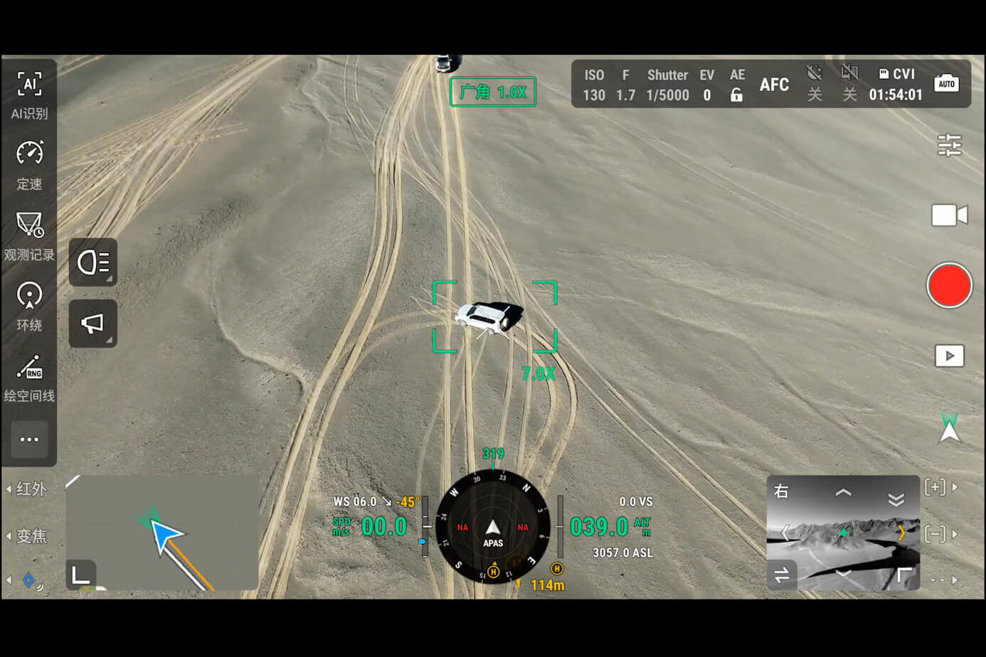
Laser Rangefinder
Up to 1800 m measurement range, point marking, line and area calculations. Assess target locations or affected areas on screen.³
Data Sharing with Teams
Share measurement and annotation data with relevant teams through DJI Pilot QR codes or FlightHub 2.
Observation Range Recording
DJI Pilot 2 shows the camera frame's center and observed ground area on the map.
Efficient Flight,
Intelligent Operations
Cruise Control
Maintains flight in a chosen direction without continuously holding the sticks, simplifying piloting on long missions.
FlyTo
Supports adjusting route and speed to the environment while approaching a selected target.
Smart Track
Target positioning, automatic zoom and reacquisition support after brief obstruction.
POI (Point of Interest)
Continuous observation and image collection from different angles around a selected point.
From Field to Analysis.
A Connected Workflow.
DJI Pilot 2
Customizable intelligent-function toolbar, flight routes and field information sharing with FlightHub 2.
DJI FlightHub 2
Remote flight and payload control, mission planning and management of multiple live streams on one screen.
DTAT 3.0 Thermal Analysis
Annotate, analyze and process thermal images from Matrice 4T. Assess abnormal temperature points.
DJI Terra and DJI Modify
Modeling from visible-light data; editing 3D meshes and point clouds, model repair and sharing.
Developer Ecosystem
Custom payloads, mobile apps and enterprise integration with PSDK, Mobile SDK 5 and Cloud API.
Data Security
Local Data Mode, one-tap device data clearing and AES-256 video transmission encryption.
Technical Specifications
All the details, together.
General and Flight Performance
| Model | DJI Matrice 4T |
|---|---|
| Takeoff weight | 1219 g with standard propellers, battery and microSD card. May vary with manufacturing tolerances. |
| Dimensions | Folded: 260.6 × 113.7 × 138.4 mm Unfolded: 307.0 × 387.5 × 149.5 mm Excluding propellers |
| Maximum takeoff weight | Standard propellers: 1420 g Low-noise propellers: 1430 g |
| Maximum payload | 200 g |
| Maximum flight time⁵ | Standard propellers: 49 min Low-noise propellers: 46 min |
| Hovering time⁵ | Standard propellers: 42 min Low-noise propellers: 39 min |
| Maximum horizontal speed | 21 m/s; at sea level, without wind |
| Ascent / descent | 10 m/s / 8 m/s With accessories: 6 m/s / 6 m/s |
| Wind resistance | 12 m/s during takeoff and landing |
| Maximum altitude | 6000 m; 4000 m with payload |
| Operating temperature | −10 °C to +40 °C |
Visible-Light Cameras
| Wide-Angle Camera | 1/1.3-inch CMOS, 48 MP effective pixels, f/1.7, 24 mm equivalent |
|---|---|
| Medium Telephoto Camera | 1/1.3-inch CMOS, 48 MP effective pixels, f/2.8, 70 mm equivalent |
| Telephoto Camera | 1/1.5-inch CMOS, 48 MP effective pixels, f/2.8, 168 mm equivalent |
| Shutter speed | Electronic: 2–1/8000 s |
| Minimum photo interval | 0.7 s |
| Maximum photo size | Wide-angle: 8064 × 6048 Medium telephoto: 8064 × 6048 Telephoto: 8192 × 6144 |
| Photo format | JPEG |
| Tele camera zoom | 16× digital; 112× hybrid zoom |
Thermal Camera and NIR Auxiliary Light
| Thermal sensor | Uncooled VOx microbolometer; native resolution 640 × 512 |
|---|---|
| High-resolution mode¹ | 1280 × 1024 image support |
| Lens | f/1.0; 53 mm equivalent focal length; DFOV 45° ±0.3° |
| Pixel size / frame rate | 12 μm / 30 Hz |
| Thermal sensitivity | ≤50 mK @ f/1.0 |
| Temperature measurement | Point and area measurement |
| Temperature measurement range | High gain: −20 °C to +150 °C Low gain: 0 °C to +550 °C |
| Temperature measurement accuracy | High gain: ±2 °C or ±2%, whichever is greater Low gain: ±5 °C or ±3%, whichever is greater |
| Thermal photo format | JPEG (8 bit), R-JPEG (16 bit) |
| Thermal video¹ | MP4; 640 × 512 / 30 fps 1280 × 1024 / 30 fps with Super Resolution on and Night Mode off |
| Thermal digital zoom | 28× |
| NIR field of view | Approximately 6°; DJI technical value 5.7° ±0.3° |
| NIR illumination distance² | Up to 100 m; for tele camera |
Laser Rangefinder and Positioning
| Measurement range³ | 1800 m (1 Hz); on a target with 20% reflectivity |
|---|---|
| Oblique incidence range | 600 m (1 Hz) |
| Blind zone | 1 m |
| Ranging accuracy | ± (0.2 + 0.0015 × D); D is measurement distance in meters. At 1–3 m: system error <0.3 m; random error <0.1 m @1σ. |
| RTK GNSS accuracy | RTK Fix: horizontal 1 cm + 1 ppm; vertical 1.5 cm + 1 ppm |
| Positioning | GNSS + Vision Fusion Positioning and Navigation System; integrated RTK and L5 frequency support |
| Environmental sensing | Omnidirectional binocular vision system; downward 3D infrared sensor |
Video and Gimbal
| Visible-light video | 4K: 3840 × 2160 / 30 fps FHD: 1920 × 1080 / 30 fps |
|---|---|
| Video encoding | H.264 / H.265 |
| Maximum video bitrate | H.264: 60 Mbps H.265: 40 Mbps |
| Gimbal | 3-axis stabilization |
| Controllable tilt | −90° to +70° |
Connectivity, Storage and Battery
| Image transmission | O4 Enterprise; 1080p / 30 fps live view |
|---|---|
| Maximum transmission distance | FCC: 25 km; CE: 12 km. One-way communication range without obstacles or interference. |
| Connection ports | 1 × E-Port, 1 × E-Port Lite. Accessories must be installed before powering on. |
| Storage | microSD; U3 / Class 10 / V30 or higher. No internal storage. |
| Battery | 6741 mAh; 14.76 V; 99.5 Wh; Li-ion 4S |
| Battery weight | 401 g |
| Charging temperature | +5 °C to +40 °C |
| Charging hub | Sequential charging of 4 batteries; standard 100% and standby 90% modes |
- The thermal sensor's native resolution is 640 × 512. The 1280 × 1024 value applies to high-resolution processing. Thermal video at this resolution requires Super Resolution on and Night Mode off.
- The 100 m NIR illumination distance is specified under test conditions where the tele camera captures effective imagery while the aircraft hovers 100 m above ground.
- The 1800 m laser range is specified for a target with 20% reflectivity. Rain and fog may reduce measurement performance.
- The 12 km CE range is one-way communication range without obstacles or interference, not actual mission distance. Fast downloads depend on close range and an interference-free connection.
- 49/46-minute flight: measured without wind or payload at approximately 9 m/s until 0% battery. 42/39-minute hover: measured at sea level without wind from 100% to 0%. Values are for standard / low-noise propellers and may vary in actual use.
Do not point the thermal lens directly at the sun, lasers or similar high-energy sources; permanent sensor damage may occur.
Compatible Accessories
Explore lighting, surveying, connectivity and computing solutions for your mission.
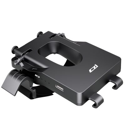 CZI – TH2 Hook Release DeviceExplore product ↗
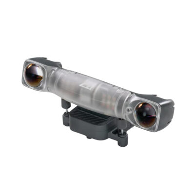 CZI – GL10V2 Gimbal SpotlightExplore product ↗
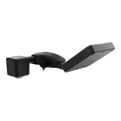 CZI – MF30-M4/M30 Flow MeterExplore product ↗
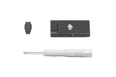 DJI Cellular DongleExplore product ↗
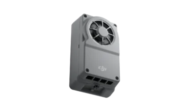 DJI Manifold 3Explore product ↗
For third-party products, mounting, adapter and software compatibility depend on the selected configuration.
DJI AL1 Spotlight
Gimbal-following lighting with continuous and flashing modes. Light coverage follows the camera direction.
DJI AS1 Speaker
Live broadcast, recorded messages and media transmission. Text-to-speech supports English and Mandarin Chinese.
D-RTK 3 Multifunctional Station
Precision positioning for multiple aircraft and surveying workflow support with Rover mode.
DJI RC Plus 2 Enterprise
High-brightness display, IP54 protection and a −20 °C to +50 °C operating range. O4 Enterprise and 4G hybrid transmission in supported regions.
DJI Power 2000
Portable power for field operations. Supports Matrice 4 Series batteries with compatible charging equipment.
Meet Matrice 4T with Atay
We tested Matrice 4 Series Smart Track for you!
Matrice 4T for Your Project.
Contact us to learn more about or purchase Matrice 4T.
Applications
A multi-sensor platform for public safety, inspection and energy operations.

Public Safety
Situational awareness, firefighting, disaster prevention and response, and search and rescue.

Industrial Inspection
Transformer, facility, pipeline and roof inspections.

Energy Infrastructure
Electrical infrastructure, solar and wind farm inspections.