
Matrice 4D
Precision Mapping. Detailed Inspection.
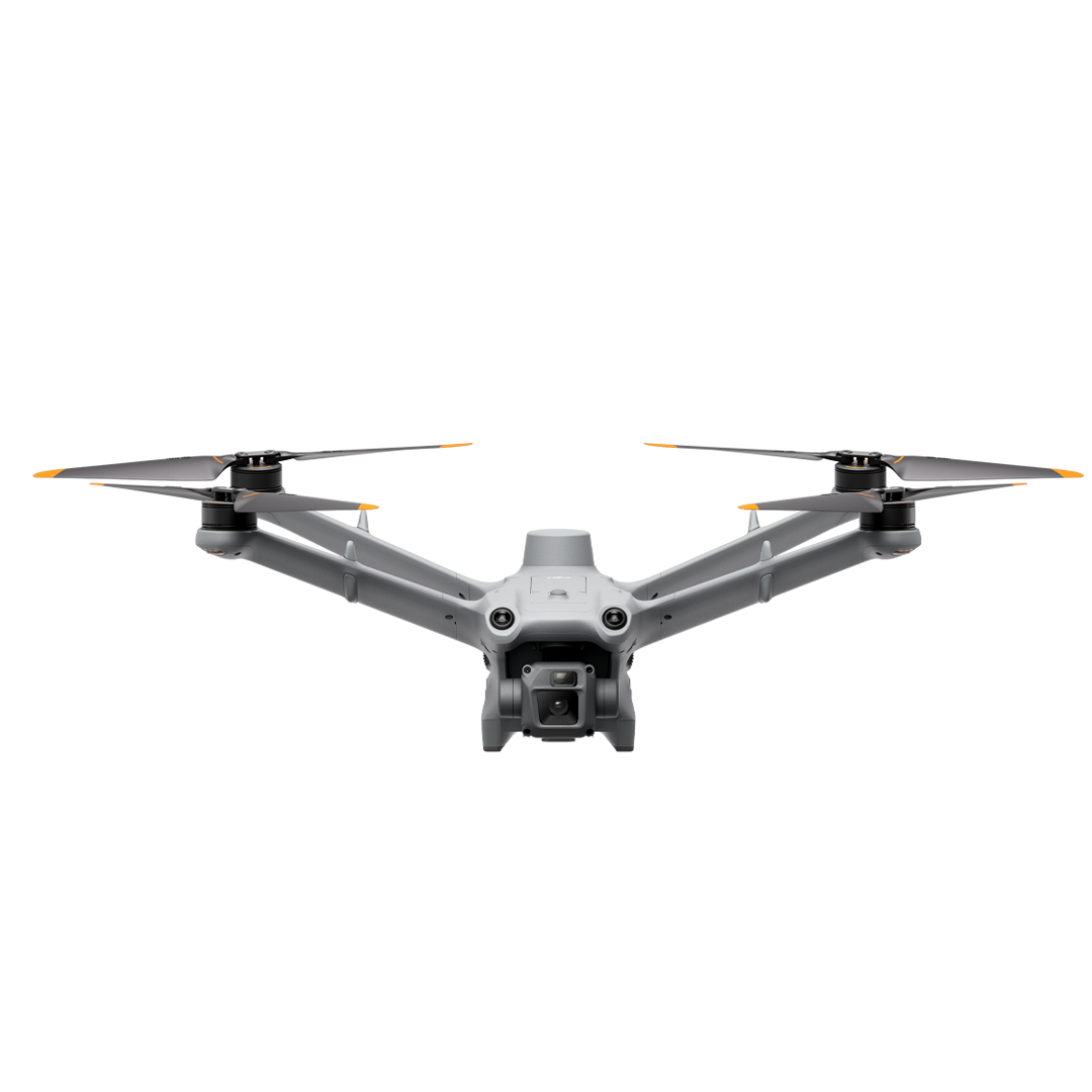
Matrice 4D is a water- and dust-resistant aircraft developed for DJI Dock 3. It supports extended field missions and can also operate independently when paired with DJI RC Plus 2 Enterprise.
The wide-angle, medium tele and tele cameras work with a laser rangefinder for high-precision mapping and detailed surface inspection.
Maximum Flight Time
At a constant forward flight speed of 12 m/s.
Water and Dust Resistance
An airframe for challenging field conditions.
20 MP Mapping Camera
Mechanical shutter and RAW support.
Fast Photo Interval
JPEG capture with the wide-angle camera.
Laser Rangefinder
For distance and position information.
Remote or Independent Operation
With Dock 3 or RC Plus 2 Enterprise.
DJI DOCK 3 ECOSYSTEM
Autonomous Operation Solutions.
Choose the dock and aircraft combination that suits your mission.
Matrice 4D + Dock 3
Remotely manage takeoff, missions, landing and charging with Dock 3. DJI FlightHub 2 lets you plan routes, monitor live video and access field data. Choose a fixed installation or vehicle-mounted deployment with suitable mounting equipment to meet your requirements.
The vehicle must remain stationary throughout vehicle-mounted missions. Dock 3 is designed for Matrice 4D and 4TD; it is not compatible with Matrice 4E / 4T. The dock, controller and software licences are supplied separately depending on the selected package.
HIGH-PERFORMANCE DRONES
Imaging for Every Mission.
The wide-angle camera combines a 4/3 CMOS sensor, 20 MP resolution and mechanical shutter. Medium tele and tele cameras enable detailed surface inspection on the same platform.

Wide-Angle Camera
4/3 CMOS · 20 MP · f/2.8–f/11 · 24 mm equivalent. Mechanical shutter: up to 1/2000 s.
Medium Telephoto Camera
1/1.3-inch CMOS · 48 MP · f/2.8 · 70 mm equivalent. Detailed imaging for medium-range inspections.
Telephoto Camera
1/1.5-inch CMOS · 48 MP · f/2.8 · 168 mm equivalent. Up to 112× hybrid zoom.
Laser Rangefinder
Measurement up to 1800 m; 600 m at oblique incidence. Blind zone: 1 m; performance depends on target and environmental conditions.[3]
Fast and Flexible Recording
JPEG photo intervals as short as 0.5 seconds. DNG (RAW) on the wide-angle camera; 4K/30 fps video.
Clear Images and Stable Shots
Foreground stabilization helps retain detail at 10× zoom and above. Lens defogging is supported on all three cameras.
FLIGHT PERFORMANCE
Longer Flight Time, Robust Protection.
Matrice 4D can fly forward for up to 47 minutes at 15 m/s. It supports wide-area operations with approximately 18 minutes on task at a 10 km mission radius.[1]
Up to 54 Minutes
Maximum flight time was measured in a constant 12 m/s forward-flight test. This differs from the conditions for the 47-minute value at 15 m/s.[1]
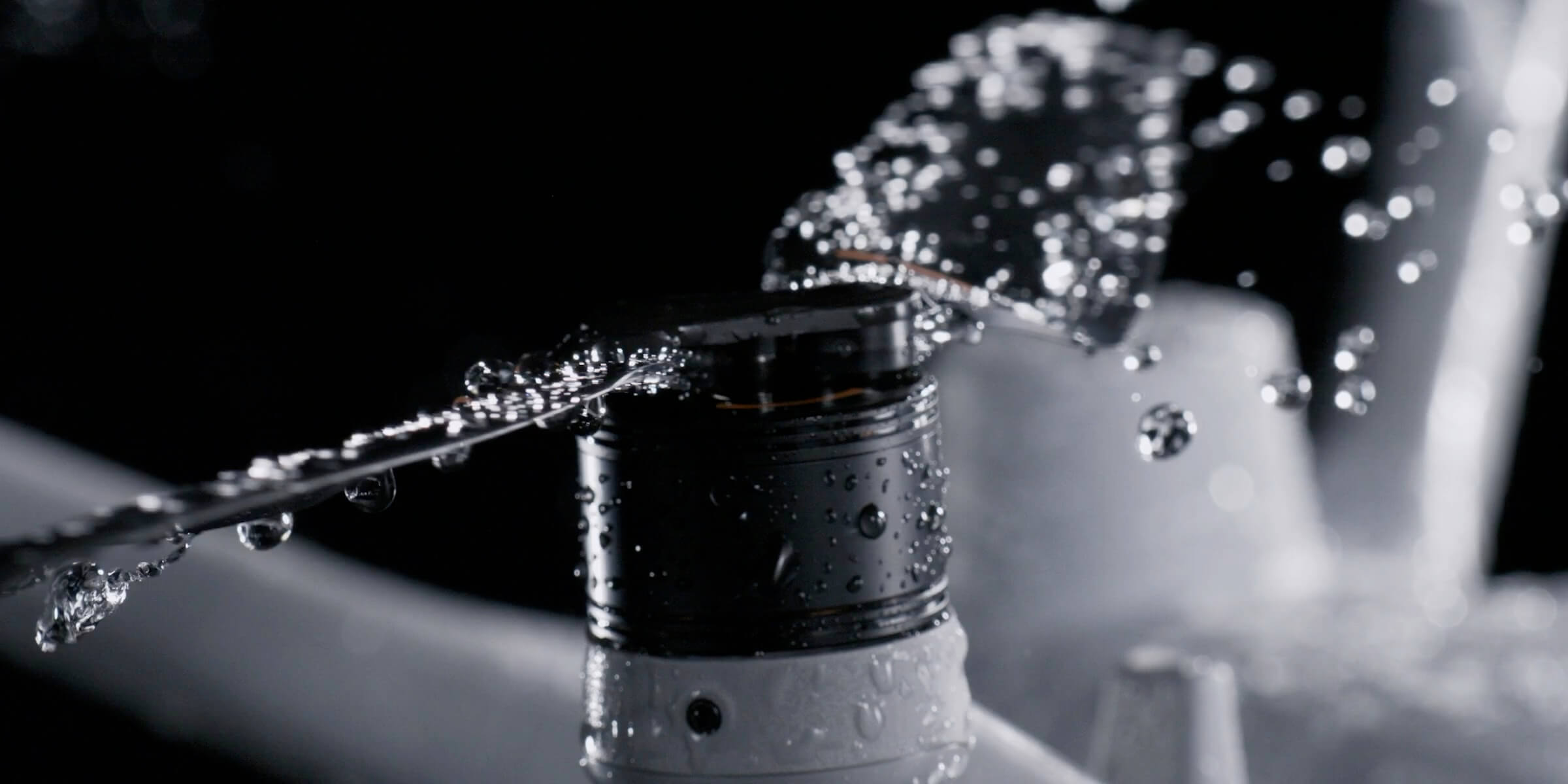
IP55 Protection
Water- and dust-resistant airframe; aircraft operating range of −20 °C to +50 °C.[2]
12 m/s Wind Resistance
Wind resistance during takeoff, landing and flight. Standard low-noise and anti-icing propellers.
ADVANCED SENSING
Obstacle Sensing for Safer Operations.
Omnidirectional vision sensing, a downward infrared sensor and low-light positioning support flight in complex environments. The optional Obstacle Sensing Module combines rotating LiDAR and millimeter-wave radar.
Thin-Wire Detection
Under specified conditions, the optional module supports detection of 12 mm diameter wires at speeds up to 15 m/s.[4]
Complex Field Conditions
Additional sensing and positioning support in obstacle-dense areas such as power distribution lines and substations.
Low-Light Positioning
Four high-resolution low-light fisheye cameras support visual positioning and obstacle sensing.
The Obstacle Sensing Module is sold separately. Performance varies with light, precipitation, surface characteristics and field of view.[4]
MAPPING AND MODELING
From Detailed Data to Measurable Results.
The wide-angle camera's mechanical shutter helps reduce geometric distortion in moving shots. It supports mapping workflows without ground control points under suitable RTK and mission conditions.[9]
Five-Direction Oblique Capture
Collect imagery from different angles to produce data for 3D modeling.
Three-Direction Orthophoto Capture
Collect regular imagery on mapping missions with the wide-angle camera's fast photo interval.
Real-Time Terrain Following
Helps maintain terrain-relative flight height in supported missions. Features depend on mission type and software version.
High-precision mapping applies to the wide-angle camera. Results depend on RTK, image overlap, flight height, surface and processing conditions.[9]
VISUAL INSPECTION
Clear Images and Stable Shots.
The medium tele camera supports inspecting details such as pins, surface cracks and gauges from approximately 10 meters. Under suitable conditions, the 48 MP tele camera helps capture signs and fine details from up to 250 meters.
Foreground Stabilization
Stable imaging of foreground objects at 10× zoom and above.
Full-Color Night Vision
Night Vision mode enables color imaging in low light.
Lens Defogging
Defogging on wide-angle, medium tele and tele lenses helps maintain image clarity in difficult conditions.
Matrice 4D has no thermal camera or NIR auxiliary light. For night and thermal missions, explore Matrice 4TD ↗.
FLEXIBLE OPERATION
Remote with Dock. On Site with a Controller.
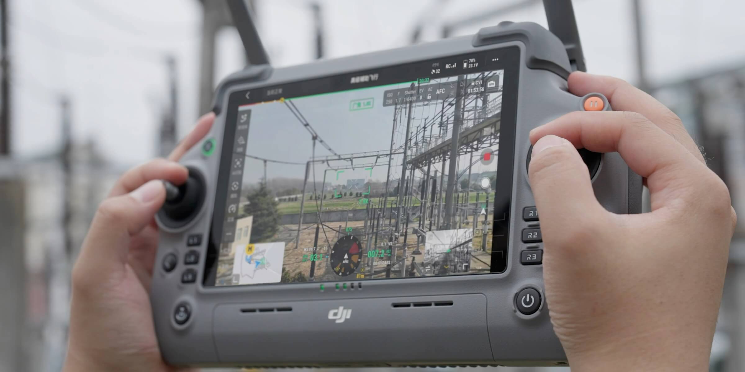
Run missions remotely through Dock 3 or configure independent operation with DJI RC Plus 2 Enterprise.
DJI RC Plus 2 Enterprise
On-site mission planning and control with a 7.02-inch, 1400-nit display and DJI Pilot 2.
O4+ Enterprise
Transmission without obstacles or interference: FCC 25 km; CE, SRRC and MIC 12 km. Optional 4G Enhanced Transmission in supported regions.[6]
Independent Airborne Relay
Relay support with two aircraft and RC Plus 2 Enterprise controllers. This feature is unavailable in Dock 3-connected operation.
TECHNICAL SPECIFICATIONS
Every Detail, in One Place.
Select the headings to explore aircraft, camera, connectivity and power system specifications.
General and Flight Performance
| Product Name | DJI Matrice 4D |
|---|---|
| Weight | 1850 g; including battery, propellers and microSD card, excluding additional payloads |
| Maximum Takeoff Weight | 2090 g |
| Dimensions | 377.7 × 416.2 × 212.5 mm; excluding propellers |
| Diagonal Wheelbase | 498.5 mm |
| Maximum Flight Time | 54 minutes; tested at a constant forward-flight speed of 12 m/s. [1] |
| Flight Time at 15 m/s | Up to 47 minutes of forward flight. The 54-minute maximum was measured at a different speed. [1] |
| Maximum Hovering Time | 47 minutes [1] |
| Maximum Operating Radius | 10 km; with 18 minutes of work at the mission site under specified conditions. [1] |
| Maximum Total Flight Distance | 43 km; tested at a constant speed of 16 m/s. [1] |
| Horizontal Speed in Normal Mode | Forward: 15 m/s; backward: 12 m/s; sideways: 10 m/s With obstacle sensing enabled. |
| Horizontal Speed in Sport Mode | Forward: 21 m/s; backward: 19 m/s; sideways: 15 m/s Sport mode is available in standalone operation with a remote controller. Only Normal mode is supported with Dock 3. |
| Maximum Ascent Speed | Normal mode: 6 m/s Sport mode: 10 m/s |
| Maximum Descent Speed | Normal mode: 6 m/s Sport mode: 8 m/s |
| Wind Resistance | 12 m/s during flight, takeoff and landing |
| Maximum Takeoff Altitude | Aircraft: 6500 m Dock 3 installation altitude: up to 4500 m |
| Maximum Pitch Angle | Normal mode: 25° Sport mode: 30° |
| Maximum Angular Velocity | 200°/s |
| Protection and Temperature | IP55; -20 °C to +50 °C [2] |
| Propellers | 1364F folding low-noise anti-ice propellers. The aircraft arms do not fold. |
| RTK and Beacon | Integrated aircraft RTK module and beacon |
| GNSS | GPS + BeiDou + Galileo + QZSS + GLONASS QZSS and GLONASS are supported only when the RTK module is enabled. |
| Hovering Accuracy | Vertical: ±0.1 m vision / ±0.5 m GNSS / ±0.1 m RTK Horizontal: ±0.3 m vision / ±0.5 m GNSS / ±0.1 m RTK In calm or light-wind conditions. |
Wide-Angle Mapping Camera
| Wide-Angle Sensor | 4/3 CMOS; 20 MP effective pixels |
|---|---|
| Wide-Angle Lens | 24 mm equivalent; 84° field of view; f/2.8–f/11; focus: 1 m–∞ |
| Shutter | Mechanical: 2–1/2000 s Electronic: 2–1/8000 s |
| Maximum Wide-Angle Photo Size | 5280 × 3956 |
| Photo Format | Wide-angle: JPEG / DNG (RAW) Medium telephoto and telephoto: JPEG |
| Minimum Photo Interval | 0.5 s; in JPEG format |
| Night Scene ISO | Wide-angle: 100–204800 Medium telephoto / telephoto: 100–409600 |
| Panorama | 20 MP source image; 100 MP stitched image |
| Thermal Camera | Not available |
| Mapping Features | Wide-angle camera with mechanical shutter; mapping without GCPs under suitable RTK and mission conditions. Supports five-direction oblique and three-direction orthophoto capture. [9] |
Medium Tele, Tele and Video
| Medium Telephoto Camera | 1/1.3-inch CMOS; 48 MP; 70 mm equivalent; f/2.8; 35° field of view; focus: 3 m–∞ |
|---|---|
| Telephoto Camera | 1/1.5-inch CMOS; 48 MP; 168 mm equivalent; f/2.8; 15° field of view; focus: 3 m–∞ |
| Medium Telephoto / Telephoto Photo Size | Medium telephoto: 8064 × 6048 Telephoto: 8192 × 6144 |
| Telephoto Zoom | 16× digital; up to 112× hybrid zoom |
| Lens Defogging | Supported on wide-angle, medium tele and tele cameras. |
| Normal ISO Range | 100–25600 |
| Visual Video | 4K: 3840 × 2160, 30 fps FHD: 1920 × 1080, 30 fps |
| Video Encoding | H.264 / H.265; CBR / VBR H.264: 60 Mbps; H.265: 40 Mbps |
| File System / Memory Card | exFAT; U3 / Class 10 / V30 or higher microSD |
Laser Rangefinder and Gimbal
| Laser Measurement Range | At normal incidence: 1800 m, 1 Hz, 20% reflectivity At oblique incidence (1:5): 600 m, 1 Hz Blind zone: 1 m |
|---|---|
| Laser Measurement Accuracy | 1–3 m: systematic error <0.3 m; random error <0.1 m @1σ Other distances: ±(0.2 + 0.0015D) m; D is the distance in metres. Rain and fog may affect performance. |
| Gimbal Stabilisation | 3-axis mechanical gimbal |
| Controllable Tilt Range | −90° to +35° |
| Gimbal Mechanical Range | Tilt: −140° to +50° Roll: −52° to +52° Pan: −65° to +65° |
| Gimbal Speed and Vibration | Maximum tilt control speed: 100°/s Angular vibration: ±0.005° |
Sensing and Video Transmission
| Sensing System | Omnidirectional binocular vision system and a downward 3D infrared sensor |
|---|---|
| Forward Sensing | Measurement: 0.5–20 m; detection: 0.5–200 m Effective speed ≤15 m/s; 95° horizontal / 90° vertical field of view |
| Backward Sensing | 0.5–20 m; effective speed ≤12 m/s 95° horizontal / 90° vertical field of view |
| Lateral Sensing | 0.5–16 m; effective speed ≤10 m/s 90° horizontal / 90° vertical field of view |
| Upward / Downward Sensing | Upward: 0.5–20 m; downward: 0.5–16 m Effective speed ≤6 m/s |
| Sensing Environment | Forward, backward, upward and downward: clear surface patterns and >0.1 lux Left and right: >20% diffuse reflectivity and >6 lux |
| Optional Sensing Module | Rotating LiDAR and millimetre-wave radar. Supports detection of obstacles as thin as 12 mm cables at speeds up to 15 m/s under specified conditions. [4] |
| Video Transmission | DJI O4+ Enterprise |
| Live View Quality | Dock 3 + FlightHub 2: 540p / 720p / 1080p, 30 fps RC Plus 2 Enterprise: 720p / 1080p, 30 fps |
| Maximum Transmission Distance | FCC: 25 km CE / SRRC / MIC: 12 km In unobstructed, interference-free conditions. [6] |
| Aircraft Antennas | 8 antennas; 2T4R |
| Maximum Download Speed | 20 MB/s with Dock 3 or RC Plus 2 Enterprise; laboratory result |
| Latency | Approximately 100 ms between the aircraft and Dock 3; Dock-to-FlightHub 2 latency depends on the network and computer. |
| Airborne Relay in Standalone Operation | Supported between two aircraft using RC Plus 2 Enterprise controllers. Airborne relay is not supported when operating through Dock 3. |
Battery and Charging
| Battery Capacity | 6768 mAh |
|---|---|
| Voltage / Maximum Charging Voltage | 22.14 V / 25.5 V |
| Battery Type | Li-ion 6S; LiNiMnCoO₂ |
| Energy / Weight | 149.9 Wh / 640 g |
| Charging Cycles | 400; usage and battery-care conditions apply. |
| Battery Charging Temperature | +5 °C to +45 °C; self-heating charging support at low temperatures |
| Discharge / Charge Rate | Discharge: 4C Maximum charge: 1.8C |
| 240 W Charging Hub | Charges 3 batteries sequentially. Standard mode: 100%; Ready-to-Fly mode: 90% |
| External Charging Times | With the 240 W charging hub: approximately 40 minutes from 15% to 100%, or approximately 30 minutes from 15% to 90%. |
| 240 W Power Adapter | 100–240 V AC, 50/60 Hz, 3 A Up to 240 W total; USB-C up to 65 W USB-C up to 45 W when both ports are used together |
| Charging Hub Operating Temperature | +5 °C to +40 °C |
| Fast Charging with Dock 3 | Approximately 27 minutes from 15% to 95%; aircraft powered off at 25 °C ambient temperature. [7] |
| Full Charging with Dock 3 | Approximately 37 minutes from 15% to 100%; under test conditions. [7] |
DJI RC Plus 2 Enterprise
| Display | 7.02-inch; 1920 × 1200; 1400 nits; 60 fps |
|---|---|
| Internal Battery | 6500 mAh @7.2 V; 46.8 Wh |
| External Battery | Optional WB37; 4920 mAh @7.6 V |
| Operating Time | Internal battery: 3.8 hours Additional time provided by the external battery: 3.2 hours |
| Charging | USB-C PD; up to 65 W Approximately 2 hours for the internal battery, or internal and external batteries together, with the controller powered off |
| Memory and Storage | 8 GB RAM; 128 GB internal storage; microSD expansion |
| Connectivity | HDMI 1.4, USB-C OTG, USB-A 2.0, SD 3.0; Wi-Fi 6 and Bluetooth 5.2 |
| Operating Temperature | -20 °C to +50 °C |
| Dimensions / Weight | 268 × 163 × 94.5 mm; 1.15 kg, excluding external battery |
| Software | Android 11; DJI Pilot 2 |
| Application | For Matrice 4D operation independent of Dock. Controller and DJI Pilot 2 software must be up to date. |
Compatible Accessories and Integration
| DJI AL1 Spotlight | Approximately 4.3 lux at 100 m; 32 W; IP55 Continuous and strobe lighting; wide-field-of-view lighting mode. [8] |
|---|---|
| DJI AS1 Speaker | 114 dB at 1 m; approximately 300 m broadcast distance; 15 W; IP55 Live broadcasting, record-and-broadcast, file playback and text-to-speech. [8] |
| AS1 Text-to-Speech | English and Mandarin Chinese are supported; Turkish text-to-speech is not supported. |
| DJI Cellular Dongle 2 | 4G Enhanced Transmission in supported regions; module and service purchased separately. [6] |
| Obstacle Sensing Module | Rotating LiDAR and millimeter-wave radar. Sold separately. [4] |
| RTK Equipment | D-RTK 3 Multifunctional Station is considered for independent field operation. The D-RTK 3 Relay Fixed Deployment Version for Dock installations is a different product. |
| Integration | PSDK, E-Port / E-Port Lite, Mobile SDK 5 and DJI Cloud API for compatible payloads and apps, depending on supported software and workflow. |
- 54-minute maximum flight: constant forward flight at 12 m/s, 20 m above sea level, without wind, photography or obstacle avoidance, from 100% to 0% battery. The 47-minute forward flight at 15 m/s and 47-minute hover are separate tests. Approximately 18 minutes on task at a 10 km radius was measured at about 25 °C, without wind, with outbound and return flights at approximately 15 m/s and a 15% safe battery level. Actual duration and distance depend on payload, wind and mission plan.
- Matrice 4D is specified at IP55 with an operating range of −20 °C to +50 °C. Dock 3's IP56 rating and −30 °C lower temperature limit do not apply to the aircraft. Protection is established under controlled tests and may decrease with wear and usage conditions.
- Laser: 1800 m / 1 Hz at normal incidence on a 20%-reflective target; 600 m / 1 Hz at 1:5 oblique incidence. At 1–3 m, system error is <0.3 m and random error <0.1 m @1σ; at other distances, accuracy is ±(0.2 + 0.0015D) m, where D is distance in meters. Target properties, rain and fog affect measurement.
- The Obstacle Sensing Module is optional. The 12 mm wire and 15 m/s values apply under the manufacturer's specified test conditions. Rain, snow, fog, dust, moving obstacles and blind spots may affect performance; radar functions depend on region and software support.
- FCC 25 km and CE/SRRC/MIC 12 km are one-way communication tests without obstacles or interference, not round-trip flight ranges. Frequencies and 4G service depend on regional availability. DJI Cellular Dongle 2, mobile network access and associated services are purchased separately.
- With Dock 3, charging from 15% to 95% takes approximately 27 minutes and 15% to 100% approximately 37 minutes, measured at 25 °C with the aircraft off. With an external 240 W hub, 15% to 100% takes approximately 40 minutes and 15% to 90% approximately 30 minutes. Times depend on temperature and battery condition. Dock 3 charges the battery; it does not automatically replace it.
- AL1 / AS1 performance values apply under laboratory conditions at approximately 25 °C. Upward obstacle sensing is disabled with AL1 mounted; obstacle avoidance is disabled while the spotlight is on. AS1 text-to-speech supports English and Mandarin Chinese. Accessories may affect flight time and sensing functions.
- High-precision mapping features apply to Matrice 4D's wide-angle camera with mechanical shutter. DJI notes that the specified intelligent mapping functions currently do not meet urban mapping needs. Accuracy targets should be assessed with RTK, mission type, overlap, terrain and processing method.
COMPATIBLE ACCESSORIES
Complete Your Mission Setup.
Compact solutions for positioning, connectivity, lighting and field operation.
 D-RTK 3Multifunctional RTK station for precise positioning in independent field missions.Explore Product ↗
 DJI Cellular Dongle 2Enhanced video transmission with 4G connectivity in supported regions.Explore Product ↗
 Obstacle Sensing ModuleAdditional sensing support with rotating LiDAR and millimeter-wave radar.Learn More ↗
 DJI AL1 SpotlightGimbal-following lighting in continuous or flashing mode.Learn More ↗
 DJI AS1 SpeakerRemote audio communication with live speech, recordings and file broadcasts.Learn More ↗
 DJI RC Plus 2 EnterpriseController with a 7.02-inch, 1400-nit display for independent operation.Learn More ↗


Accessories are purchased separately. With AL1 mounted, upward obstacle sensing is disabled; with the spotlight on, obstacle avoidance is disabled. AS1 text-to-speech is limited to English and Mandarin Chinese.[8]
FREQUENTLY ASKED QUESTIONS
Choose the Right Configuration.
Can it operate without Dock 3?
Yes. Matrice 4D can operate independently when paired with DJI RC Plus 2 Enterprise. The controller and suitable charging equipment are purchased separately depending on the package.
What is the main difference between Matrice 4D and Matrice 4TD?
Matrice 4D focuses on mapping with a 4/3 CMOS 20 MP wide-angle camera and mechanical shutter. Matrice 4TD adds a thermal camera and NIR auxiliary light to its 48 MP wide-angle camera for night missions and thermal inspections.
Is the Obstacle Sensing Module included as standard?
No. The module combining rotating LiDAR and millimeter-wave radar is optional. The aircraft has its own omnidirectional vision sensing system.
ATAY MÜHENDİSLİK
The Right Matrice 4D Configuration for Your Project.
Let's assess camera, Dock 3 connectivity, controller and accessory options for your missions.
APPLICATIONS
Detailed Data for Your Site.
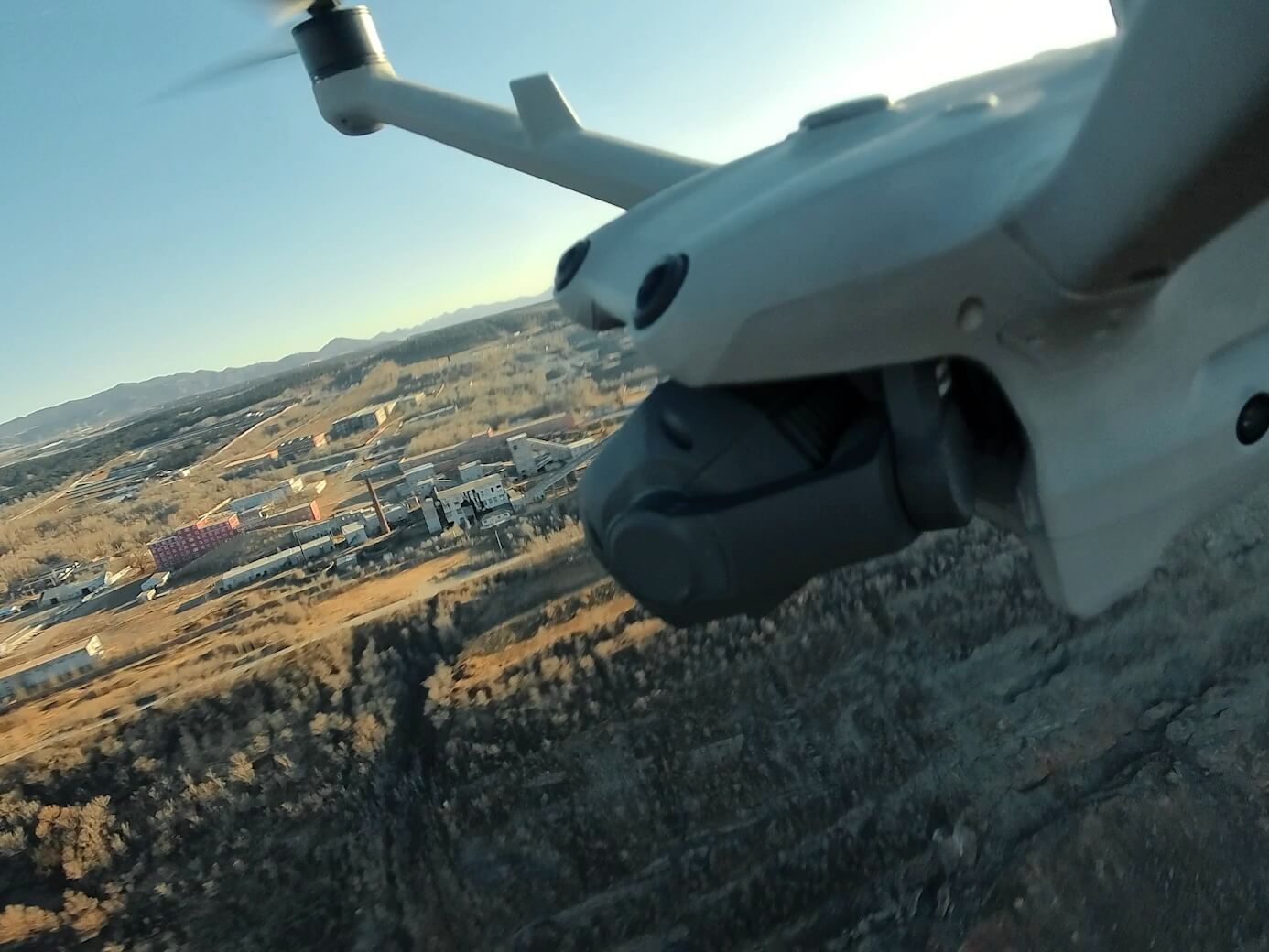
Mapping and Earthworks
Collect photogrammetric data for assessment and measurement in terrain models, orthophotos and earthworks.
Progress and Asset Tracking
Document construction progress and site assets through regular flights and compare data from different dates.
Facility and Infrastructure Inspection
Visually inspect facilities, pipelines and solar sites. Assess distant details with medium tele and tele cameras.