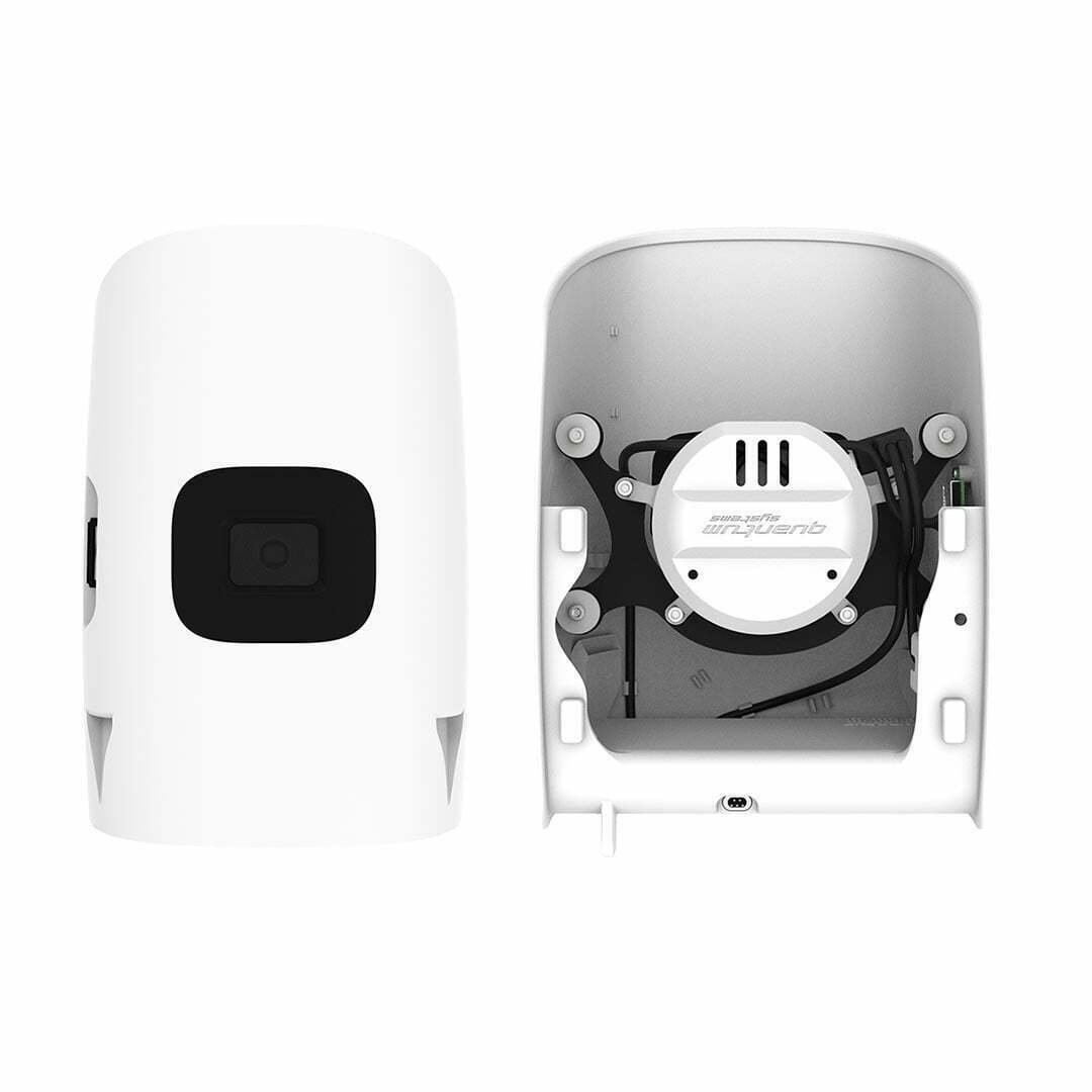
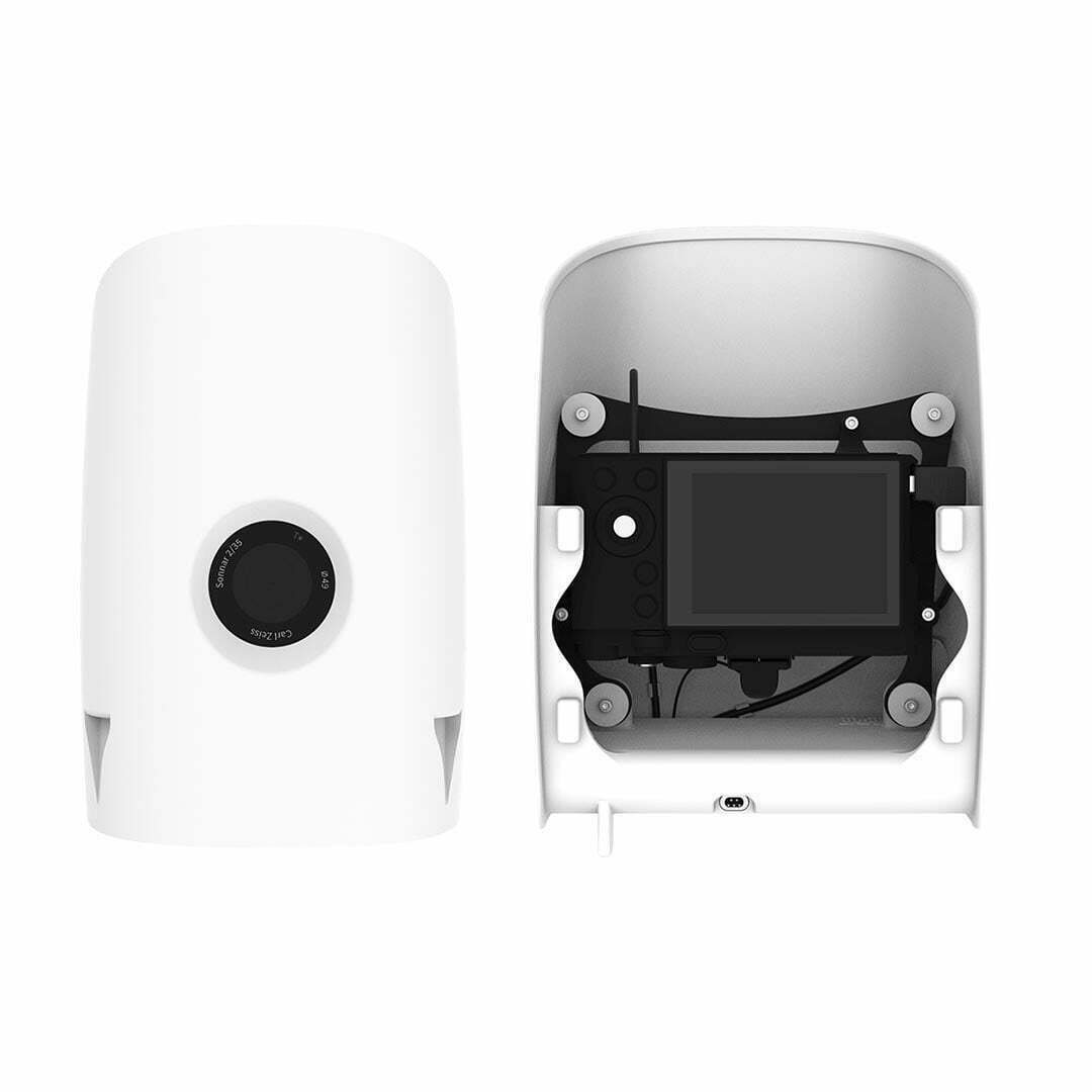
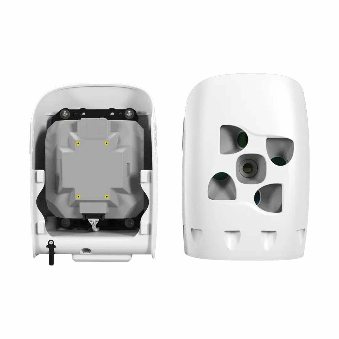
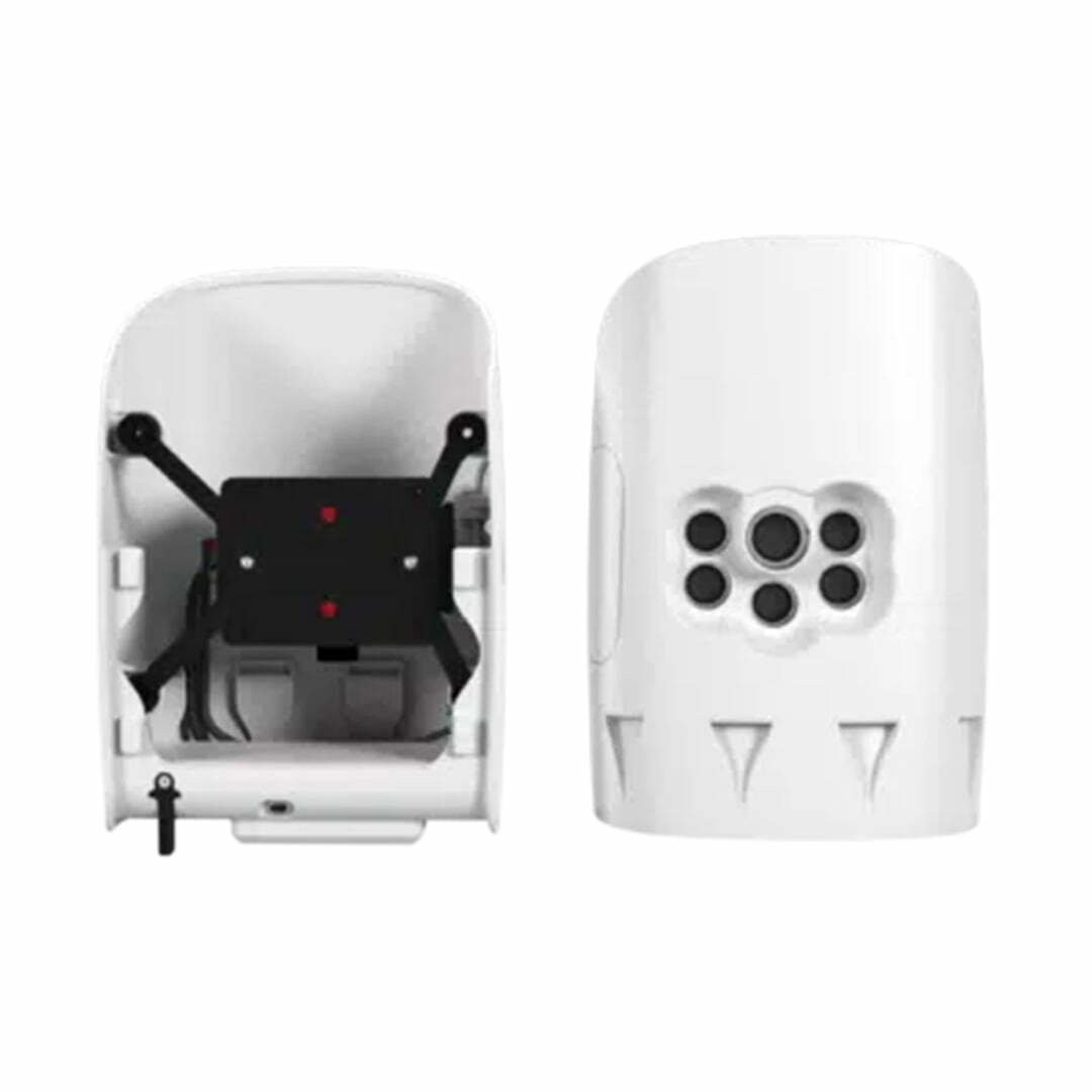
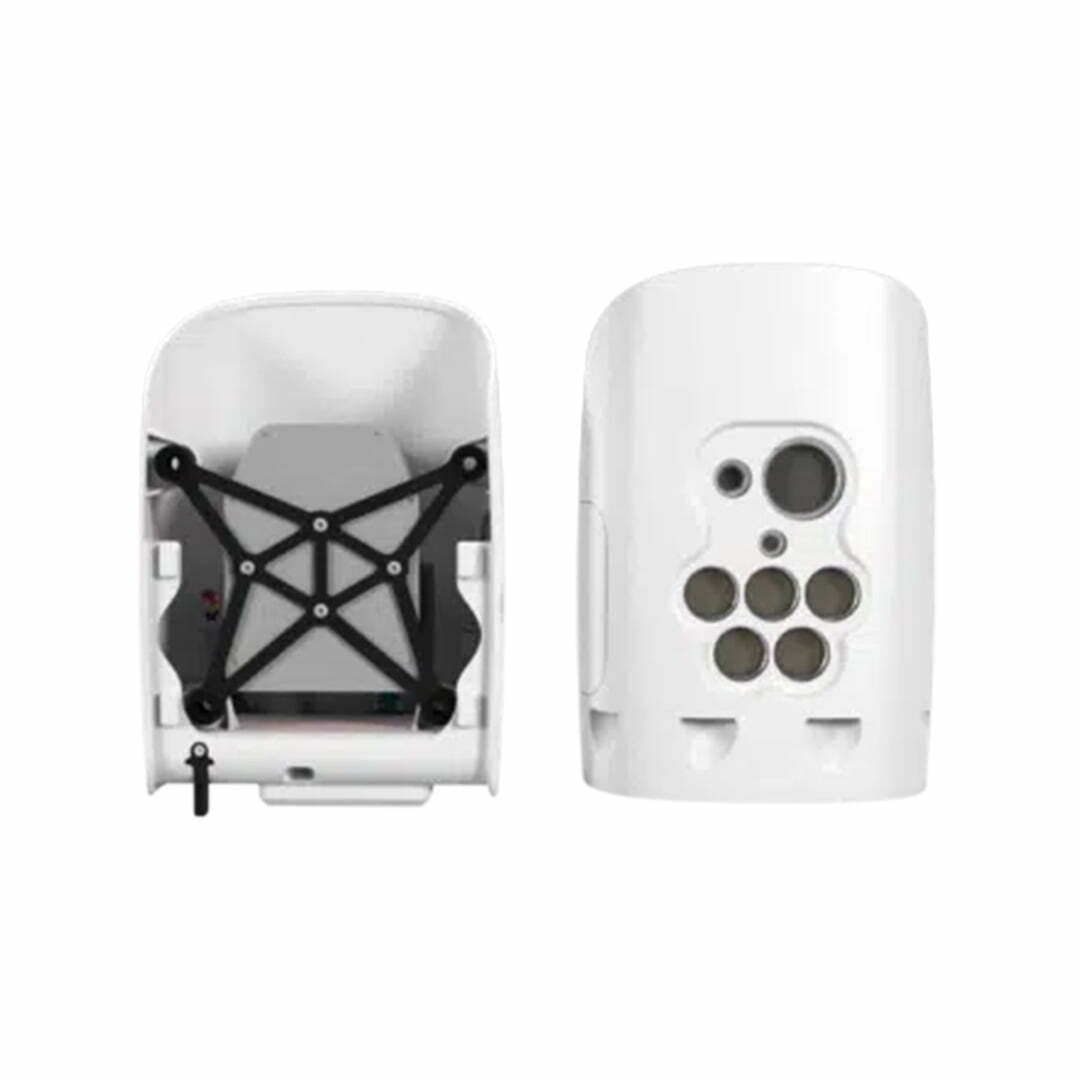
Qube 240 (Trinity F90+)


The Qube 240 LiDAR is a geomatic-grade LiDAR scanner integrated into the payload compartment of the Trinity F90+ drone without compromising data quality. The Trinity F90+ can fly the Qube 240 for up to 60 minutes. Qube 240 is offered as a complete solution with YellowScan CloudStation Software package and license.
As the core technology of the future for autonomous driving, LiDAR sensors are also the first choice for high-throughput research tasks.
Geomatics Class LiDAR
- Class: 1 (Eye Safe)
- Wavelength: 905 nm
- Maximum height: 140 m AGL
- Precision: 1.8-2.5cm
- Accuracy: < 3 cm
- Scanner field of view: 70°
- 240,000 dots per second, 3 turns, a total of 720,000 dots in 1 second
- Dot density @100m: 50-100 dots/m²
- Multi-echo technology: 3 turns per beat
- Applanix POSPacTM UAV, GNSS and INS software for PPK
- Qube 240 data processing software to create LAS Files
It is a small and powerful LiDAR sensor for Trinity
The Qube 240 LiDAR sensor inherits the YellowScan Ultra Surveyor LiDAR scanner. Advances in downscaling and card-wide performance improvements have enabled a significantly smaller form factor and increased range and accuracy.


Geomatics grade LiDAR solution from a single source
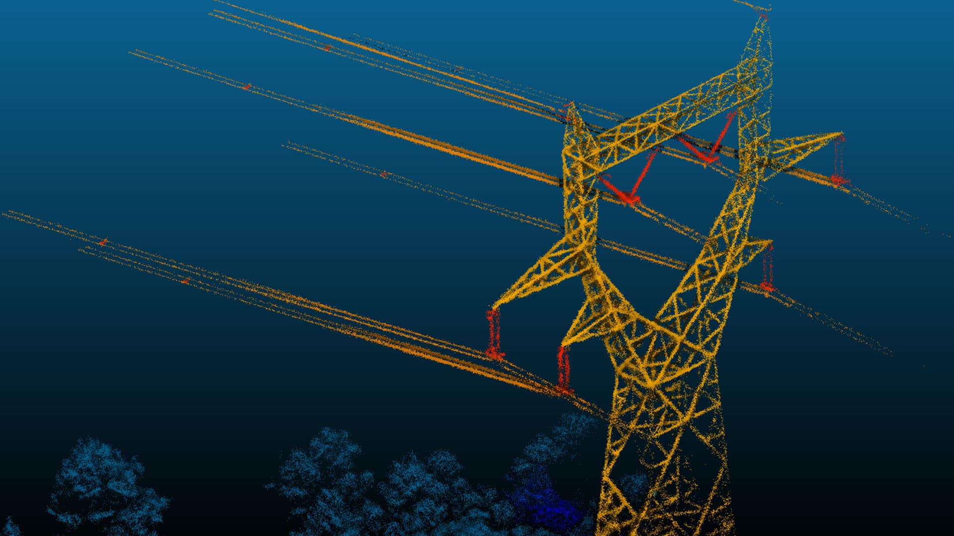
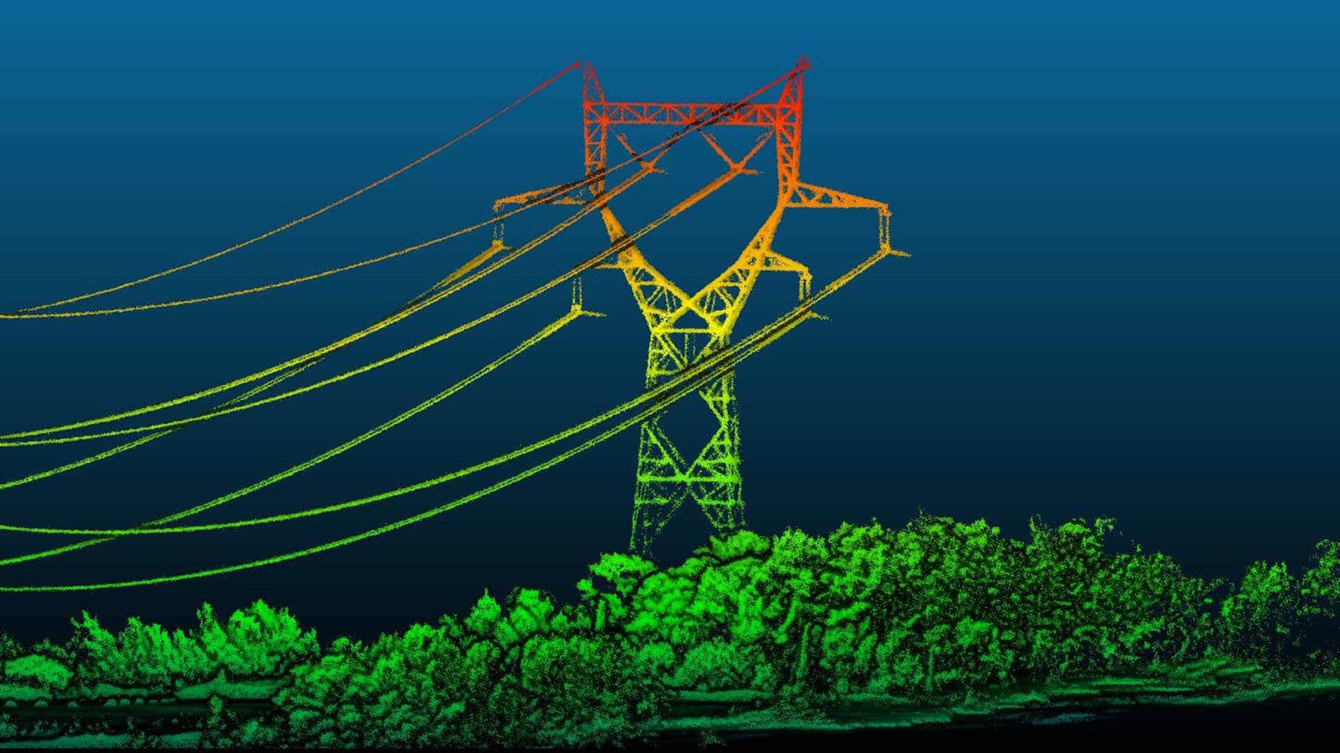
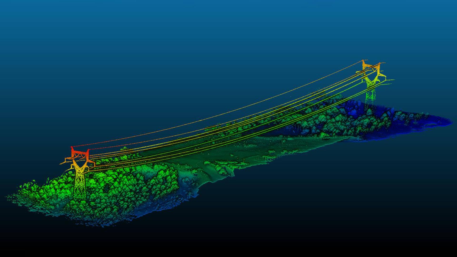
The Qube 240 LiDAR creates an accurate 3D image of the environment with 240,000 distance measurements per second, providing the necessary information for surveying and mapping.
Exceptional absolute accuracy is achieved with the help of the integrated Applanix APX15 INS. Qube 240 allows a geodetic accuracy that could only be achieved with LiDAR Systems in the upper price segment before. It is easy to use and install and user friendly. Raw data is processed quickly and easily.
It comes with YellowScan CloudStation software and a 1-year license.