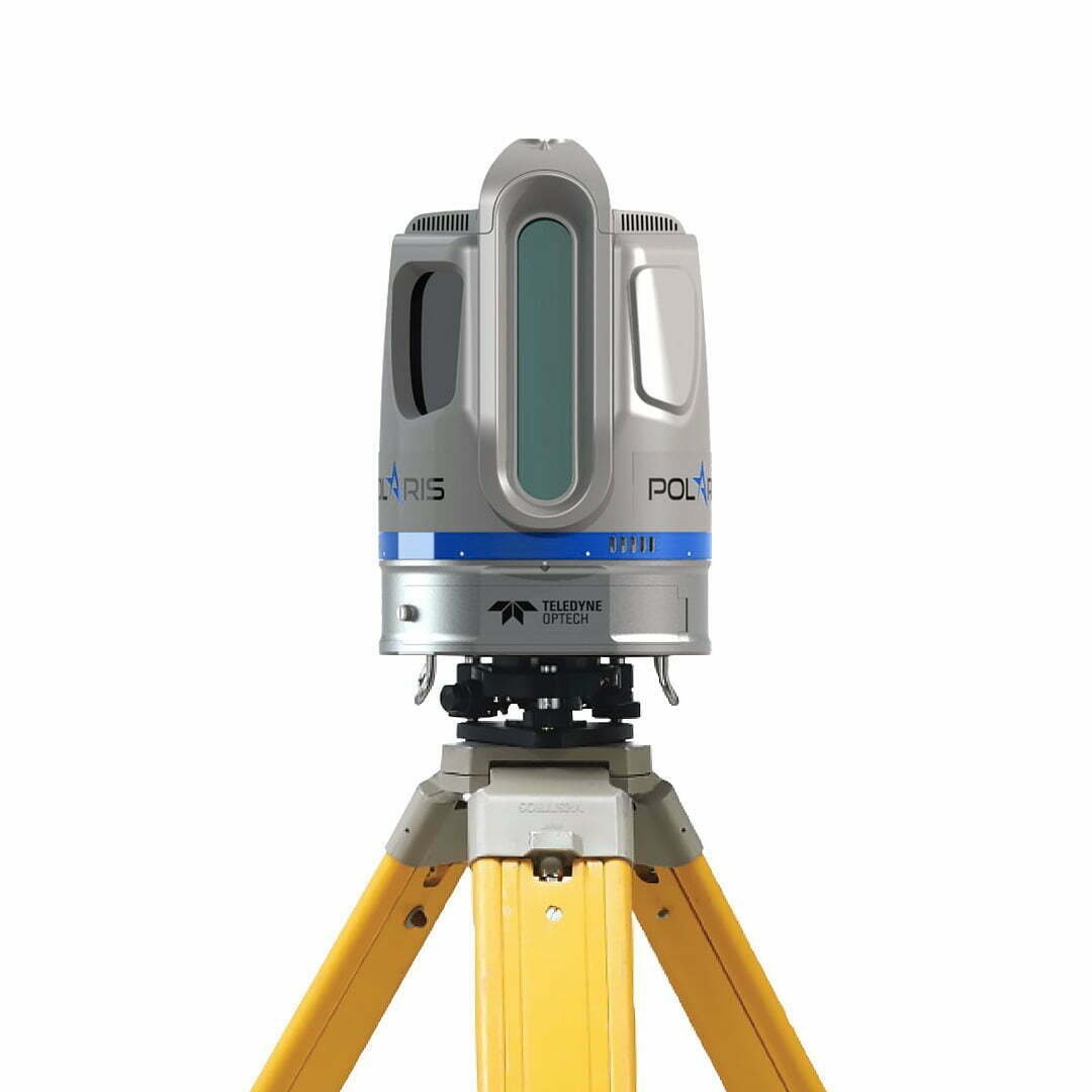
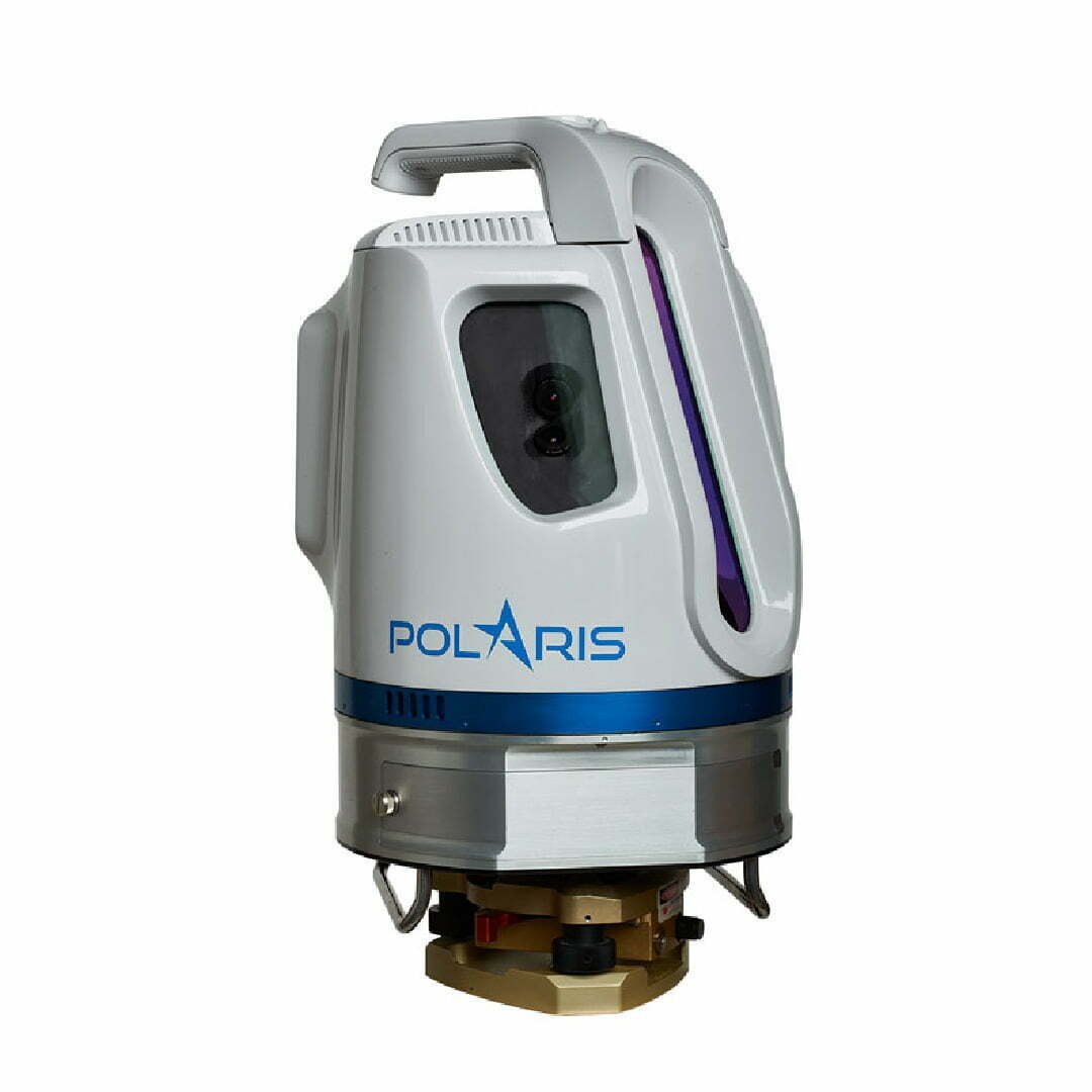
Polaris Laser Scanner
Compact and Powerful Scanning Technology
With an integrated high resolution 5 MP dual camera, inclinometer, compass, GPS receiver and weatherproof body, the Polaris Laser Scanner can be used in many environments and fields. In addition, with the camera that can be integrated on, it provides high resolution images.
It has a fast, sensitive and variable range option as no other laser scanner. Polaris comes with 2 different range modes: It introduces ER modes for Medium Range Applications and LR for Long Range Applications.
APLLICATION AREAS

Construction & Architecture

Mining

Road Projects

Restoration & Documentation & Archeology

Crime Scene Investigatio

Forestry

Scientific Research
Polaris ER – For Mid-Range Applications
In mid-range applications up to 750 meters, the programmable laser scanner provides sensitive data with data acquisition speed (Additionally available with external cameras and GNSS options).
Polaris ER System Performance
Laser Regeneration Rate (most intense and effective, kHz) 200 500 kHz
Max. Distance @90% reflectance (m) 750 250 m
Max. Distance @20% reflectance (m) 400 125m


Polaris LR – For Long Range Applications
It is an excellent scanner that provides programmable data acquisition speed and precise data acquisition in all long-range applications of 2000 meters and more (Additionally with external cameras and GNSS options).
Polaris LR System Performance
Laser regeneration rate (most intense and effective, kHz) 50 200 500 kHz
Max. Distance @90% reflectance (m) 2000 750 250 m
Max. Distance @20% reflectance (m) 976 400 125 m
Advantages
- High data accuracy; data with sub-centimeter accuracy and high angular resolution
- Easy setup
- User-friendly interface
- Bright sunlight-visible touchscreen
- Internal data storage
- Ability to connect internal camera and external camera
- Automatic georeferencing and project planning
- Automatic target recognition
- Project planner
- Wide, adjustable field of view
- Versatility: mobile use on tripod, platform or vehicle
- Wide field capture in a single scan with 360° × 120° field of view
- Fast results thanks to high-speed data collection
- At night, out of light, etc. use in various environments
- Continuous measurement in all weather conditions
- Uninterrupted operation in jamming environments
- GPS receiver
PHOTOS
Video
| PERFORMANCE CHARACTERISTICS | |
|---|---|
| Resolution: | 1 mm resolution @ 75 m |
| Internal and External Imaging Systems: | Dual internal camera and external DSLR camera connection |
| Project Planning and Processing: | PC-based project planner to set up and document project work |
| Wide Field of View: | 120 vertical x 360 horizontal (fully adjustable) |
| Sensors | Internal GNSS, Tilt Sensor, Compass, Internal Camera, External Camera Connection |
| Graphical Interface: | Built-in, sunlight visible, menu orientation |
| TECHNICIAL SPECIFICATIONS | |
| Distance Measuring Method: | Pulsed Laser Beams |
| Wavelength[nm]: | 1550 |
| Laser Safety Class: | 1 |
| Distance Resolution [mm]: | 2 |
| Density Register [bits]: | 12 |
| Minimum Distance [m]: | 1.5 |
| Angular Measurement Resolution [μrad]: | 12 |
| Max.Dot Frequency: | 3 mm @ 100 m |
| Distance Accuracy (1 sigma): | 5 mm @ 100 m |
| Precise, single stroke (1 sigma): | 4mm @ 100 m |
| Max.Vertical/Horizontal Field of View: | 120° (-45° ile +75°) / 360° |
| min. Angular Horizontal Size [μrad / degree]: | 30 / 0.0017° |
| min. Angular Horizontal Size [μrad / degree]: | 12 / 0.0007° |
| Operating temperature: | min. -20°C maximum +50°C |
| Humidity: | %95 |
| Integrated Protection Panel: | Yes |
| Protection: | IP64 (Dust and Waterproof) |
| Battery Type and Working Time: | Internal and External, 2.5 hours |
| Power Input: | 9-32 VDC |
| Power consumption: | 60 W |
| PHYSICAL PROPERTIES | |
| Height: | 323 mm |
| Width (diameter): | 217 mm |
| Total weight: | 11.2 kg |
| Screen: | 5.7″ bright sunlight-visible display |
| Resolution: | 640 x 480 pixels |
| Touch screen: | Gloves, pen, stylus etc. Can be used with. |
| HARDWARE FEATURES | |
| Frequency: | 500,000 points per second, 2 Million Points with 4 Returns |
| Built-in Camera: | Yes |
| Built-in Camera Image format: | .jpeg |
| External Camera: | Yes (optional) |
| External Camera Image Format: | .jpg, .nef |
| User interface: | Integrated Touchscreen, tablet, PC |
| Additional Sensors: | Tilt Sensor, L1 GNSS, Compass |
| Registration / Forwarding Methods: | L1 GNSS,GNSS and Compass, retracement, stopped-looked |